Download
1 / 18
180 likes | 203 Views
Explore a unique approach for sensor data collection using unmanned aircraft gateways. Overcome challenges like intermittent connectivity and limited power with specialized gateway nodes. Learn about delay-tolerant networking, service discovery mechanisms, and reliable forwarding solutions.

E N D
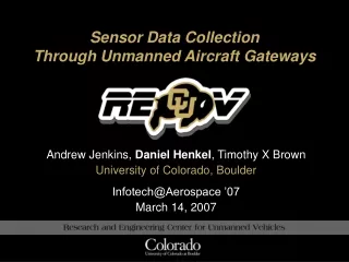
Sensor Data Collection Through Unmanned Aircraft Gateways Andrew Jenkins, Daniel Henkel, Timothy X Brown University of Colorado, Boulder Infotech@Aerospace ’07 March 14, 2007
AUGNet 16cm 241cm Group 1 Group 2 Ad hoc UAV Ground Network
Sensor Data Collection SMS-3 CDMA Gateway-2 SMS-1 SMS-2 Delay tolerant traffic! Sensor-1 Sensor-2 Gateway-1 Sensor-3 • Sparsely distributed sensors • Limited radio range, power • Multiple monitoring stations
Overview • We combine: • A restricted form of delay tolerant networking (DTN); • Service discovery mechanisms • Implement sensor data collection • Special gateway nodes the key
Problem • To deliver sensor events to monitor station • To deliver commands to sensors • Challenges • Sensors and monitors do not know each other • Links may be intermittent • End-to-end connectivity may never exist
Why not Sensor Networks? • Sensor networks: • Events collected at base stations within network • Specialized addressing and routing • What if Monitor Station is elsewhere? • Monitor Station and sensor in different networks • Addressing? • Routing?
Why not Ad Hoc Networks? • Ad hoc networks: • Peer-to-peer routing • Does not solve • Intermittent connectivity • Inter-networking
Why not IP Networks? • Traditional IP networks: • Route across network domains • Assumes • End-nodes can assume burden • End-to-end connectivity • Network-wide services always accessible DNS
Approach External Network External Network • Staged delivery • Best network for each stage • Special nodes at boundaries SMS1 GW1 SMS2 Ad HocNetwork GW2 T1 Sensors SMS3 GW3 T2 Sensors
Network Overlay Model MANET 6.0.0.0 10.0.0.0 192.168.0.0 Network 1 Network 2 Network 3 SMS Sensor Gateway Terminus SMS Sensor Gateway SMS Sensor Sends to fixed address Reliable Forwarding NAPT Multicast GW Discovery Custody Transfer Reliable Forwarding NAPT Multicast GW and SMS Discovery Custody Transfer Reliable Forwarding SMS Discovery Reliable Forwarding
Software Implementation Click Modular Router
Hardware Implementation RTT 40ms, 15hrs sustained operation • Soekris SBC, embedded Gentoo Linux • Atheros miniPCI, Madwifi-ng driver
Performance Results I Loss Rate
Performance Results II DTNClock Demo
Conclusions • Generic sensor data collection solution • Reliable (no need for end-to-end connectivity) • Hides complexity from end points • Can overlay many different networks • Working delay tolerant network
The End henk@colorado.edu http://recuv.colorado.edu/
Research & Engineering Center for Unmanned Vehicles (RECUV) Research and Engineering Center for Unmanned Vehicles University of Colorado at Boulder http://recuv.colorado.edu The Research and Engineering Center for Unmanned Vehicles at the University of Colorado at Boulder is a university, government, and industry partnership dedicated to advancing knowledge and capabilities in using unmanned vehicles for scientific experiments, collecting geospatial data, mitigation of natural and man-made disasters, and defense against terrorist and hostile military activities.