Download
1 / 138
1.38k likes | 1.48k Views
Learn about a quick project by Pike County to protect County Road #107 on Haw Creek from erosion, using various techniques. Explore the methods employed and challenges faced during construction.

E N D
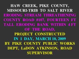
HAW CREEK, PIKE COUNTY, MISSOURI-TRIB TO SALT RIVERERODING STREAM THREATHENING COUNTY ROAD #107, FOURTEEN FT TALL ERODING BANKWITHIN 4 FT OF THE ROAD, PROJECT CONSTRUCTED IN 1 DAY, MARCH 10, 2009BY PIKE COUNTY PUBLIC WORKS DEPT, LaDON ATKINSON, ROAD SUPERVISOR
HAW CREEKGENERAL INFORMATION • Bank erosion is threatening county road, threatening public safety • Stream wildly meandering in response to historic straightening • Decent riparian areas in places • Bed material: gravel-sand. Channel is incised • Pool-riffle-pool regime, slope less than 1% • Average width 30-40 ft, 15 ft tall banks • Funding, equipment, and manpower provided by Pike County, MO
DIRECTIONS TO HAW CREEK, From Hwy 61 (Pike County, 15 miles south of Hannibal, MO), turn east on Rt. B, then left on Rt. 107. 3-4 miles project is on the south side after a long straight section, then “S” bend. Contact: Jaynie Doerr, regulatory, St. Louis Dist. Jaynie.g.Doerr@USACE.ARMY.MIL
PRE-PROJECT PHOTOSby JAYNIE DOERR, REGULATORY, ST. LOUIS DISTRICT FEBRUARY 25, 2009
Looking US at the bend US of the project bend. PRE PROJECT-HAW CREEK-PIKE COUNTY, MO. PIX BY DERRICK 3-10-09
Looking DS @ the upper end of the project bend. PRE-PROJECT - HAW CREEK-PIKE COUNTY MO. PIX BY JAYNIE DOERR 2-25-09
LOCKED LOGSWe utilized the two existing logs (next picture) that had fallen in by placing them angled downstream and building the LPSTP on top to “lock” the logs in place.
Looking DS @ the center of the bend & the threatened County Road 107, Pike County, MO. We used the two trees as Locked Logs. PRE-PROJECT - HAW CREEK-PIKE COUNTY MO. PIX BY JAYNIE DOERR 2-25-09
Looking DS @ the lower end of the project bend PRE-PROJECT - HAW CREEK-PIKE COUNTY MO. PIX BY JAYNIE DOERR 2-25-09
Looking DS @ exit conditions to the project bend PRE-PROJECT - HAW CREEK-PIKE COUNTY MO. PIX BY JAYNIE DOERR 2-25-09
Looking US @ the project bend. Road is 4 ft from 14 ft tall eroding bank. PRE-PROJECT - HAW CREEK-PIKE COUNTY MO. PIX BY JAYNIE DOERR 2-25-09
Down at the farm & feed store, education !!!! CONSTRUCTION-HAW CREEK-PIKE COUNTY, MO. PIX BY DERRICK 3-10-09
CONSTRUCTION PHOTOSby Dave Derrick, COE; Jaynie Doerr, COE; & Matt Methaney, MDCMARCH 10, 2009
We have 500 willows, stone, diesel, equipment, and time on our hands! A dangerous combination!! CONSTRUCTION-HAW CREEK-PIKE COUNTY, MO. PIX BY DERRICK 3-10-09
Pike County Highway 107 Haw Creek, MO Pre-project Forest The vertical eroding bank is 14 ft tall & 4 ft from the shoulder of the road. WE NEED SPACE!!!! Forest
15 ft wide engineered floodplain bench with Living Dikes, poles, & Live Siltation Pike County Highway 107 Haw Creek, MO. Highway protection plan Straight vegged key 110 ft of Longitudinal Peaked Stone Toe Protection with Single Stone Bendway Weirs 30 ft long vegetated key with soil cover
Pike County Highway 107 Haw Creek, MO. Highway protection plan
Self-Adjusting, Self-Filtering Stone Depending on size, angularity, and gradation, stone can be neither, either, or both!! • Self-Adjusting Stone: Stone must be well-graded (from coarse to fine) so that it has the ability to "launch", or self-adjust into, and armor, scour holes formed on the streamward side, and/or stream end, of a river training structure. -Charlie Elliott says a good rule of thumb in Mississippi sand-bed streams {CAUTION: this might not apply equally well to every stream in the world} is that one ton of rock per linear ft will armor three ft of scour • Self-Filtering Stone A soil analysis should always be performed to determine stability and erodability of bank materials and whether a filter material, (either granular or synthetic) is required. A self-filtering stone that has worked well on the Mississippi River, and numerous other rivers and smaller streams (acting as a granular filter to prevent loss of underlying bank material) has 10% to 15% of the gradation either less that 4 inches in diameter, or less than one pound in weight, depending on how the stone is specified.
QUESTIONABLE STONE Stone used for keys & LPSTP was a sub-standard shot rock of questionable hardness. The amount of fine material was close to 20-30%. This was a self-filtering stone, but not well-graded, & not self-adjusting.
Stone is not well-graded & too many fines. The stone is self-filtering, but not self-adjusting, but only $4.70/ton delivered. CONSTRUCTION-HAW CREEK-PIKE COUNTY, MO. PIX BY DERRICK 3-10-09
STONE COSTSHowever, the stone was extremely inexpensive. The 432 tons of rock used in the project, at $4.70 per ton (delivered) total cost of stone = $2032. That was very cost effective for what we accomplished.
HAW CREEKMETHODS EMPLOYED • 110 ft of Longitudinal Peaked Stone Toe Protection (LPSTP), crest built to 4 ft above the base flow water surface elevation • Locked Logs • A vegetated floodplain bench • Single-Stone & Short Bendway Weirs • Live Willow Pole Plantings • Vegetated & curved upstream key, straight DS key • Living Dikes • Slit Brush Layering (Joint Planting) in riprap bank • Live Siltation
A KEY HAS ONE MAIN JOB, TO CONNECT THE RIVER TRAINING STRUCTURE TO THE REST OF THE WORLD (DON’T LET THE STREAM GET BEHIND {FLANK} RIVER TRAINING STRUCTURES)
THE STEP-BY-STEPS FOR HAW CREEK, TRIB. TO SALT RIVER, PIKE COUNTY, FRANKFORT, IOWA All drawings by Dave Derrick
Detail for key Flow Cross-section for keyway
Looking DS at hoe digging the upstream key. CONSTRUCTION-HAW CREEK-PIKE COUNTY, MO. PIX BY DERRICK 3-10-09
Looking DS. Setting topsoil aside for use as backfill topping CONSTRUCTION-HAW CREEK-PIKE COUNTY, MO. PIX BY DERRICK 3-10-09
Place Willow Poles against the DS side of the trench Detail for key Flow
Looking DS. Placing willow poles against the DS side of key trench. CONSTRUCTION-HAW CREEK-PIKE COUNTY, MO. PIX BY DERRICK 3-10-09
Place stone in trench Detail for key Flow
Choke stone with gravel (white areas) & water in. Detail for key Flow
Looking DS. Placing stone and creek gravel choke in US key trench. CONSTRUCTION-HAW CREEK-PIKE COUNTY, MO. PIX BY DERRICK 3-10-09
Backfill and overfill with native soils, then compact (some settling will still occur) Detail for key Flow
Looking DS. Backfilling key with quality top soil. CONSTRUCTION-HAW CREEK-PIKE COUNTY, MO. PIX BY DERRICK 3-10-09
Hydro seed Detail for key Flow DONE
ENHANCED LONGITUDINAL PEAKED STONE TOE PROTECTION (LPSTP) WITH SINGLE-STONE BENDWAY WEIRS, LOCKED LOGS, SOIL CHOKING, LIVE SILTATION, POLE PLANTINGS, LIVING DIKES, ROOTED – STOCK PLANTS, & A FLOODPLAIN BENCH
Road Top bank ENHANCED LONGITUDINAL PEAKED STONE TOE PROTECTION (LPSTP) Eroding bank Stream channel
Road ENHANCED LONGITUDINAL PEAKED STONE TOE PROTECTION (LPSTP) “Locked Logs” placed on bed of river for improved aquatic habitat & energy dissipation. Locked Logs should be angled downstream 25 to 35 degrees so as to shed debris.
LONGITUDINAL PEAKED STONE TOE PROTECTION {LPSTP} • Description: A continuous stone dike placed longitudinally at, or slightly streamward of, the toe of the eroding bank. Cross-section is triangular. The LPSTP does not necessarily follow the toe exactly, but can be placed to form a "smoothed" alignment through the bend. Smoothed alignment might not be desirable from the environmental or energy dissipation points of view . Amount of stone used (2 tons/linear ft, 1 ton/ft, or less) depends on depth of scour at the toe, estimated stream forces (impinging flow) on the bank, and flood durations and stages. • Tie-backs are short dikes connecting the LPSTP to the bank at regular intervals. Tie-backs are usually the same height as the LPSTP or elevated slightly toward the bank end, and are keyed into the bank. If tie-backs are long they should be angled upstream to act as bendway weirs.
Longitudinal Peaked Stone Toe Protection (LPSTP) As-built After a couple of high flow events stream has scoured at the toe & stone has self-adjusted Sediment has deposited landward of the LPSTP
ENHANCED LONGITUDINAL PEAKED STONE TOE PROTECTION (LPSTP) Locked Logs are then “locked” under the Longitudinal Peaked Stone Toe Protection (LPSTP).
Looking US @ completed US key. Forming stone into Longitudinal Peaked Stone Toe Protection (LPSTP) CONSTRUCTION-HAW CREEK-PIKE COUNTY, MO. PIX BY DERRICK 3-10-09
Looking US. LPSTP crest is 4 ft above base flow stage CONSTRUCTION-HAW CREEK-PIKE COUNTY, MO. PIX BY DERRICK 3-10-09
ENHANCED LONGITUDINAL PEAKED STONE TOE PROTECTION (LPSTP) Tree or shrub poles (called Live Siltation) installed on top of LPSTP Willow, dogwood, river birch poles can then be laid on the stone and up against the bank. Basal ends should be in vadose zone (capillary zone). Willow used on this project.
ENHANCED LONGITUDINAL PEAKED STONE TOE PROTECTION (LPSTP) Live Willow poles were then laid up against the eroded bank
Looking DS. Class laying willow on LPSTP & against bank. CONSTRUCTION-HAW CREEK-PIKE COUNTY, MO. PIX BY DOERR 3-10-09