Download
1 / 12
120 likes | 145 Views
Explore contributions of surface processes to deep convection & storm development using various equipment & methods in this workshop.

E N D
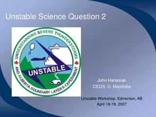
Unstable Science Question 2 John Hanesiak CEOS, U. Manitoba Unstable Workshop, Edmonton, AB April 18-19, 2007
Science Question 2 • What are the contributions of surface processes to the initiation of deep moist convection and the development of severe thunderstorms in the Alberta Foothills region?
Equipment • Radiometrics WVR-1100 • Total column vapor and liquid water • Temporal resolution depends on scanning cycle • Acoustic Doppler sodar • 3-component winds & standard deviations • Up to 1km, 50m resolution, 15-30 min averages • AERI • Vertical profiles of temperature & vapor • Up to 3km, 100-200m resolution, every 15 min • Limitation = clouds & low level saturation • Radiometrics 3000A • Vertical profiles of temperature & vapor, cloud base, & total column • Up to 10km, 100-250m resolution, less than 5 min • Limitation = precipitation • MARS (Mobile Atmospheric Research System) • Portable rawinsonde • 2 Campbell Sci weather stations • Laser precipitation sensor • Mobile vehicle (T, RH, wind)
Mobile Atmospheric Research System (MARS) • UofM URGP & NSERC
portable rawinsonde weather station AERI sodar AMR
Sub-Questions & Methods • (a) Is there a noticeable difference in storm initiation and evolution between wet and dry areas over the cropped region (as defined by a crop model) over the duration of the project? • (b) Are there noticeable gradients of surface and boundary layer water vapour across the major wet/dry areas and how do these evolve over the project? • J. Brimelow
Sub-Questions & Methods • (c) Are mesoscale circulations detectable in the vicinity of boundaries between wet and dry areas? If so, how do they appear to influence storm initiation and evolution?Methods: • Mobile observations (surface vehicle & sodar on MARS) • Mesonet • Array of rawinsondes • Aircraft • Radar? • Satellite & radar for initiation zones in association with these observations
Sub-Questions & Methods • (d) What are the latent and sensible heat fluxes over the region, especially across any wet/dry areas that may exist? How do they influence temperature and water vapor stratification?Methods: • Aircraft • Any available eddy correlation or bulk profile measurements • Rawinsondes, MARS, radiometers, boundary layer models
Sub-Questions & Methods • (e) How does the orientation of synoptic (background) flows modify (b) - (d) on a day-to-day basis?Methods: • Synoptic analysis fields in relation to field measurements (i.e. are there detectable spatial 3D variations in thermodynamic and dynamic fields … transient boundaries) • Perpendicular versus angled synoptic flows in relation to surface wet/dry boundaries
Sub-Questions & Methods • (f) Can the surface contributions to total boundary layer moisture be quantified?Methods: • Aircraft flux measurements • Water balance exercise • Estimated as a residual in the water balance equations? • How do we deal with storage?
Sub-Questions & Methods • (g) How can the existing observational network be improved to better represent surface processes that contribute to the initiation and development of severe thunderstorms?Methods: • Soil moisture / flux measurement sensor array (strategic areas) • Make better use of satellite surface products (validation) • “enhance” confidence in crop model and/or CLASS output
Break-Outs • Refinement of the UNSTABLE science questions • Data, instrumentation and deployment strategies necessary to answer the science questions • Who plans to be directly involved in the UNSTABLE field campaign and how • Funding strategies and opportunities for in-kind support • Others as suggested by discussion groups