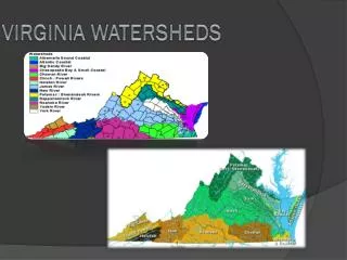
The Impact of Impervious Surfaces on Water Quality in Duluth Watersheds
This study examines the relationship between impervious surfaces and water quality across Duluth's watersheds, specifically Amity, Tischer, Chester, and Miller. Aerial photos reveal varying levels of imperviousness, highlighting urban, rural, and forested land uses. Findings indicate that as imperviousness increases, water quality declines. The data is vital for urban planning and conservation efforts, illustrating the need for better zoning practices to mitigate environmental degradation. Understanding these dynamics is crucial for promoting sustainable development in the region.

The Impact of Impervious Surfaces on Water Quality in Duluth Watersheds
E N D
Presentation Transcript
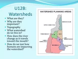
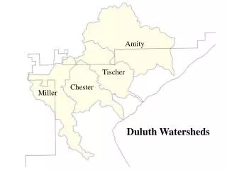
Duluth Watersheds Amity Tischer Chester Miller
Impervious Surface is a Strong Indicator of Water Quality Relationship Between % Imperviousness and Water Quality 80 70 60 50 40 30 20 10 0 WATERSHED IMPERVIOUSNESS (%) DEGRADED IMPACTED PROTECTED STREAM DEGRADATION ADAPTED FROM SCHUELER, ET. AL., 1992
NEMO Classes Red – Urban areas, roads and railroads Yellow – Farmsteads and rural developments Green – Forested areas Brown – Grasslands, agricultural, bare rock, gravel pits, regeneration forest Blue – Open water, wetlands
City of Duluth Land Use/Covercombined with zoning boundaries
Removal of Steep Slopes, Wet areas, and current Impervious areas