Download
1 / 20
210 likes | 557 Views
Real Estate Law Legal Descriptions of Property. Legal Descriptions of Property. Subjects Covered: Types of Legal Descriptions Surveys. Methods of Property Descriptions. Real property is legally described by its surface There are three methods of legally describing real property:

E N D
Real Estate Law Legal Descriptions of Property
Legal Descriptions of Property • Subjects Covered: • Types of Legal Descriptions • Surveys
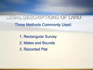
Methods of Property Descriptions Real property is legally described by its surface There are three methods of legally describing real property: • Lot, Block and Tract (Plat) Method • Metes and Bounds Method • Government (Rectangular) Survey Method* * Note: The Government Survey Method is not used in Massachusetts
Lot 10 in Block A on plan entitled: Johnson Hills Subdivision, Jefferson, Mass., January 2, 1996, Scale 1”=100’, said plan recorded in the Washington County Registry of Deeds Plan Book 10, Page 300 Property Description Lot, Block and Tract Method Property is described by its specific identifiers (i.e. Block and Lot Numbers) on a recorded Subdivision Plan Johnson Hills Subdivision Plan
Metes and Bounds Method (a.k.a. Measurements and Directions) - Property is described by the direction and length (metes) of its various boundaries (bounds) • The description starts at a Point of Beginning(P.O.B.), which is located by its position in relation to a fixed point called a monument Point ofBeginning • A Monument can be: • Natural (e.g. trees, rocks, rivers) • Artificial (e.g. iron stakes, fences, roads, surveyor’s benchmarks) Monument
Metes and Bounds Method (cont’d) A Boundary can be: • An imaginary line: • Defined by a compass heading • Defined on a recorded Plan • A physical featurebordering the property, e.g.: • A Road • If public, the boundary is the edge of the road • If private, the boundary is the center of the road • A River or Stream • If navigable, the boundary is the bank of the waterway • If non-navigable, the boundary is the center of the waterway • A Seashore or Tideland – the boundary is the tide line • Next, beginning at the P.O.B., each boundary of the property is called out sequentially in a clockwise direction with its length in feet – the last boundary must end back at the P.O.B. • Finally, the area of the property is calculated and called out in square feet or acres – “More or Less” (MOL) • 43,560 sq.ft. = 1 acre
Begin at Marker X on Cleveland Way West 60.0 feet to a Point of Beginning Northeasterly along a line north 12o0’ east a distance of 203.0 linear feet 200.0’ Easterly by Lot 9, as shown on the hereinafter mentioned plan, a distance of 200.0 linear feet 200.0’ 12o0’ 203.0’ Southerly by the Webster River a distance of 200.0 linear feet Westerly by Cleveland Way a distance of 240.0 linear feet to the Point of Beginning 240.0’ Marker X Point of Beginning Metes and Bounds Method - Example 44,000 sq.ft. MOL Property Description A “Call”
Massachusetts Property Descriptions In Massachusetts, a full legal description of property consists of three elements: • Street or designated address of the property (e.g. “commonly known as 234 Washington Street located in LINCOLN, Adams County, Massachusetts”) Full Legal Description • Metes and Bounds description • Reference description - i.e. to some other recorded document, e.g.: • Current Deed (by Book, Page and Date) • Subdivision Plan in the Registry of Deeds • Certificate Number from Land Court records
N Range (R) Tier (T) Meridian X ¤ W E Baseline Garfield Baseline and Meridian (GB&M) Garfield, Missouri S Government (Rectangular) Survey Method • Land is divided into 24 mile square Quadrangles • Each Quadrangle contains 576 square miles • - Quadrangles are bordered by meridians (N/S lines) and parallels (E/W lines) Property is located about 14 miles NNE of Garfield, Missouri Township T3N, R2E, GB&M Each quadrangle is divided into 16 Townships - Each Township measures 6 miles square and contains 36 square miles. - A Township is identified by its relation to a specific meridian and parallel (baseline) intersection Garfield Quadrangle
Property is described by its specific location within a Section N 6 5 4 3 2 1 NE ¼ of Section 12, T3N, R2E, GB&M 7 8 9 10 11 12 18 17 16 15 14 13 W E 19 20 21 22 23 24 30 29 28 27 26 25 31 32 33 34 35 36 S Property Description Township T3N, R2E, GB&N Government (Rectangular) Survey Method (cont’d) Each Township is divided into 36 Sections – Each Section measures 1 mile square and contains 160 acres – Sections are consistently numbered by a uniform scheme N 40 acres W E S Section 12
Government (Rectangular) Survey Method (cont’d) Area covered by this method:
Surveys • Definition: An investigation or examination that determines the boundaries of a parcel of land or locates all improvements on the parcel. • Types: • Boundary survey: sets forth the boundaries of a parcel. • As-built survey: sets forth the location of improvements on a parcel (also known as a record survey or loan survey). • Condominium survey. • Topographic survey. • Special-purpose survey.
statement of the type of survey depicted, name, address, and certificate of authorization number of the surveying firm, surveyor’s name and license number, date of the field survey and date(s) of any revisions, graphic scale of the map, plotted features supported by accurate survey measurements, clearly referenced bearings, if applicable, showing of any inconsistencies between the legal description and map, description of all monuments, showing of all fences, walls, and other open, notorious evidence of boundary lines, indications of any encroachments from or onto neighboring property, location of recorded private and public rights-of-way and easements, and location of fixed improvements in reference to the boundaries. Minimum Technical Standards Set forth by state statutes, administrative codes, or professional standards such as ALTA/ASCM Minimum Standards and NSPS Model Standards. Typically include:
Obtaining A Survey • Buyer typically asks for and pays for a survey. If using institutional lending, most lenders require a survey. • Seller determines: • whether Seller has an existing survey, and • how old it is • if additions have been made since the survey date • If a new survey is required, most attorneys representing buyers want to have a title commitment in hand prior to receipt of the survey so the surveyor can demarcate on the survey map all easements and all other encumbrances set forth in the commitment.
Obtaining A Survey (cont’d) • When ordering a survey for the Buyer-client, the surveyor should be provided with: • a legal description of the property, • a copy of the title commitment, • a list of all permitted exceptions included in the contract for purchase and sale, and • specific instructions regarding the minimum technical standards that must be met, together with any other specific instructions of the lending institution or title insurance company
Survey Review • Cover letter – check: • the type of survey ordered with survey received. • the delivery date stated in the letter with the date the survey was received. • the minimum technical standards specified with survey received. • any special instructions set forth in cover letter with survey received.
Survey Review (cont’d) • Contract for purchase and sale – check: • to ensure that the survey meets the contract’s requirements. • the time period within which to make objections to the survey defects and time to cure defects. • the exceptions set forth in the contract. • Title commitment – check: • legal description in survey with legal description in commitment, for discrepancies. • legal description against the drawing. • list of exceptions in title commitment with the drawing.
Common Survey Problems • Easements not listed as permitted exceptions under contract. • Encroachments. • Violations of zoning or land use ordinances or statutes. • Variation between legal description in contract or deed and actual boundary measurements on survey. • Slight variation: Title company can issue survey endorsement.
Quiz True/False • The bearing provides the measurement of the distance traveled. • Range lines run in a north and south direction. • A check is 6 miles square. • The property described as NE ¼, NE ¼, SW ¼, SE ¼ is 5 acres in size. • An irregular-sized tract of land labeled by government surveyors is called a government lot. F T F F T
Quiz (cont’d) • Another name for the plat method of legal description is the lot and block method. • The plat method is the most common type of legal description. • Each degree can be divided into 60 minutes. • In a real estate transaction, the buyer is the one who typically asks for a survey and pays for it. • A title commitment should be ordered after receipt of the survey. T F T T F