Download
1 / 15
150 likes | 163 Views
This study explores the factors influencing changes in urban heat island (UHI) in metropolitan Phoenix from 1990 to 2004. The study examines the impact of synoptic conditions, location in urban development zones, and the pace of housing construction on minimum temperatures. The results show that UHI is influenced by the type of urban development zone and the number of home completions. The analysis provides insights into the spatial and temporal variation of UHI in the region.

E N D
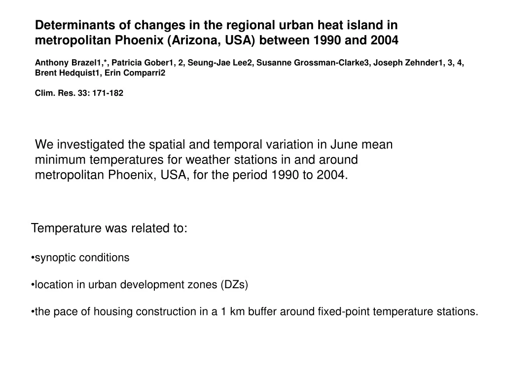
Determinants of changes in the regional urban heat island in metropolitan Phoenix (Arizona, USA) between 1990 and 2004 Anthony Brazel1,*, Patricia Gober1, 2, Seung-Jae Lee2, Susanne Grossman-Clarke3, Joseph Zehnder1, 3, 4, Brent Hedquist1, Erin Comparri2 Clim. Res. 33: 171-182 We investigated the spatial and temporal variation in June mean minimum temperatures for weather stations in and around metropolitan Phoenix, USA, for the period 1990 to 2004. • Temperature was related to: • synoptic conditions • location in urban development zones (DZs) • the pace of housing construction in a 1 km buffer around fixed-point temperature stations.
Large-scale, rapid urbanization (from fewer than 1 million people in 1970 to almost 4 million today) 5 development zones (DZs): core, infill, agricultural fringe, desert fringe, and exurban (hereafter labeled CORE, INFILL, AGFRINGE, DESFRINGE, and EXURBAN) we evaluated whether DZ affects temperature, the changes in temperature over the study period, and the way new home construction and synoptic conditions affect temperature
For the array of sites used, no significant correlation was found between minimum temperature and elevation within the station network (r2 = 0.07) We restricted the analysis to a monthly time scale, and to a time of year (June) during which Phoenix experiences relatively hot, clear, calm conditions for most days, an excellent time for UHI evaluation
Fig. 2. Residential completions from 1990 to 2004 in 5 yr increments. Gray areas are new housing completions
DZ typology of weather stations • stations in the inner CORE of the urbanized area where little new construction occurred • INFILL locations that were clearly part of the urbanized area in 1990 but became more densely settled by 2004 • AGFRINGE locations centered in areas of new construction on former irrigated agricultural lands • DESFRINGE sites where new construction has replaced open desert land • EXURBAN locations outside the built-up urbanized area
We used a synoptic variable to account for inter-annual variation in temperatures experienced across the weather network For June, 64% of the days are typed dry tropical with light winds (<5 ms–1), and another 20% of days are associated with cool air intrusions related to troughs that have developed in the Western USA that reduce mean monthly minimum temperature. In our analysis, the variable used was the number of days in June that a weather type is characterized by this second category, defined in SSC2 as Dry Moderate (later coded as DRYMOD) The highest correlation (r2 = 0.75, inverse relationship) was observed between the frequency of the DRYMOD weather type per month and monthly mean minimum temperature.
Our analysis evaluated the effects of the cumulative number of new homes constructed in year j (HOUSINGj), the number of days in a June month corresponding to the dry moderate weather conditions in year j (DRYMODj), and DZ (including AGFRINGE, DESFRINGE, CORE, EXURBAN, and INFILL) on mean June minimum temperature in year j (TEMPj) Our goal was to determine whether DZ affects the way DRYMOD and HOUSING influence temperature
Fig. 5. Monthly mean minimum air temperature patterns (using ordinary kriging methods) from 1990 to 2004 in 5 yr increments
where i = treatment effects, j = number of observations, x = 4 book-keeping variates for DZs, μ = intercept, z = 2 continuous variables DRYMOD and HOUSING, e = random error term that is assumed to be normally distributed and αk and βl are coefficients The slope coefficients of the DRYMOD and HOUSING variables did not vary significantly among the 5 DZs
In June, the average number of SSC2 DRYMOD days is ~3 to 4 per month, which on average would mean a cooling impact of some 1.1 to 1.4 K on the monthly mean minimum temperature. The HOUSING impact coefficient is +0.0014 K per home completion, or +1.4 K per 1000 homes (equivalent to complete build up around a weather site in given a buffer size of 1 km). There is variability around this value (SE = 0.4 K) the agricultural fringe adds just 0.1 K to exurban sites, which was not statistically significant. The desert fringe added 0.5 K and infill locations 1.0 K, and the urban core was 2.2 K warmer than the rural countryside.
Significant temperature variation was explained by surface effects captured by the type of urban DZ, which ranged from urban core and infill sites, to desert and agricultural fringe locations, to exurban. An overall spatial urban effect, derived from the June monthly mean minimum temperature, is in the order of 2 to 4 K. The cumulative housing build-up around weather sites in the region was significant and resulted in average increases of 1.4 K per 1000 home completions, with a standard error of 0.4 K. Overall, minimum temperatures were spatially and temporally accounted for by variations in weather type, type of urban DZ (higher in core and infill), and the number of home completions over the period