Topological Mapping using Visual Landmarks
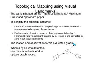
Topological Mapping using Visual Landmarks. The work is based on the "Team Localization: A Maximum Likelihood Approach" paper. To simplify the problem, assume: Landmarks are directional (In Player-Stage simulation, landmarks are represented as pairs of color boxes.)

Topological Mapping using Visual Landmarks
E N D
Presentation Transcript
Topological Mapping using Visual Landmarks • The work is based on the "Team Localization: A Maximum Likelihood Approach" paper. • To simplify the problem, assume: • Landmarks are directional (In Player-Stage simulation, landmarks are represented as pairs of color boxes.) • Each episode of motion consists of an in-place rotation by . Followed by moving straight forward by d. and d are corrupted by zero-mean Gaussian noises. • The motion and observation forms a directed graph. • When a cycle was detected, use maximum likelihood to update graph nodes.
Problem One: Cycle Detection • Unlike team localization, in which each Robot can be identified correctly, Landmarks with the same visual cues (color pairs) are indistinguishable. • Cycle Detection, when observing a landmark the robot has seen before: • Backup old map. • Assume a cycle is detected, update map accordingly. • After updating the map, compute the average negative-log-likelihood of updated graph edges. If the average is below a threshold, keep the new map. • Otherwise, restore the old map and add a new landmark. • The problem is setting the threshold, which depends on the motion model parameters.
Problem Two: Gradient Descent • The project uses the simplest Steepest Descent algorithm to update the map. Which poses the problem of slow converging. • Each node in the graph update itself to maximize the total local likelihood of connecting edges. The global maximum then is slow to reach. • Exploiting the algorithm: • When update motion nodes, ignore landmark nodes that is newly observed and have not been updated before, except the on which forms the cycle. • Applying better gradient descent algorithmmay improve the result.
Result: • Cycle Detection: • Can detect cycles when observed a landmark the robot have seen before. • Can distinguish similar landmarks that are placed not too close to each other. • Map Updating: • Not very good due to Steepest Descent algorithm.