Download
1 / 13
130 likes | 438 Views
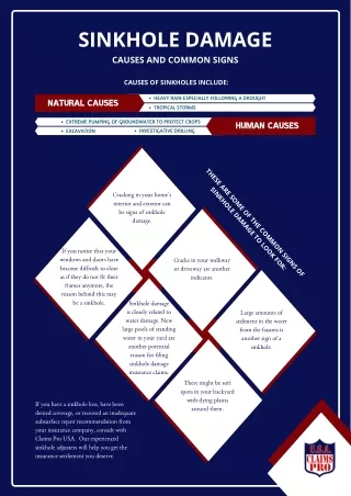
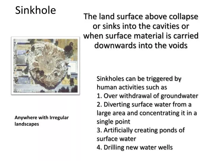
Sinkhole. Sinkholes can be triggered by human activities such as 1. Over withdrawal of groundwater 2. Diverting surface water from a large area and concentrating it in a single point 3. Artificially creating ponds of surface water 4. Drilling new water wells.

E N D
Sinkhole Sinkholes can be triggered by human activities such as 1. Over withdrawal of groundwater 2. Diverting surface water from a large area and concentrating it in a single point 3. Artificially creating ponds of surface water 4. Drilling new water wells The land surface above collapse or sinks into the cavities or when surface material is carried downwards into the voids Anywhere with Irregular landscapes
Caves Caves are mostly found in northwest Georgia. Most caves are created at or just below the water table in the zone of saturation in limestone. If the water table is stable large openings can be created because water would contact all surfaces of the cave dissolving the limestone at a large scale. Most caves are created at or just below the water table in the zone of saturation in limestone. Caves can form because of erosion they also show signs of deposition .
Oxbow lake Meanders shift position. During a flood a stream may cut a new channel that by passes a meander. The cut off meander forms a crescent shaped lake, which is called an oxbow lake An oxbow lake starts out as a curve, or meander, in a river. A lake forms as the river finds a different, shorter, course. The meander becomes an oxbow lake along the side of the river. Oxbow lakes usually form in flat, low-lying plains close to where the river empties into another body of water. On these plains, rivers often have wide meanders. Most are found in New York
Drumlins Are hills that form from piles of deposited glacial drift. Found by mountains
Erratics Are large boulders that were transported and deposited by glaciers. Found in glaciers mountains
By mountains Kettle lake Form when chunks of ice are deposited by a glacier and glacial drift builds up around the ice chunks. When the ice melts becomes a lake.
Karst Topography Forms on limestone or other soluble rock and is characterized by cravens, sinkholes, and streams that disappear underground. Indiana, Missouri, and Kentucky, as we as other limestone regions.
Found in mountains Alpine glacier Flowing water in a stream forms a v- shaped valley. An alpine glacier is a glacier that forms in a V-shaped Valley between mountains.
the Arctic, Antarctic circles, Greenland and islands in the polar regions. Continental glaciers form at high latitudes where temperatures remain cold enough during the summer to keep the previous winter's snow from melting allowing snow and ice to accumulate. Continental glacier
Erosional Landform Cirque Are bowl shaped depressions where glacial ice cuts back into the mountain walls.
Erosional Landform Alaska Hanging valley Small glacial valleys that join the deeper main valley. Manny valley form waterfalls after the ice is gone.
New Zealand U-shaped valley Glacier erodes a river valley . The valley changes form its original V-shaped to a U-shaped.
V-shaped valley Flowing water in a stream forms a v- shaped valley.