Download
1 / 42
440 likes | 620 Views
Landscape Quality Assessment. Flinders University Research Colloquium, 13 August, 2014. Dr Andrew Lothian Scenic Solutions. Scope. Why measure landscape quality? How to measure landscape quality Acquiring the data Respondents Overall findings Mapping Lessons & Applications

E N D
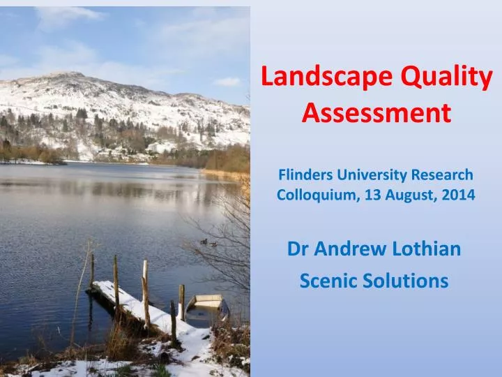
Landscape Quality Assessment Flinders University Research Colloquium, 13 August, 2014 Dr Andrew Lothian Scenic Solutions
Scope • Why measure landscape quality? • How to measure landscape quality • Acquiring the data • Respondents • Overall findings • Mapping • Lessons & Applications • The presentation focuses on the study of the Lake District in England but also draws on other studies conducted in South Australia Dr Andrew Lothian, Scenic Solutions
Who is Andrew Lothian? • I worked in environmental policy in SA Government for many years in Australia. Lectured at Flinders in policy. • Long interest in how to quantify landscape aesthetics. • During 1990s, undertook PhD in landscape quality assessment at the University of Adelaide. • Since then I have conducted 10 consultancy studies on landscape quality & visual impact assessment of developments including wind farms. www.scenicsolutions.com.au Flinders Ranges River Murray S.A. Coast Barossa & Eden Valleys Dr Andrew Lothian, Scenic Solutions
Why measure landscape quality? • Unlike biophysical assets, landscape aesthetics is a qualitative asset, as perceived by people. • The European Landscape Convention defines landscape as “an area, as perceived by people, whose character is the result of the action and interaction of natural and/or human factors.” • Landscape quality is the human subjective aesthetic response to the physical landscape. • Beautiful landscapes attract millions of tourists throughout the world to areas such as the Swiss Alps, the Canadian Rockies, the Italian lakes and Amalfi coast. The Lake District in England attracts 20 million visitors annually. Australia’s Great Barrier Reef, Kakadu and the Kimberlies, Uluru and Kangaroo Island attract many overseas visitors. They come to see the wild and natural landscapes, not the cities. Many World Heritage areas are outstanding landscapes. • Exposure to natural landscapes provides significant health and restorative benefits. • Views of attractive landscapes adds significant value to properties. Dr Andrew Lothian, Scenic Solutions
How not to measure landscape quality Landscape character units defined and mapped • There have been many attempts to measure landscape quality by recording all the physical features – land forms, land cover, land use, water, geology, etc, in the expectation that by analysing all of this data, the landscape quality would emerge. • It never did! • The reason is that this process is a cognitive activity involving analysis and thinking. • But landscape quality involves making judgements about what we like – i.e. preferences. This is an affective process. • Example: We know whether or not we like chocolate by tasting it, not by analysing its content, origin, colour etc. These can inform us but do not define its taste. Similarly we judge music by whether we like it, not by analysis of the instruments, score, etc. Scenic quality indicators mapped Weightings applied Scores of attributes applied Subjective judgements made Scenic quality comparisons made Scenic quality described and/or mapped Dr Andrew Lothian, Scenic Solutions
Psychophysics – basis for measuring landscape quality • Preferences are our likes and dislikes and are based on affect, not cognition. • The dictionary define aesthetics as “things perceptible by the senses as opposed to things thinkable or immaterial.” • This clearly differentiates thinking from the senses. • Researchers fell into the trap of assuming cognition was the same as affect. • They are completely different. • IN the 19th century, Gustav Fechner, a German physicist, developed psychophysics – the science of measuring the brain’s interpretation of information from the senses (sight, sound, smell, taste, touch). • Over recent decades, psychologists have applied its methods to measuring human landscape preferences. Gustav Fechner 1801 - 1887 Dr Andrew Lothian, Scenic Solutions
Applying the affective paradigm • Only by applying the affective paradigm can the attractiveness of a landscape be determined. • Attractiveness is determined by measuring preferences. • As it relies on preferences it is a subjective quality but preferences can be analysed objectively. Common elements in research methodologies are: • Selection of scenes for rating. • Rating scale – e.g. 1 to 10. • Rating instrument – i.e. a means for showing scenes with a rating scale. • Participants who rate the scenes – a sufficient number of raters for statistical analysis. They should be disinterested in the subject – i.e. have no stake in the outcome. Dr Andrew Lothian, Scenic Solutions
Community Preferences Method 1. Photograph region The method I use involves photographing the area, classifying the area into units of similar landscape characteristics, selecting photographs representative of these characteristics, rating of the photographs, analysing the results, and using the understanding gained to map the landscape quality. 2. Classify region’s landscape units 3. Select survey photographs 4. Identify & score landscape quality components 5. Prepare & implement Internet survey 6. Prepare data set and analyse results 7. Map region’s landscape quality Dr Andrew Lothian, Scenic Solutions
Use of Photographs • Advantages of photographs: • Avoids transporting large groups of people through large region. • Enables widely separated locations to be assessed on comparable basis. • Can cover seasonal changes. • Can assess visual impact of hypothetical developments. The principle is standardisation so that respondents judge the landscape, not the photograph • Criteria for photographs • Standardised horizontal format • 50 mm focal length (digital equivalent) • Colour • Non-artistic composition • Sunny cloud-free conditions (ideal) • Avoid strong side lighting of early morning or evening • Good lateral & foreground context to scenes • Avoid distracting and transitory features including people Many studies have shown that photographs will provide similar ratings as field assessments providing certain criteria are met. A meta-analysis of studies found a correlation of 0.86 between on-site and photo assessments. Dr Andrew Lothian, Scenic Solutions
Landscape Units • Areas of similar characteristics e.g. land form, land cover, land use, water, texture, colour – as shown in the map. • Simple classification of Lake District: • Coastal estuaries, marshes and beaches • Plains • Low fells • Valleys without lakes • Valleys with lakes • High fells • High mountains • Base the selection of photographs on sampling the landscape units. Lake District Landscape Typology Dr Andrew Lothian, Scenic Solutions Chris Blandford Associates
Landscape components • In addition to having photographs rated for landscape quality, a small group scored the scenes for a range of components that might contribute to landscape quality. • 1 – 5 scale used to score the visual significance of the component in each scene. • For the Lake District, components covered: • Water • Land forms • Land cover – shrubs and trees • Naturalness – absence of human influence • Diversity – total busyness of the scene • Cultural elements – artificial features • Stone walls & hedgerows • By combining these scores with the ratings the strength of their contribution to landscape quality can be determined. Scores: Stone walls & hedgerows 3.31, naturalness 2.54, land cover 3.57 Scores: Land cover 4.22, water 3.10, land form 4.11, diversity 3.90 Dr Andrew Lothian, Scenic Solutions
Acquiring the Data – Lake District • Photography March, June and July, 2013 covering winter, spring & summer • Over 4000 photographs • 145 photos selected and Internet survey prepared in August • 1500 invitations emailed to potential participants Routes travelled for photography Progress in survey participation Dr Andrew Lothian, Scenic Solutions
Survey data • 540 responses • 314 rated all 145 scenes, 73% • 34 rated 0 scenes • 4 displayed strategic bias – mostly 10s • Net 430 UK-born respondents & 72 non-UK born • Analysis covered only UK-born • Comparison of ratings by non-UK born included. Number of completed surveys Histogram of scene means Dr Andrew Lothian, Scenic Solutions
Respondent characteristics The respondents were generally middle aged, with many more males participating than females, and most were very well educated. Characteristics covered • Age • Gender • Education • Birthplace • Postcode • Familiarity • Residence Dr Andrew Lothian, Scenic Solutions
Comparison of respondents with UK population Compared with the general UK population, the respondents were: • Older • More males • Higher levels of education The differences were statistically different. Dr Andrew Lothian, Scenic Solutions
Similarity of ratings The respondents differed significantly from the UK population. Does this matter? It would matter if preferences varied widely across age, gender & education. But they don’t varysignificantly. The top graph compares the average preferences on a 1 – 10 scale, indicating their similarity. The bottom graph exaggerates the scale to show the differences. The range is only 0.32 or +/- 0.16. So regardless of their characteristics, people rated the scenes similarly. Dr Andrew Lothian, Scenic Solutions
Respondent origins & familiarity • Many of the respondents came from the north-west, 64% lived in Lancashire and Cumbria. • 57% lived in the Lake District • Familiarity increased ratings by as much as 14% • Familiarity might breed contempt, but in respect of landscapes it has the opposite effect. This is due to “place attachment”. Dr Andrew Lothian, Scenic Solutions
Overall ratings by landscape type Dr Andrew Lothian, Scenic Solutions
Mountains • 22 scenes • Mean rating 7.05 • Range 5.43 to 8.36, a wide range of 2.93 • Strong skew to higher ratings – histogram • Diversity & naturalness have quite strong influence on ratings #122 8.36 #44 7.55 #141 6.51 #26 7.20 Histogram Dr Andrew Lothian, Scenic Solutions y = 0.78x + 4.20, R² = 0.37 y = 0.86x + 4.43, R² = 0.48
Rockfaces • 10 scenes • Mean rating 6.81 • Range 5.73 to 7.73, a moderate range of 2.00 • Strong skew to higher ratings – histogram • Surprisingly, neither height or steepness influenced ratings #81 6.38 #99 6.91 #17 7.02 #111 6.02 y = -0.49x + 8.85, R² = 0.26 y = 0.19x + 5.92, R² = 0.09 Dr Andrew Lothian, Scenic Solutions
High Fells • 22 scenes • Mean rating 5.87 • Range 3.85 to 7.39, a wide range of 3.54 • Low to high ratings – histogram • Diversity & naturalness have strong influence on ratings #28 7.14 #30 5.04 #77 4.39 #59 4.39 Dr Andrew Lothian, Scenic Solutions y = 0.61x + 3.94, R² = 0.16 y = 1.47x + 2.51, R² = 0.46
Low fells • 11 scenes • Mean rating 5.66 • Range 4.36 to 6.64, a wide range of 2.28 • Middle rating – histogram • For those low fells with stone walls, their presence actually decreased ratings • Highest influence of tree spacing on ratings was for scattered trees #5 5.50 #55 5.41 #100 5.85 #109 6.04 2 = isolated, 3 = scattered, 4 = scat-dense, 5 = dense Dr Andrew Lothian, Scenic Solutions y = -0.26x+ 6.79, R² = 0.14
Valleys without lakes • 9 scenes • Mean rating 6.27 • Range 5.55 to 6.93, a narrow range of 1.38 • Middle to higher ratings – histogram • Land cover & naturalness have moderate influence on ratings #11 5.88 #120 6.93 #57 6.19 #63 6.18 Dr Andrew Lothian, Scenic Solutions y = 0.80x + 4.00, R² = 0.36 y = 0.54x + 4.45, R² = 0.44
Valleys with lakes • 25 scenes • Mean rating 7.02 • Range 5.51 to 8.66, a wide range of 3.15 • Mainly higher ratings – histogram • Even a glimpse of water increased ratings • Naturalness has a strong influence on ratings #16 8.12 #38 7.34 #89 7.59 #136 7.47 Dr Andrew Lothian, Scenic Solutions y = 1.20x + 2.98, R² = 0.40
Influence of water on ratings The scores of water in the scenes was compared with the area of water as measured on each photo. There was a reasonable correlation (0.52) but other factors were clearly involved in determining the visual significance of water in a scene The area of water as a % of the non-sky portion of each scene was measured and related to the ratings. Surprisingly this found virtually no relationship between the percentage of the scene that was water and the ratings, which suggests that any amount of water, small or large, increases ratings. Dr Andrew Lothian, Scenic Solutions
River Murray Study A similar finding was made in the study of the River Murray. Scenes without water rated 4.43 but the presence of even a small glimpse of water (score 1) raised this to 5.78. The difference in ratings between a glimpse and extensive water was only 1 unit. Water score 1.05, Rating 6.08 Dr Andrew Lothian, Scenic Solutions
Plains • 10 scenes • Mean rating 4.15 • Range 3.11 to 5.77, a wide range of 2.66 • Low to middle ratings – histogram • Abundance of land cover has slight influence • Plains are low in diversity but it has a strong influence. #18 3.74 #64 4.05 #107 4.74 #75 3.89 Dr Andrew Lothian, Scenic Solutions y = 1.45x + 1.40, R² = 0.60 y = 0.44x + 2.77, R² = 0.53
Components vs components Landscape components were scored on a 1 – 5 scale. Comparing the scores of one component with another brings out some interesting relationships. Revised cultural Dr Andrew Lothian, Scenic Solutions
Components vs ratings Comparing ratings with scores shows their influence Cultural elements include farming, sheep and cattle, stone walls and hedgerows, fields, narrow winding roads, and farmhouses. It indicates that cultural elements had little influence on ratings. Dr Andrew Lothian, Scenic Solutions
Barossa Study The Barossa study made an interesting discovery through comparing factor scores with scenic ratings. It might be thought that the vines enhance scenic quality but this is not so, they actually reduce it. It is the presence of trees around the vineyards that enhance scenic quality. Dr Andrew Lothian, Scenic Solutions
Comparison scenes – with & without features Powerlines Sheep Colour 4.73 4.05 5.79 4.84 2.92 3.74 Dr Andrew Lothian, Scenic Solutions
Stone walls & hedgerows Seasonal change Water 7.34 5.50 8.31 4.83 8.00 6.06 Dr Andrew Lothian, Scenic Solutions
Trees Trees were inserted into 4 scenes to assess the effect of revegetating the fells on the landscape. 3 were rated higher without the trees & one was higher with the trees. Respondents may have rejected trees on familiar fells. Or they rejected the dense trees as scattered trees received a positive rating. Or they prefer the fells to be bare rather than vegetated. 5.02 4.80 7.14 7.17 5.04 5.12 Dr Andrew Lothian, Scenic Solutions
Mapping Mapping proceeded area by area, 40 in all, to build up the complete map. The generic ratings that were derived from the survey were applied to each area. The map shows the main rating to be 5 (yellow) with ribbons & areas of 6 (light red - rivers, valleys without lakes, steep fells). Many lakes and mountains from 700 – 850 m were 7 (darker red) and inside those were small areas of 8 (darkest red). Dr Andrew Lothian, Scenic Solutions
Landscape quality ratings Dr Andrew Lothian, Scenic Solutions
Why do we like what we like? What generates the appeal of landscapes? – why do we like what we like? Hierarchy of influences – innate individual Most landscape theory is based on evolutionary perspective – what we like is survival enhancing. We like what aids our survival as a species. This might explain our preference for water but doesn’t explain liking for the sea which we cannot drink. Or survival in mountains . DEMOGRAPHIC Individual Indi FAMILIARITY Regional CULTURE Society INNATE All people It may however explain preferences for scattered trees – like African savannah - rather than dense trees which can hide predators & be difficult to climb. Dearden’s Pyramid of Influences Dr Andrew Lothian, Scenic Solutions
Restorative benefits of viewing nature 2012 Cumbria Visitor Survey found that the top reasons for visiting the area was because of the physical scenery and landscape of the area (69%) followed by the “atmospheric character of the area being peaceful, relaxing, beautiful and so on (54%).” • Studies from experiencing natural environments: • Reduced anger and violence among residents of Chicago apartments and reduced crime in their neighbourhood • Less fatigue and more rapid recovery from fatigue • Reduced blood pressure • Lower heart rates and reduced stress for students swotting for exams • Even viewing posters of natural scenes is beneficial. Intuitive understanding of the restorative benefits of viewing nature helps explain the popularity of the Lake District which attracts 20 million visitors a year. The landscape survey found that the naturalness correlated highly with ratings, as did land form and diversity, both part of naturalness. Dr Andrew Lothian, Scenic Solutions
What is the economic value of Lake District landscape? A century ago, the Swiss landscape was judged to be worth $200m/annum 2009 – 2012 visitation averaged 22.05 million visitor days . Average expenditure of £980 million/year = £44.44/visitor/day. The area of the Lake District National Park is 2219.68 km2 Annual expenditure = £441,505/km2 or £4,415/ hectare. Farmgate income £59m = £31,536/sqkm or £315/ha = 7% of its value for visitors. Total: £473,041/sq km or £4,730/ hectare. Dr Andrew Lothian, Scenic Solutions
Applications • Possible applications include: • Incorporating landscape quality provisions in policies and planning to ensure its recognition, protection and enhancement; • Defining scenic quality objectives for the management, protection and enhancement of landscape quality in the region; • Assisting in the definition and substantiation of nominations of areas for World Heritage and National Park status; • Promoting the tourism and recreational opportunities of the region; • Assisting in the selection of routes for transmission lines and roads and for minimizing developmental impacts, e.g. wind farms. Dr Andrew Lothian, Scenic Solutions
Conclusions • The project provides insights and understanding of how the community view the Lake District’s scenic assets. • Measuring and mapping the landscape quality of the Lake District is a first for the UK which abandoned landscape quality assessment decades ago. • However the project demonstrates that a robust and credible method of measuring community preferences is available. Dr Andrew Lothian, Scenic Solutions
Dr Andrew LothianDirector, Scenic Solutions PO Box 3158, Unley, Adelaide South Australia, 5061, AUSTRALIA Mobile: 0439 872 226Phone/fax: (618) 8272 2213 Email: lothian.andrew@gmail.comInternet:www.scenicsolutions.com.au Dr Andrew Lothian, Scenic Solutions