Download
1 / 35
350 likes | 541 Views
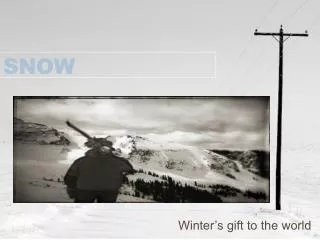
Snow / Ice / Climate I Energy and Mass. “The Essence of Glaciology” Processes of: accumulation – precipitation ablation – melt, sublimation, calving wind & avalanche can affect either Transformation of snow firn ice takes time – depends on mass, temperature, etc

E N D
Snow / Ice / Climate IEnergy and Mass • “The Essence of Glaciology” • Processes of: • accumulation – precipitation • ablation – melt, sublimation, calving • wind & avalanche can affect either • Transformation of snow firn ice • takes time – depends on mass, temperature, etc • Balance of acc & abl energy budget
Energy and Mass • The annual energy budget of a glacier is the sum of inputs minus the sum of outputs ± changes in storage. • The annual mass budget of a glacier is the specific (at-a-point) budget times the area to which it applies, summed across the entire glacier: • Bn = Σ(1-i) (bni x Ai)
INPUTS OUTPUTS Solar (short-wave) radiation Reflection [albedo] Long-wave radiation Long-wave Conduction (air) Conduction Conduction (ground) Convection (air) [sensible] Convection Latent heat Latent heat Condensation, freezing Evaporation, melt ?? energy from sliding/friction, water flow ? Energy Budget
Energy Balance? • Varies with position on a glacier, time of day, season, cloud cover, wind … • Convection often estimated by difference (assuming balance) • “Balance” implies no change in storage (temperature) • Studies are rare because of difficulty.
Specific Mass Budget – Stratigraphic • Most commonly, End Of Summer to EOS • Uses old snow / firn / ice as a marker
Specific Mass Budget Protocols • Stakes = aluminum conduit melted into ice • Winter balance (bw) • bw = depth of snow x density (= “water equivalent”) • Summer balance (bS) • bs = bn – bw (accumulation area) • bs = bw + lost ice times 0.917 (ablation area) • Firn line, bn = 0 • Equilibrium line altitude (ELA), bn = 0
Specific Mass Budget Trends • Accumulation often increases slightly with increasing altitude above the ELA. • @ ELA, bn = 0 • Ablation increases rapidly with decreasing altitude below the ELA.
Specific Mass Budget with Climate • “Accumulation gradient” = Δmassacc/Δelevation= mmH2O/melevation • “Ablation gradient”= Δmassabl/Δelevation= mmH2O/melevation • “Activity gradient”= gradient @ ELA • Maritime = high activity gradient • Continental = low A.G.
Specific Mass Budget with Climate • “Accumulation gradient” = Δmassacc/Δelevation= mmH2O/melevation • “Ablation gradient”= Δmassabl/Δelevation= mmH2O/melevation • “Activity gradient”= gradient @ ELA • Maritime = high activity gradient • Continental = low A.G.
Why is the ablation gradient >>the accumulation gradient? • Accumulation = f (precip) • Ablation = f (melt) • Melt = f (T, albedo) • snow ~ 0.9 • ice ~0.5 • debris ~ 0.2, BUT can also insulate • other reasons?
Specific Mass Budget with Time • Remarkably consistent! • Shape = f (climate) • Position = f (weather)
Snow / Ice / Climate IISnowlines – Space and Time • Snowlines and their many definitions • Estimating bn = 0 • Contemporary controls on snowlines • local climate / weather and topography • Spatial variability • Temporal variability • Pleistocene snowlines and climates
Snowlines I – Cirque Floors • Permanent snowfields? No – glaciers! • Cirque floor elevations • Maximum erosion at minimum size • Problems = size, timing
Snowlines II – Lateral Moraines • Highest laterals = initiation of deposition[discuss more with “glacier flow” ?] • Problem = postglacial slope erosion/removal
Snowlines III –Glaciation Threshold • True “snowline” • Problems = many • Area? • Topography? • Summits > glacier elevations
Snowlines IV – THAR • Toe-headwall altitude ratio • Requires reconstruction • Assumes known “correct” ratio – 40%?
Snowlines V – AAR • Accumulation area ratio • Requires complete reconstruction • Assumes correct ratio .55–.60–.65 ? • [topo map method]
Snowline Comparisons • Meierding (1982) • CO Front Range • tried many ratios • Locke (1990) • Montana • small glaciers • s.d. ~ 350 m
ELA = representative? • Many studies say so! • e.g., Sutherland (1984) • ELA balance represents average winter balance for entire glacier • Measure once – use a lot!
Glacial Climates • Glaciers exist only in a narrow range of climates • = f(winter ppt and summer T) • = f(P, T, and continentality
Controls on Snowlines I – Latitude • Latitude ≈ temperature (treeline) • highest near equator • Latitude ≠ precipitation (snowlines) • saddle near equator • Weak gradients (<1 m/km)
Controls II – Continentality • Lowest near moisture source • Higher inland • Strong gradients • up to 10 m/km
No Hem Glaciers • Latitude? • Continentality • Ocean currents • Local precipitation
Temporal Resolution • Glaciers respond at annual to decadal scales
Temporal Inconsistency • Not all glaciers respond similarly • Not even glaciers in the same region!
Temporal Inconsistency • Not all glaciers respond similarly • Not even glaciers in the same region!
PleistoceneSnowlinesI • SierraNevada • Note effects ofsubtropical high &rain shadow Wahrhaftig and Birman, 1965
Pleistocene Snowlines II • US West(Porter et al. 1983) • Effects of: • SubT High • Westerlies • Storm tracks • Orography
Montana Climate & Glaciers • Glaciers • Inferred air mass movement • Residuals • Inferred causes
MT/ID Paleoclimate • Complex pattern! • More detailed than modern weather stations and SNOTEL sites!
Spatial Resolution • Humlum (1985) • West Greenland • Local data are consistent • Needs no smoothing • High resolution!