Download
1 / 23
230 likes | 356 Views
The temperature gradient and transition timescales as a function of topography in complex terrain. Chad Higgins, Kellie Vache, Chadi Sayde, Sebastian Hoch, and Eric Pardyjak. Experiment specifics. 1.5mm white multimode fiber optic cable Oryx DTS unit, 1m, 2 minute resolution 4 km sample range

E N D
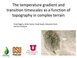
The temperature gradient and transition timescales as a function of topography in complex terrain Chad Higgins, Kellie Vache, Chadi Sayde, Sebastian Hoch, and Eric Pardyjak
Experiment specifics • 1.5mm white multimode fiber optic cable • Oryx DTS unit, 1m, 2 minute resolution • 4km sample range • Double ended measurement, 2 calibration baths • ~100m total elevation gain • Wild horses dragged the experiment away, twice! Thank you CTEMPS.org 1m 0.5m Channel 2 15s later Channel 1
Calibrated data, distance time slice at one height Oct 9 2012, z=0.5m
day night
Search for explanatory variables • Slope • Elevation • Relative positioning? • Contributing area? DEM not sufficient, but we can look at Google earth Photos and on-the-ground photos
Micro-topography has a dramatic influence on drainage flows, all of these features are not visible on a 10m DEM
Contributing area, and thus the relative spatial positioning is a major factor in these flows ES3
Search for explanatory variables • Slope • Elevation • Relative positioning? • Contributing area? Hypothesis stage at this point, can verify if u* is a function of range during the day, need higher resolution DEM to compute drainage areas at night
H Rn A G
Assume a functional form Use shadow front as starting time Fit with nonlinear least squares
Cooling rate Fast timescale
Clear sky conditions Oct 9 2012, z=0.5m
Oct 14 2012, z=0.5m Clear sky conditions
Clouds, but apparent shadow front Oct 15 2012, z=0.5m
Clouds, but apparent shadow front Oct 14 2012, z=0.5m
Clouds, but no apparent shadow front Oct 11 2012, z=0.5m
Clouds, but no apparent shadow front Hypothesis: energy balance closure is better on this day. Oct 13 2012, z=0.5m
Conclusions • Micro-topography has high impact on nighttime temperature and air drainage and temperature gradient • Slope has a greater impact on daytime temperature gradients, but spatial disposition plays a equally important role • The daytime temperature gradient begins to vanish ad we go farther up the hill • The onset timescale of the temperature transition is impacted heavily by local slope • The cooling rate is more impacted by the spatial positioning • Advection always has the proper sign in complex topography for the thermal driven flows • If there is no observable shadow front, the evening transition occurs in the opposite direction