Download
1 / 19
190 likes | 292 Views
Explore the geological wonders of western Ireland through an undergraduate research presentation focusing on fieldwork, map making, and data analysis conducted from May to July '08. Discover how the data collected contributes to understanding ancient glacial movements and geomorphology. Learn about the tools used, methods applied, and connections to pedagogical concepts. Utilize ArcGIS and Google Maps to delve deeper into geological information.

E N D
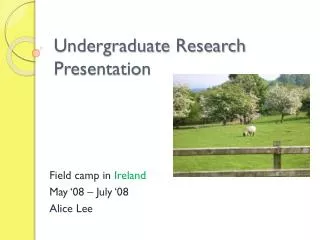
Undergraduate Research Presentation Field camp in Ireland May ‘08 – July ‘08 Alice Lee
I conducted my research in western Ireland http://www.rootsweb.ancestry.com/~wipgs/PGS/IrelandCountiesMAP.jpg
I conducted my research in western Ireland http://www.oar.noaa.gov/spotlite/archive/images/driftcard_ireland2.jpg
A little terminology • Lough = Lake • Knock = Mountain • GPS = Global Positioning System • ArcGIS= Program used for digital maps and upload/input GPS data • Strike and Dip = Measurements of orientation of bedding in a rock formation
Field camp objectives • JMU department of Geology and Environmental Science capstone course • Qualified to work for an industry, write project report, draft publishable map, generate database, become confident at scientific observation, interpretation, and solution of geological problems in the field • Emphasis on map making, data recording, and report preparation
Designing and conducting open-ended investigations in Geology • Final project was an independent mapping project (5 days) of Ballard in Co. Galway • Covered a 6 km2 area • GPS, Field map, Brunton compass • Gather your own GPS points, strike and dip of bedding • Analyze and interpret the geology of the land • Write a memoir of your conclusions about the geomorphology and present all data
Using mathematics and evidence to map ancient glacial movement • Cirque = a curvature or an ampitheatre-like valley formed at the head of a glacier by erosion • GPS points and strike/dip and measure height, width and distance to interpret the glacial movement • Finding and measuring striations and moraines to see how the glacier moved and where it sat • Composition, direction, strike/dip, magnetic north
Evidence in research paper • All the projects required • lithofacies description • Stratigraphic column • Stereonet • Memior about the interpretation of the geology and conclusion based on your data • Figures and tables. Visual aid great for teaching
Using ArcGIS and Google Maps • Digital Mapping Field Exercise • Mapping geologic formations and strike and dip in Finny on Knock Kilbride Co. Mayo, Ireland • Climb Knock Kilbride, Lock-in locationand take strike and dip of outcrop. • Record location and strike/dip on GPS • Input data into ArcGIS to create a map
Google Maps • Data we collected was inputed into ArcGIS as well as a project by Google maps and Galway University • Over the next few years data that we collected will be uploaded into Google maps • Allowing anyone to access geological information and data about the land
Connections to teaching, major pedagogical concepts and principals for planning instruction • Field work (or labs) is necessary. Gather your own data and get your hands a little dirty. Make your own interpretations and conclusions. • Everything in this world is connected. Ireland and east coast of US collided at one point (Interpreting Ireland helps us understand more about east coast. ex: Burren) • Using Google maps and ArcGIS/GPS