Download
1 / 13
130 likes | 292 Views
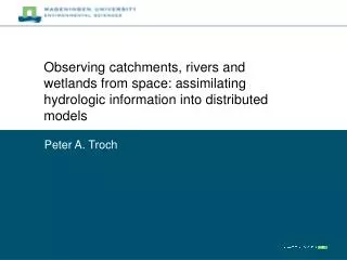
Potential of Distributed GRACE Measurements to Estimate Spatially Variable Terrestrial Water Storage Changes in the Colorado River Basin. Peter A. Troch and Matej Durcik HWR-SAHRA, University of Arizona Shaakeel Hasan, Remko Uijlenhoet and Ruud Hurkmans Wageningen University.

E N D
Potential of Distributed GRACE Measurementsto Estimate Spatially Variable Terrestrial WaterStorage Changes in the Colorado River Basin Peter A. Troch and Matej Durcik HWR-SAHRA, University of Arizona Shaakeel Hasan, Remko Uijlenhoet and Ruud Hurkmans Wageningen University
Support and Acknowledgment • NSF EAR-Hydrologic Sciences: Sustainability of Semi-arid Hydrology and Riparian Areas (SAHRA; PIs: Jim Shuttleworth, Juan Valdés, Kathy Jacobs) • US Dept. of the Interior – Bureau of Reclamation: Enhancing Water Supply Reliability in the Lower Colorado River (PI: Kathy Jacobs, Peter Troch) • WSP-UA (TRIF FY07-11): Tracing Arizona’s Water Reserves from Space • Andy Wood, 3Tier and Univ. Washington • Dennis Lettenmaier, Sonia Seneviratne
Focus Area: Colorado River Basin • Important water resource in semi-arid southwest of US; • Global change imposes enormous stress on the basin’s hydrology; • Assessing climate variability impacts on stream flow requires accurate estimates of terrestrial water storage variability.
What is terrestrial water storage (TWS)? • TWS is the total amount of water stored (surface and subsurface), at a given time, in a river basin; • TWS is an important indicator of the hydrologic state and defines the basin’s response to atmospheric forcing, e.g. • Snow pack defines (potential) spring runoff • Groundwater storage defines baseflow • In Colorado River basin, surface reservoir inflow (e.g. Lake Powell) depends on TWS, hence accurate estimates of TWS can help water management & planning
Cq W E P S R Wet years 1996-2000 Dry years 2001-2006 Terrestrial Water Storage (TWS) Dynamics http://www.iac.ethz.ch/data/water_balance/ Troch et al., 2007 (EOS)
Near real-time TWS monitoring system http://voda.hwr.arizona.edu/twsc/sahra/
GRACE data processing • We used Release 04 (RL04) of monthly gravity field for 2003-2006; • GRACE estimates of surface mass anomalies for the Colorado basin are obtained from the University of Colorado website:http://geoid.colorado.edu/grace/grace.php • More info on RL04 gravity coefficients conversion into 1-degree maps of equivalent water thickness can be found athttp://grace.jpl.nasa.gov/data/mass/ (Chambers, 2006). • Averages of three data sets (JPL, CSR, GFZ) of solutions up to degree and order 40 are used. • GRACE estimates of TWS anomalies at 1-degree resolution are compared to VIC estimates and in-situ data of SWE
Results • Basin-average intercomparison between VIC simulated TWS anomalies and GRACE derived mass anomalies; • Correlation coefficients are generally high, except during 2nd half of 2004.
Results (2): 1-degree correlation maps Total Storage Soil Moisture Snow Storage Groundwater 2003 2004 2005 Total Storage
Results (3): In-situ correlation maps • a) Pixels containing surface reservoirs; • b) Pixels containing groundwater wells; • c) Pixels containing stream flow gauges; • d) Pixels containing Snotel sites; • Numbers refer to time lag of maximum correlation.
Results (4): Effects of Topographic Surface Roughness • a) Slope of regression relationship between GRACE and VIC TWS anomalies (>1: VIC overestimates TWS anomalies); • b) Relationship between slope of regression line and topographic surface roughness (left y-axis) and standard deviation of elevation (right y-axis).
Conclusion and Outlook • Distributed GRACE measurements show great potential to estimate spatially variable terrestrial water storage anomalies in the Colorado River basin; • Current research efforts focus on using TWS information to improve seasonal to interannual stream flow predictions conditioned by climate variability indicators (See Matt Switanek’s talk at 2:15PM in Room 129B).