Download
1 / 11
110 likes | 308 Views
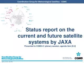
Status report on the current and future satellite systems by JAXA Presented to CGMS-41 plenary session, agenda item [D.2]. Overview - Planning of JAXA satellite systems. ALOS-2 SAR. ALOS/PALSAR. [Land and Disaster monitoring]. ALOS "DAICHI". ALOS/PRISM AVNIR2. ALOS-3 Optical. TRMM/ PR.

E N D
Status report on the current and future satellite systems by JAXAPresented to CGMS-41 plenary session, agenda item [D.2]
Overview - Planning of JAXA satellite systems ALOS-2 SAR ALOS/PALSAR [Land and Disaster monitoring] ALOS "DAICHI" ALOS/PRISM AVNIR2 ALOS-3 Optical TRMM/PR TRMM GPM/DPR [Precipitation] Aqua/AMSR-E [Wind, SST , Water vapor] GCOM-W2 Aqua GCOM-W1/ AMSR2 [Vegetation, aerosol, cloud, SST, ocean color] GCOM-C1/ SGLI 250m, multi-angle, polarization [Cloud and Aerosol 3D structure] EarthCARE/CPR GOSAT “IBUKI" [CO2, Methane] [CO2, Methane] GOSAT-2 Mission status Phase B~ Phase A Extension On orbit
Coordination Group for Meteorological Satellites - CGMS • JAXA currently operates GOSAT, Ibuki and GCOM-W1, Shizuku • TRMM/PR is still working well. 15th anniversary symposium was held in Tokyo in last November. • All types of the GOSAT data products are to be provided for general users. Data users can search and order the Level 1 data and the higher level data products. The Level 1 data and the Level 2 data products whose uncertainties have been evaluated in the instrument calibration and data validation activities are open to the general users. Carbon dioxide flux estimates based on the observational data by GOSAT are released to general users as the Level 4 data products. • The initial calibration and checkout of GCOM-W1, Shizuku was successfully conducted. The AMSR2 products are available at the GCOM-W1 Data Providing Service website. CURRENT R&D SATELLITES
GOSAT, Ibuki GOSAT enables global (with 56,000 points) and frequent (at every 3 days) monitoring CO2 and CH4 column density. (Launched in Jan 2009) Current Ground-based Observation Points (320pts) Provided by WMO WDCGG TANSO-FTS(Fourier Transform Spectrometer) TANSO-CAI (Cloud and Aerosol Imager) Increase of Observation Points using GOSAT (56,000pts)
AMSR2 onboard GCOM-W1 “SHIZUKU” • Successor of AMSR-E on Aqua and AMSR on ADEOS-II. • Deployable main reflector system with 2.0m diameter (1.6m for AMSR-E). • Frequency channel set is identical to that of AMSR-E except 7.3GHz channel for RFI mitigation. • Two-point external calibration with improved HTS (hot-load). • Add a redundant momentum wheel to increase reliability.
Coordination Group for Meteorological Satellites - CGMS • The developments of ALOS-2, GPM/DPR, EarthCARE/CPRand GCOM-C1 are under way. • Both ALOS-2 and GPM core satellite will be launched in JFY2013. • GPM observatory will be shipped to Japan around in October 2013 for launch. Both NASA/GSFC and JAXA are developing ground system to process GPM standard products. At JAXA‘s GPM Mission Operation System in Tsukuba, software development and test, including internal and external interface test, was completed. Mission Simulation Test and End-To-End test is under way at GSFC and at JAXA • Both ALOS-2 and GPM core satellite will be launched in JFY2013. While EarthCARE and GCOM-C1 will be launched in JFY2016. FUTURE R&D SATELLITES
ALOS-2 Specification ALOS-2: SAR Satellite • August, 2009: Project Team was established • December 2009: Preliminary Design Phase • October 2010: Critical Design Phase • Planned to be launch in 2013
GPM Core Observatory with DPR GPM core observatory in GMI and HGA deployed configuration (photo provided by NASA) DPR mechanically integrated to the core observatory (photo provided by NASA)
EarthCARE/CPR CPR Climate monitoring of earth radiation, cloud and aerosol Cooperation between ESA and Japan (JAXA/NICT) • Mission • Vertical profile of clouds, aerosol • Interaction between clouds and aerosol • Cloud stability and precipitation • Orbit • Sun synchronous • Equator crossing time13:45 • Altitude400km • Instrument • CPR (Cloud Profile Radar) • ATLID (Atmospheric LIDAR) • MSI (Multi-Spectral Imager) • BBR (Broad Band Radiometer) • Task sharing • JAXA/NICT (CPR) • ESA (LIDAR, MSI, BBR, Spacecraft) • Launch target • JFY2016 BBR MSI ATLID 9
GCOM-C1 and SGLI • Improvement of land, coastal, and aerosol observations. • fine (250m) spatial resolution • polarization/along-track slant view 250m over land or coastal area, and 1km over offshore Multi-angle obs. for 674nm and 869nm 250m-mode possibility
Thank you for your attention Enjoy your stay in Japan


![Overview - Planning of [CGMS agency] satellite systems](https://cdn1.slideserve.com/3541507/slide1-dt.jpg)