Download
1 / 23
240 likes | 466 Views
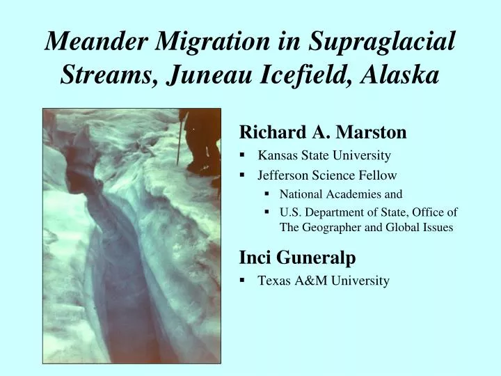
Meander Migration in Supraglacial Streams, Juneau Icefield, Alaska. Richard A. Marston Kansas State University Jefferson Science Fellow National Academies and U.S. Department of State, Office of The Geographer and Global Issues Inci Guneralp Texas A&M University. Juneau Icefield.

E N D
Meander Migration in Supraglacial Streams, Juneau Icefield, Alaska Richard A. Marston • Kansas State University • Jefferson Science Fellow • National Academies and • U.S. Department of State, Office of The Geographer and Global Issues Inci Guneralp • Texas A&M University
Juneau Icefield • 4000 km2 of sub-polar ice in Boundary Coast Range of AK-BC • 30 outlet glaciers from high plateau of ice at 1400 m • Supraglacial stream research at confluence of Vaughan Lewis and Gilkey glaciers at 1100 m elevation • Research supported by FGER, NSF-REU
The rates and directions of meander migration remain poorly understood Could study with… • historical aerial photos, maps, field surveys • lab simulations with stream tables Landsat: Mississippi River, AR-MS
Use supraglacial streams as an analogue • Best formed in firn below the transient snowline • Must downcut faster than glacier surface ablation • Few crevasses Near C-18B, Gilkey Glacier-Vaughan Lewis Glacier convergence zone
Supraglacial streams • Time & scale not important in meander development • Sediment load not necessary to initiate meanders but clastics do alter meander dimensions • Super-elevation of water surface against outer bank could provide the incremental frictional heat for differential thermal erosion Near C-29, Cathedral Glacier
SG streams similar to incised meanders • Meanders migrate simultaneous with downcutting • SG streams similar to meanders cut in alluvium with high %clay-silt • Hydraulic geometry • Unit stream power vs. sinuosity • Discharge vs. meander wavelength • Channel width vs. meander wavelength Near C-18B, Vaughan Lewis Glacier
Each day a longitudinal groove forms in the channel caused by diurnal variations in stream width
Simultaneous with downcutting and formation of daily grooves, SG meanders migrate by translation and extension 3-D record of meander position Near C18B, Vaughan Lewis Glacier
Objective of study was to describe & explain rate & direction of meander migration in supraglacial streams Near C-29, Cathedral Glacier
Field Methods1) measure geometry for 6 meanders2) track daily change in position of apex of each meander3) measure peak Q and distribution of shear stress in each bend
Supraglacial stream dimensionsWidth (W) ranged from 18-120cmSinuosity (P) ranged from 1.07-1.67Channel curvature (r/W) ranged from 1.8-9.2Peak discharge (Qp) ranged from 20-240 l/s
Results • Extension is more important than translation in meanders with high P, low r/W, low Qp (e.g., meander #6) • Translation dominate over extension in meanders with low P, high r/W, high Qp (e.g., meander #4) • Extension and translation both increase as Qp increases • Total rates of migration = 8 to 77 cm/d