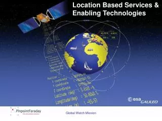
Location Based Services & Enabling Technologies
This overview explores the latest developments in Location-Based Services (LBS) and enabling technologies through the Global Watch Mission led by Professor Jonathan Raper at City University. Key projects include Webpark for outdoor activities, LBS4all for the visually impaired, and Locus for context-aware tools. The report discusses advancements in architectures, such as web browser-based systems and adaptive filtering methods, emphasizing the importance of providing relevant information based on user needs. Safety scoring and travel options for disabled users are highlighted, showcasing future possibilities in LBS.

Location Based Services & Enabling Technologies
E N D
Presentation Transcript
Location Based Services & Enabling Technologies Global Watch Mission
LBS Value Chain Professor Jonathan Raper Global Watch Mission
About City University LBS work • Webpark: LBS for outdoor activities (EU funded with Geodan, EADS, LNEC, Swiss National Park & U. of Zurich) • LBS4all: location-based services for the visually impaired and older people (ESRC funded with Kings College, Royal National Institute for the Blind and Ordnance Survey) • Locus: development of context tools for LBS (EPSRC funded with 3 and GIG) Global Watch Mission
LBS platform for applications • Architecture developed • based on web browser • GML content • SVG portrayal • client or server connected • java applications • GPS bluetooth positioning Global Watch Mission
LBS architectures GPS map DB content WFS WMS OGC requests http server on device + cache Display Data (html) Maps (GML/SVG) Pocket MS-IE Augmented/ Virtual reality Agent-based Information filtering Adaptive scaling Data mining Routes/POI’s Client Server Global Watch Mission
Adaptive LBS • LBS need to adapt to users through • Information filtering by location • Augmented reality • Data mining travel options Global Watch Mission
Information filtering by location • Key problem in LBS is how to provide information appropriate to user needs • Stochastic simulation of possible future movement, used to search ahead for points of interest • Points of interest ranked on the relevance surface Global Watch Mission
Augmented reality • Realisations of cityscapes & landscapes on mobile devices • Digital compass used to orient the user • User controlled labelling Global Watch Mission
Data mining travel options • Define routes and areas accessible within a certain time • Produce space-time access prisms based on real travel • Present ‘real’ travel isochrones around current position • Show safety ’scoring’ of routes for disabled users Global Watch Mission