Download
1 / 4
40 likes | 165 Views
Principal Investigator : Josef Kellndorfer Woods Hole Research Center Research Team: Wayne Walker, Jesse Bishop, Tina Cormier, Greg Fiske, Katie Kirsch Woods Hole Research Center Elizabeth LaPoint , Mike Hoppus , Jim Westfall USDA Forest Service FIA Program: Collaboration:

E N D
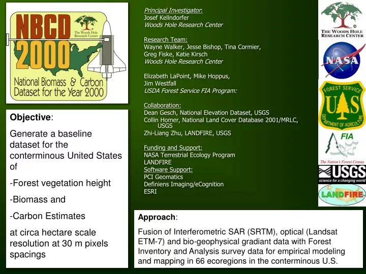
Principal Investigator: Josef Kellndorfer Woods Hole Research Center Research Team: Wayne Walker, Jesse Bishop, Tina Cormier, Greg Fiske, Katie Kirsch Woods Hole Research Center Elizabeth LaPoint, Mike Hoppus, Jim Westfall USDA Forest Service FIA Program: Collaboration: Dean Gesch, National Elevation Dataset, USGS Collin Homer, National Land Cover Database 2001/MRLC, USGS Zhi-Liang Zhu, LANDFIRE, USGS Funding and Support: NASA Terrestrial Ecology Program LANDFIRE Software Support: PCI Geomatics Definiens Imaging/eCognition ESRI • Objective: • Generate a baseline dataset for the conterminous United States of • Forest vegetation height • Biomass and • Carbon Estimates • at circa hectare scale resolution at 30 m pixels spacings Approach: Fusion of Interferometric SAR (SRTM), optical (Landsat ETM-7) and bio-geophysical gradiant data with Forest Inventory and Analysis survey data for empirical modeling and mapping in 66 ecoregions in the conterminous U.S.
Detailed Views at 30 m Pixel Scaling Midwest
NBCD Uncertainty Estimates in Comparison to FIA at Plot, County, and State Scale Plot Scale: Height Plot Scale: Biomass State Scale: Biomass County Scale: Biomass