Download

1 / 43
430 likes | 529 Views
Explore the functions of healthy streams, the impact of natural disasters on river ecosystems, historical river management practices, and the principles of stream corridor restoration. Understand the factors influencing fluvial geomorphology and the importance of maintaining dynamic equilibrium in stream systems.

E N D
Stream Geomorphology Leslie A. Morrissey UVM July 25, 2012
What Functions do Healthy Streams Provide? • Flood mitigation • Water supply • Water quality • Sediment storage and transport • Habitat • Recreation • Transportation • Aesthetic qualities
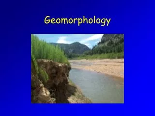
When streams go wild In Vermont, most flood damage is caused by fluvialerosion
History of River Management • Transportation • Power • Agriculture
Traditional River Management • Goal - contain flow within straight channel • Stream channels were: • dredged • bermed • armored to withstand the increased stream power
Disaster Can Result Energy kept in the channel during flooding can cause catastrophic damages downstream
Precipitation Runoff Streams are Indicative of Watershed Condition A change in the watershed will impact the stream network
Disturbance-induced changes in stream structure and function
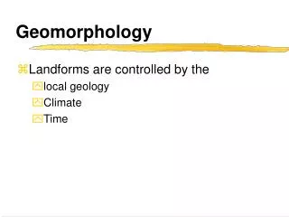
Channel characteristics (e.g., sinuosity, width, depth) are determined by stream discharge and sediment Fluvial Geomorphology Influenced by: Watershed area Land use and land cover Soils and geology Topography Climate Human impacts
Streams Adjust to Changing Conditions Lateral Vertical Longitudinal Temporal Stream Corridor Restoration: Principles, Processes, and Practices. 1998. Federal Interagency Stream Restoration Working Group.
Vertical Movement of Stream Channel 1992 - 2007
Headwaters Stream Corridor Longitudinal Profile (dominated by slope) Transfer zone Deposition zone Miller, 1990
Approximate location of 1900 channel Channelized reach along toe of valley wall (today) Temporal Changes in Stream Channel Lewis Creek
Terrace Left Bank Right Bank Thalweg Downstream
Stream Channel Patterns • Straight channels → • indicative of strong geologic structure (bedrock) or human control • Braided streams ↘ • multiple interwoven channels • Meandering channels ↓ • highly variable, sinuous
Meander Pattern Tributary Floodplain
Pool and Riffle Sequence Pool Riffle
Water is the Driver Runoff
Velocity vs. Discharge • Q = v x A = Discharge (cfs) • v = Velocity (ft/s) • A = Cross-Section Area (ft2) Stream Corridor Restoration: Principles, Processes, and Practices. 1998. Federal Interagency Stream Restoration Working Group
Velocity affects erosion and deposition Faster flow -> erosion Slower flow -> deposition
Shaping and Reshaping of Channels • As gradient (slope) decreases, stream flow meanders -> lateral erosion • Since flow is faster around the outside of a bend, meanders shift sideways by eroding their outer bank • Since flow is slower on the inner bank, sediment is deposited
Channel Migration Process (Planform Change)
Water and Sediment Connection Flow velocity Particle size on stream bottom Discharge
Headwaters Transfer zone Deposition zone High elevation Steep slopes V-shaped valleys Narrow channels High velocity Erosion (vertical) Longitudinal Summary Gentle slopes Streams merge Channels begin to meander Floodplain broadens Channels widen Erosion and deposition Flat, broad floodplain Low slopes Meandering channels Lateral erosion High discharge Deposition dominates Miller, 1990
Dynamic Equilibrium A stable stream transports the water and sediment produced by its watershed, such that over time it maintains its dimension, pattern, and profile, while neither degrading nor aggrading. However, if any factor changes, the other variables must change to reach a new equilibrium. Sediment Load Stream Power In balance with The amount of sediment and the size of the sediment particles that can be transported in a stream are directly related to the gradient (slope) of the stream channel and amount of water flowing in the stream channel at a particular time. Lane (1955)
Storm > ↑ Discharge >>> Degradation Sediment Load Stream Power Sediment Size Coarse Fine Stream Slope Flat Steep Aggradation Degradation Sediment Supply (Volume) Discharge
Waterfall > ↑ Slope >>> Degradation Sediment Load Stream Power Sediment Size Coarse Fine Stream Slope Flat Steep Aggradation Degradation Sediment Supply (Volume) Discharge
Road construction > ↑ Sediment Supply >>> Aggradation Road Construction (assume no change in stream power) Sediment Load Stream Power Sediment Size Coarse Fine Stream Slope Flat Steep Aggradation Degradation Sediment Supply (Volume) Discharge
Upstream Dam > ↓ Sediment Supply >>> Degradation Upstream Dam Sediment Load Stream Power Sediment Size Coarse Fine Stream Slope Flat Steep Aggradation Degradation Sediment Supply (Volume) Discharge
Unvegetated Point Bars (aggradation) Out of Balance • When a stream is unstable, i.e. out of balance, it is either aggrading (gaining sediment along its bed and banks) or it is degrading (deepening or widening due to the removal of sediment) Cut banks (degradation)
Vegetative Clearing Channelization Streambank armoring Development Bare soil Irrigation or drainage Overgrazing Roads and railroads Dams Water withdrawal What Can Change Streamflow?(Dynamic equilibrium) • Storms
Examples Culverts Agricultural ditches Channel straightening Rerouting
Constrictions • Stream crossings • roads • railroads • bridges • Road culverts • Channelization • Dams • Bedrock
What’s going on here? < Bedrock control Elevation (m) < Alluvium
Storm events can trigger catastrophic floods • Baseflow - sustained amount of flow in a stream when no precipitation event has occurred • Peak discharge - stream flow attributed to a precipitation event Climate change implications?
Greater runoff and higher in-stream velocities contribute to streambank erosion Causes of bank erosion • Lack of riparian buffers • Channelization • Dams • Overgrazing • Commercial dredging • Piped discharge • (culverts, ditches) • Development • Impervious surfaces
Sediment in Streams and Rivers • Leading non-point source of pollution • Largest source of impairment to streams and rivers worldwide (EPA) • Decreased water quality • Negatively impacts habitat health Colchester Point Tropical storm Irene (02 September 2011)
rock rip-rap (armoring) cedar trees Bank Protection
Development increases runoff ↑ Impervious surfaces ↓ Riparian buffers ↑Stormwater inputs ↑ Peak discharge (flooding) ↑ Sediment loading Post development Pre development
Google Earth Activity • 1. Photointerpret stream features along Browns River • Stream features • erosion • deposition • Channel modifications • straightening, armoring, ditches, dams • Channel adjustments