Download
1 / 22
220 likes | 349 Views
Revision session. Rivers. The next 5 weeks. Will all have a similar format. Each week will be a different section: Week 24: Rivers Week 25: Hazards Week 26: no lesson – last day of term and no school as we are making our way to Brecon for IH weekend Week 27: Eco activity & energy

E N D
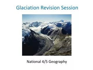
Revision session Rivers
The next 5 weeks • Will all have a similar format. • Each week will be a different section: • Week 24: Rivers • Week 25: Hazards • Week 26: no lesson – last day of term and no school as we are making our way to Brecon for IH weekend • Week 27: Eco activity & energy • Week 28: Urban • Week 29: Fragile environments • After that – a mixed bag of any questions I can locate!
Weeks 24 - 29 • Each again will be similar: • Luckily we have loads of old exam questions which more or less match the units we have studied. So we will look at a selection in class – the first lot is a bit of try it and see. But this is my thoughts – tho’ this can change! • I have put 5 questions into the class notes and all 5 are in the PP too, but I would guess that we will not come close to finishing them in the lesson. • My hope is we will get to the end of qu 4 and qu 5 we will not touch • So for homework, you will write up qu 5 which we will not have discussed and one other, which we will. See how it works for this week anyway.
Specimen(this is so I know what we have done and what not) • (a) Study Figure 1a which shows the hydrological cycle.
((i) Read the statements below and in each case underline the correct sentence. 1. Some water goes directly to evaporation from precipitation Some water goes directly to evaporation from percolation 2. Some water reaches rivers directly from interception Some water reaches rivers directly from evaporation Some water reaches rivers directly from groundwater 3. Infiltration means Any form of water falling from the atmosphere The movement of water into the soil Heat changing water into water vapour
(b) Study Figure 1b, which shows a map of two river valleys. Below the map is a hydrograph for each of the rivers. • (i) What is the time of the peak discharge of River B? (1) • (ii) What is the discharge (in cumecs) of River B at 18.00 hours? (1)
(b) Study Figure 1b, which shows a map of two river valleys. Below the map is a hydrograph for each of the rivers. • (iii) Explain why the peak discharge of River B is later than that of River A?(6)
(c) Explain how you could estimate the discharge of a river, stating clearly the measurements you would need to make and how these would be obtained.(6) • (d) Rivers often flood. This is likely to be a problem for towns built on their flood plains. • For a town you have studied which has a flood protection scheme • (i) Name the town and the river. • (ii) Explain why building often takes place on a flood plain.. (4) • (iii) Explain how the town mentioned is protected against flooding. (9)
May 2005 • (a) Study Figure 1, which shows the hydrological cycle of a drainage basin
(iii) What stores water at A? (1) (iv) What process is represented by arrow B? (1) (i) Name the input of water into the drainage basin. (1) (ii) Name the output of water from the drainage basin. (1) May 2005
(b) (i) What term is used to describe the volume of water in a river channel? (1) • (ii) Draw and label a diagram of a drainage basin. (4) • (c) How would you plan to carry out water quality tests to see if water was clean?.(5) • (d) (i) What is river flooding? (2) • (ii) Explain the main physical causes of river flooding. (2) • (iii) Suggest how human activities in a drainage basin can help to cause flooding. (3) • (d) (i) Using a named example, explain why a dam might be built in a drainage basin.(5) • Named example: ................................................... • (ii) Referring to the example, what are the disadvantages of building dams in a drainage basin? (4)
Nov 2005 • (a) Study Figure 1. It shows the percentage of the population of some countries with access to clean drinking water.
(i) On Figure 1 plot the following information. (2) Iran 83 % Nepal 44 % (ii) What is meant by clean water?(2) (iii)Which country has the lowest water quality? (1) (iv) In how many countries do more than 50% of people not have clean drinking water? (1) (v) Give two reasons why water quality is low in some countries. (2)
(b) (i) Water is used for drinking. Name two other uses of water. (2) • (ii) How do countries collect and supply clean water? (4) • (iii) Select one common potential cause of river pollution and explain how using water quality tests you could assess whether this was the case.(6) • (c) Explain, with the use of named countries, why the use of water increases as countries develop. (9)
May 2006 • (a) Study Figure 1a, which is a field sketch showing part of a river’s course.
(i) What is the correct geographical term for the bends in a river? (1) • (ii) Which of the two processes, deposition or erosion, is more important at: (2) • Point A Point B
(b)(i) Figure 1b is a cross-section of the same river channel between points A and B. • Write the numbers 1 to 4 on the cross-section in Figure 1b to locate the following features(4) [modified use 1 to 8 for class time] • 1. the slowest flowing water • 2. the fastest flowing water • 3 . the river cliff • 4. the slip-off slope (or point bar). • (ii) Explain how the river cliff and slip-off slope were formed. (4)
(c) Explain how you would carry out an investigation to confirm the conclusions about speed you came to in (b) (7) • (d) (i) What is the discharge of a river? (1) • (ii) Explain why the discharge of a river increases between its source and its mouth. (3) • (iii) Give two ways in which the discharge of a river can vary after heavy rain. (2) • (iv) Explain each of these two variations. (6)
Nov 2007 ( May 2007 already used) • (a) Study Figure 1 which shows one type of waterfall
Nov 2007 ( May 2007 already used) • (i) Link spaces 1, 2 and 3 by choosing from the following words (2) • • undercutting • • plunge pool • • softer rock. • (ii) What is meant by the term hard rock? (1)
Nov 2007 ( May 2007 already used) • (iii) Why did the hard rock cause a waterfall to form? (2) • (iv) Explain how all the feature 3 shown in Figure 1 was formed. (4) • (v) Why does undercutting occur where shown in Figure 1? (2)
(b) Which of the following water quality feature would you expect to change if tests were made above and below the waterfall and why? (6) • temperature, dissolved oxygen, pH or turbidity • (c) Waterfalls can create both benefits and problems. Describe: (4) • 1. one benefit • 2. one problem. • (d)(i) Explain why waterfalls are usually found in the upper and middle courses of rivers and rarely in their lower courses. (3) • (ii)Explain how 2 other features on a river form, one from the middle course and one from the lower course. Named examples may help your answer.(6)