Magnetism
350 likes | 544 Views
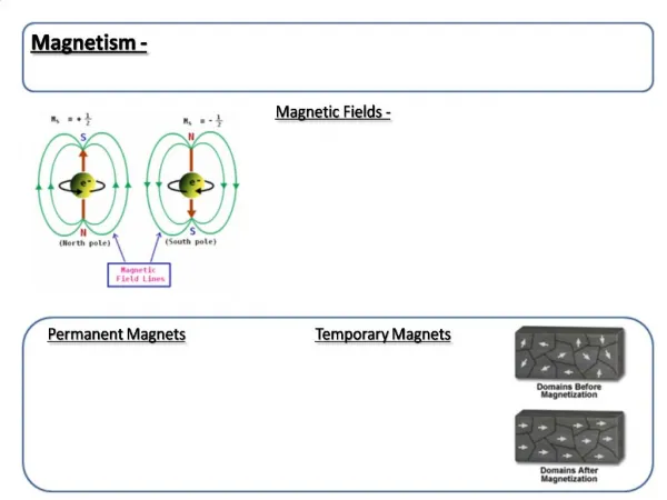
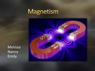
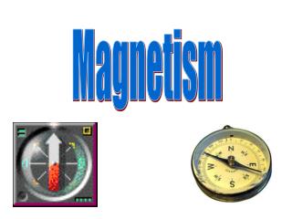
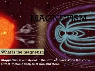
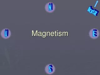
N. lost. Magnetism. W. E. S. Magnetic Dipole. Experiment: bar magnet, paper, iron filings. Iron filings will array themselves around the magnetic, along magnetic field lines. Magnet = dipole (two-pole magnet). The Earth as a Dipole.

Magnetism
E N D
Presentation Transcript
N lost Magnetism W E S
Magnetic Dipole • Experiment: bar magnet, paper, iron filings. • Iron filings will array themselves around the magnetic, along magnetic field lines. • Magnet = dipole (two-pole magnet)
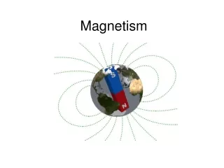
The Earth as a Dipole • Earth’s magnetic field is well-approximated as a dipole. • Magnetic field lines radiate from Earth’s N and S magnetic poles • Charged particles trapped on magnetic field lines (like iron filings) = magneto-sphere
Earth’s Dipole Magnetic Field • Earth’s magnetic field lines are not symmetrical. • Solar wind (stream of ionized gases from the Sun, 400 km/s) deforms magnetosphere --> compressed on one side, stretched out on the other. • On Sun side: 80 to 60,000 km • Away from Sun: extends >30,000 km
Magnetic N isn’t Geographic N • Magnetic field axis is tipped with respect to rotational axis • Difference = 11 degrees • Geographic north = magnetic south
Rock Magnetization: Igneous • Volcanic rock erupts and cools. • As rock cools, iron minerals lock in ambient magnetic field. • Acquisition of magnetization occurs at specific temperature called Curie temperature (e.g., 580oC for magnetite and 680oC for hematite). • Blocking temperature is few tens of degrees lower than Curie temperature; is where magnetized grains cannot be reoriented.
What causes the magnetic field? • Curie temperature>Temp of core (~ Sun surface temp) = 5000oC. • So analogy of bar magnet is not great -- core of Earth is too hot to allow coherent magnetic signal from magnetism frozen in rock. • Earth’s magnetic field would die away in 20,000 years if not constantly being regenerated (has been in existence for at least 3.5 Ga).
Where does the Earth’s magnetic field come from? • Don’t really know. • Somehow linked to rotation of Earth (Venus has similar iron composition in core, but slower rotation period (243 days) and no magnetic field). • Probably has to do with rotation of hot metallic material in Earth’s outer core. Magnetohydrodynamics.
Where does the Earth’s magnetic field come from? • “Dynamo effect” or “geodynamo” (like an electric generator). R. Nave
Where does the Earth’s magnetic field come from? • Solid inner core = size of moon, temperature of Sun. Overlain by liquid outer core. • Thermal and chemical (compositional) buoyancy drive convection in outer core. • Thermal buoyancy = Earth is cooling slowly • Chemical buoyancy = Iron-rich alloy comprising outer core solidifies, giving off latent heat of fusion.
Where does the Earth’s magnetic field come from? • Buoyancy --> fluid rises. • Coriolis force (rotation of planet) shears fluid flow. • Electric current (flow of charged particles) results from conductor (iron) moving through a magnetic field. • Electromagnet: Moving charged particles (like convecting iron) cause magnetic field.
Earth’s Magnetic Field • Earth’s total magnetic field = dipole field + non-dipole field • Magnitude of non-dipole field < magnitude of dipole field • International Geomagnetic Reference Field (IGRF) published regularly (every few years). Like go in gravity. Describe local variations in magnetic field with respect to IGRF.
Magnetic Reversals • Earth’s magnetic field aperiodically reverses (magnetic north becomes magnetic south). • Reversals have occurred for at least 3.5 Ga. • Reversals take about 10,000 years. • Mean time between reversals ~200,000 years. • Lengths of reversals varies greatly (100s of kyrs to millions of years).
Magnetic Reversals • Unclear exactly how reversal occurs. Two possibilities: (1) Existing magnetic field diffuses away and rematerializes in opposite orientation. (2) Poles stay intact and just flip. • Existing data cannot differentiate between these possibilities.
Harvard Experiment • Laboratory models have not been successful in reproducing the geodynamo. • Harvard scientists in the mid-90s set up a computer model to simulate the geodynamo: • Programmed in magnetohydrodramic equations • Set up a 3D, spherical Earth • Let it run • Have simulated 300,000 Earth years. • Produced a magnetic field with shape and intensity similar to the Earth’s! • 36,000 years into the simulation, the field spontaneously reversed. Reversal took about 1,000 years.
Harvard Experiment PSC Scientific Visualization
Harvard Experiment PSC Scientific Visualization
Harvard Experiment PSC Scientific Visualization
A curious observation • Oceanographic expeditions in the early- to mid-1900s carried magnetometers to measure the magnetic field at sea. (Magnetometers were used to detect submarines). • Subtracted out IGRF to calculate marine magnetic anomalies. • Early published maps of marine magnetic anomalies contained curious striped patterns (e.g., off western N. America, 1961).
A curious observation • As time passed, more such maps were collected. • “Stripes” were first understood by Vine and Matthews, as well as Morley, in 1963. • Oceanic crust serves as a “tape recorder” of the orientation of the Earth’s magnetic field. Each time the poles reverse, a “stripe” is created in the magnetic anomaly pattern.
A curious observation S N “normal” N N
A curious observation N S “reverse” N R R N
A curious observation S N N R N N R N
A curious observation • Width of a magnetic “stripe” is determined by (1) how fast the ridge is spreading, and (2) the length of time between magnetic reversals. • How do you calibrate the “stripes” (e.g., assign ages to them)?
Rock Magnetization: Sedimentary • Much lower magnetization than sedimentary rocks • Depositional or detrital remanent magnetization (DRM): As sediments are deposited in water, magnetized grains will orient themselves with the Earth’s magnetic field. • Chemical remanent magnetization (CRM): After deposition, chemical growth of iron oxides occurs in situ. After magnetic grains reach a critical size, magnetization is locked in.
Calibrating the stripes • Two approaches: terrestrial and marine. • Terrestrial: • Go to the field and measure the magnetic orientation of a rock sample in situ. • Then measure its age in the lab. • Completed in 1966; went back 4 Ma. • Marine: • Collect magnetic anomaly profiles perpendicular to the axis of the Mid-Atlantic Ridge in the South Atlantic. • Assume a constant spreading rate for the last 80 Ma. • Calibrate using seafloor samples collected by DSDP (precursor to ODP), dated using fossils. • Completed in 1968.
Calibrating the stripes • With additional marine data, the geomagnetic reversal time scale has undergone continual refinement.
Geomagnetic Time Scale • Specific reversal anomalies have been numbered for reference. • 0 to 80 Ma: Anomaly 0 to Anomaly 33 • 125 to 157 Ma: M0 to M27 (M = Mesozoic) • Magnetic Quiet Zone: Cretaceous, 83-124 Ma
Using the stripes • Go out on a cruise • Collect marine gravity data. • Reduce to magnetic anomalies. • Make a magnetic anomaly profile. • Wiggle-match.
Crustal Age Map • Compile magnetic anomaly picks from many cruises. • Plot locations of specific reversals on map. • Contour ages. • Result = Crustal anomaly age map. IMPORTANT NOTE: Oldest seafloor is ~180 Ma. Everything else has been subducted.
Plate Reconstructions How do we know where continents were 100 Ma? For a given block of crust,paleomagnetic data can be used to determine the latitude and orientation of the ridge that created it. Use isochron map --> remove intervening blocks of crust.
Plate Reconstructions • Limitation: Marine-based reconstructions can only go back 180 Ma. • Earlier than that, must rely on • continental magnetic data • faunal data • etc. • Limitation: Full reconstructions are possible only for ocean basins that contain only ridges. Data are lost at subduction zones (Pacific reconstructions are difficult).