Download

1 / 24
240 likes | 359 Views
This webinar provides detailed instructions for the National Resource Damage Assessment (NRDA) data management process. Participants will learn about field sampling forms, data uploading protocols, and location code determination. Additionally, the session covers effective photography techniques for field validation and the proper use of GPS tools to track sample locations. Ensure accurate data management and compliance with all requirement protocols by following these clear, illustrated guidelines. Access necessary forms and resources through the provided FTP site and support materials.

E N D
Sampling Forms & Instructions FTP Site: www.researchplanning.com/downloads Please download and print these instructions!
Sampling Forms & Instructions Detailed Instructions on Using the Field Sample Information and COC spreadsheet
Sampling Forms & Instructions • Data Management Instructions • Location Code • Compiling Field Data • Naming Conventions • Uploading Field Data
Sampling Forms & Instructions Shipping Guidance
Sampling Guidance FTP Site: www.researchplanning.com/downloads
Electronic Field Sample Form: COC Print *this* sheet and send with lab samples Make sure samples are labeled with the correct sample ID
Location Code Maps FTP Site: www.researchplanning.com/downloads
Location Code Maps 1 2 Determining Location Code: Navigate to the Index Maps folder Open the Index Map for your state Determine the correct map number 3
Location Code Maps 4 5 Determining Location Code: Navigate to Sample Grids folder Open the file corresponding to your map number Determine the correct grid cell and note the Location Code 6
Location Code Maps 7 Determining Location Code: Note the Location Code on your Sample Collection Form
Location Code Maps Water-Based Sampling: Given the extent of the Gulf activities, for water-based sampling please use the following convention: -- GU = Gulf of Mexico -- EC = East Coast -- Degree Latitude -- Degree Longitude For example, if you are sampling in the Gulf of Mexico at 27.30 North and -88.30 West, your code would be GU2788.
Sample ID naming Convention • LocationCode – DateCode - Matrix SamplerTeam# Sample# • 6-digit Location code • 5-digit date: year letter and mmdd. • A=2010, B=2011 • Matrix letter, 2 or 3-digit sample team #, and 2-digit sample number • EXAMPLE: LAAM24-A0502-T0102 • LocationCode = LAAM24; Date = 5/2/2010, Matrix=Tissue; Sample Team # = 01; & Sample # = 02 • NOTE: Water Column data on Vessels (cruises) can use the cruise naming convention for Sample ID. (E-mail DATA.SMU@NOAA.GOV for more information)
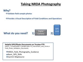
Taking NRDA Photography Why? • Validate Field Sample Photos • Provide a Visual Description of Field Conditions and Operations What do you need? Digital Camera GPS Unit Helpful GPS/Photo Documents on Trustee FTP: Home > Trustee Private Communications > Sample Data > 0_Instructions_and_Forms > Field_Photo_Validation_Documents NRDA_Field_Photography_Guidance Basic_GPS_Skills GarminMapSource
Requisite GPS Settings: • GPS/Camera must be set to local time (Set to 24-hour Military Time) • Garmin GPS: Turn GPS Unit ON> Menu > Setup > Time > Time Format = “24 hours” • Datum = “WGS 84” • Turn On GPS > Menu > Setup > Units > Map Datum = “WGS 84” 3) Set Track Log to “Wrap When Full” Turn On GPS > Menu > Tracks > Track Log (Track Log = “On”) > Setup > Check “Wrap When Full” • Set GPS to Decimal Degrees • Garmin GPS: Menu> Menu > Setup> Units > Position Format > hdd.ddddd GPS Terms: Tracks and Waypoints Tracks (or “Track Log”):The “breadcrumb trail”; a stream of continuous data points recorded when the unit’s Track Log is turned on, saved to GPS’ memory (ex. overflight path, extent of assessed shoreline) Waypoints: A specific location manually captured by the user and saved to GPS’ memory (ex. location of marine debris object, location of sample).
When using GPS in the field: • Take a photo of your GPS unit with the Date/Time (with seconds!) • (Press “Menu” twice) • Make sure it is Clearly Visible • (double-check on camera) 2) Record a Waypoint when you take a sample When taking photos in the field: • Remember to take multiple photos at each sample point – perspective is important! Take a photo zoomed into the area of interest and then take it in context of the surrounding area. • Take photos to the “tell a story” of the sampling effort (i.e., record other events, other activities of interest) • Do not delete photos • Do not open photos before zipping – may change metadata
Returning from the Field: • Connect your GPS unit to your computer (remember your cables) • Start Garmin MapSource • Click on the “Receive from Device” icon. • Click Find Device (the name of your GPS unit will appear) • Under “What To Receive” > Click only Waypoints and Tracks • Click “Receive” (you will now see the tracks/waypoints for that day) • Save .gdb and .gpx files • File > Save As… > “YYYY_MMDD_LastName_FirstName” (Save as type: .gdb) • File > Save As… > “YYYY_MMDD_LastName_FirstName” (Save as type: .gpx) • Fill out NRDA Photo Logger Form • Home > Trustee Private Communications > Sample Data > 0_Instructions_and_Forms > • Field_Photo_Validation_Documents > Photologger_Form
Post to FTP: http://www.researchplanning.com/downloads
After you upload your data to: Home > Trustee Private Communications > Sample Data > YYYY_MMDD > YourZip.zip -Email dwhnrda@gmail.com to alert us to download • We bring your data into the NRDA Database • Then pass location coordinates to ERMA and uploaded onto:https://gomex.erma.unh.edu • We also upload images to the ftp: Home > NRDA Information > Maps > Operational 2010_0701_Kugel_Kelley.zip NRDA Database Thank you! Email Questions to: dwhnrda@gmail.com