Unlocking Ireland’s Cultural Heritage: The Role of DRI and Logainm in Digital Repositories
The Digital Repository of Ireland (DRI) serves as a crucial platform for preserving and sharing contemporary and historical data related to Ireland's cultural heritage. With funding from various academic institutions, including NUI Galway and Trinity College Dublin, the DRI showcases unique collections, such as the Longfield Map Collection and the Logainm database of Irish place names. This presentation highlights how DRI facilitates access to vital resources for researchers and educators, fostering collaboration and promoting awareness of Ireland's rich linguistic and cultural history.

Unlocking Ireland’s Cultural Heritage: The Role of DRI and Logainm in Digital Repositories
E N D
Presentation Transcript
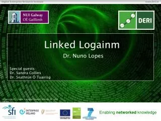
Linked Logainm Dr. Nuno Lopes Special guests: Dr. Sandra Collins Dr. SeathrúnÓTuairisg
Mission Statement • DRI is an interactive trusted digital repository for contemporary and historical, social and cultural data held by Irish institutions
Funding • Exchequer funded; HEA PRTLI 5, €5.2M • RIA (lead), NUIM, TCD, DIT, NUIG, NCAD • Partners: academic, cultural, social, industry • Sep 2011 – Sep 2015
Services • Preservation • Access • Sharing, linking • Cultural & Social heritage
Story telling Platform Policy Educational tool dri Users Content Shared Services Digitisation e-infrastructure Preservation Tools DRI Presentation
Partnership Project Place names Branch Fiontar DRI NLI DERI
Logainm.ie • The authority list of Irish place names, validated by the Place Names Branch. • Delivering a more detailed level than in DBpedia, Geonames. • Unique source of Irish language place names.
The NLI LongfieldMap Collection • The Longfield Maps are a set of 1,570 surveys carried out in Ireland between 1770 and 1840. • Currently catalogued in MarcXML, using data from Logainm, Geonames and Dbpedia. • Integrating Logainm data into their workflow.
LongfieldMap example <marc:datafield tag="650" ind1="" ind2=""> <marc:subfield code="a">Land tenure</marc:subfield> <marc:subfield code="z">Ireland</marc:subfield> <marc:subfield code="z">Rathdown (Barony)</marc:subfield> </marc:datafield> <marc:datafield tag="650" ind1="" ind2=""> <marc:subfield code="a">Land use surveys</marc:subfield> <marc:subfield code="z">Ireland</marc:subfield> <marc:subfield code="z">Wicklow (County)</marc:subfield> </marc:datafield>
Linked Logainm http://lod-cloud.net/ Media User-generated Government Publications Cross-domain Logainm Geo LinkedGeoData Life sciences Logainm 10
Geographic Data Providers • DBpedia • Include latitude and longitude for geographic entities • LinkedGeoData • Export of data from OpenStreetMap • Beyond lat/lon (eg, areas as polygons) • GeoNames • Access data as RDF (download as TSV) • GeoLinkedData • Spain • Ordnance Survey • UK
Geo-Vocabularies • W3C Geo • SpatialThing, latitude and longitude • NeoGeo(http://geovocab.org/doc/neogeo.html) • Feature vs Geometry • Spatial Relations (is_part_of) • Most providers define their own
Approach • Translate Logainm database dump into RDF • Determine links to other datasets based on: • Place names • Geographical coordinates • Hierarchy of places • Evaluation of generated links • Deployment at Logainm.ie
http://data.logainm.ie/1375542 ~100,000 place names 1. Converting Logainm dump to RDF ~800,000 triples owl:sameAs foaf:name http://sws.geonames.org/2964574/ Dublin
2a. Linking based on Place Names Place Name lookup in DBpedia Airport, Dublin 7828 “Places” in DBpedia Hospital, Limerick1217
2b. Linking based on geographical coordinates • ~50,000 out of 100,000 place names in Logainm contain geographical information • According to the Irish Grid Format: • Eg: W 35619 58358 = lat: 51.77 lon: -8.93
3. Current status 1Entities of type “Place” or “Feature” 2Entities of type “Node” 3No hierarchy info • Using Silk for discovering links • Links in other datasets 4Including internal & Freebase links
Next steps • Evaluation of generated links • Golden set • LIMES vs Silk • Links to other datasets (eg, Freebase) • Publishing Linked Data at logainm.ie • OpenLinkVirtuoso • Using the data: • NLI showcase with Longfield Map Collection • DRI/NUIG Irish Language Collection
NUI Galway and the DRI • A DRI Demonstration Project that will showcase wealth of both the University’s and its external partners’ archives • We will collate, curate and contextualisesomecontent from our various collections, focusing on unique features of Ireland’s cultural heritage - on Language, Traditional Music, Folklore, indigenous maritime heritage • It will show the evolution of the Irish-language, from early audio recordings of traditional music, through the birth of RaidiónaGaeltachta in the ‘70s, to its modern manifestation in broadcast video and audio.
Why Do This? • For researchers it opens up datasets for potential research in the fields of linguistics and socio-linguistics, literature and folklore, history, social and political studies, place names, film and media, music and song • It can function as an educational resource, in language teaching, history, etc. • Good collaboration opportunities with external partners under increasing pressure to open up archives to the public • Repurposing legacy material (e.g. Raidió na Gaeltachta recordings) ensures a public appetite for archives.
How can we create a homogenous user-experience from heterogeneous data-sets? • How can we add value to a contemporary, on-line digital archive by linking to other on-line data-sets? • How can we make an Irish-language archive accessible in a meaningful way to non-Irish speakers? • How can we realise the information content in (Irish-language) audio and video, without relying solely on descriptive meta-data?