Download
1 / 11
130 likes | 261 Views
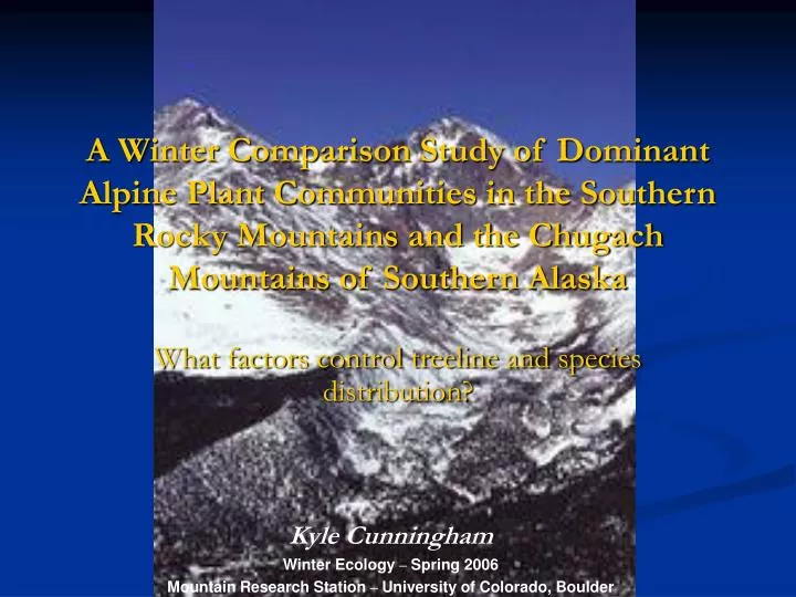
A Winter Comparison Study of Dominant Alpine Plant Communities in the Southern Rocky Mountains and the Chugach Mountains of Southern Alaska. What factors control treeline and species distribution?. Kyle Cunningham Winter Ecology – Spring 2006

E N D
A Winter Comparison Study of Dominant Alpine Plant Communities in the Southern Rocky Mountains and the Chugach Mountains of Southern Alaska What factors control treeline and species distribution? Kyle Cunningham Winter Ecology – Spring 2006 Mountain Research Station – University of Colorado, Boulder
Questions • How does treeline change with Latitude? • What factors control winter treeline communities? • Are latitude and elevation predominant controls? • What other factors are involved? • Which factors are most likely to influence sub-alpine and treeline communities?
Physical Setting • Southern Rocky Mtns. • Northern Hemisphere • Latitude : 40 degrees N • N/S tending range • Over 4830 km. long (for entire range) • Width Range : 150- 650 km. • Elevation Range : 1500 m (plains) – 4399m • Highest Peak : Mt. Elbert – 4399m (14,400 ft.)
Physical Setting • Chugach Mtns. • Northern Hemisphere • Latitude : 61 degrees N • E/W tending range • Over 482 km long • Average Elevations : 2438m – 3353m • Highest Peak: Mt. Marcus Baker – 4016m. • **Coastal Mountain Range**
Southern Rocky Mtns. Avg. Winter Temperature: -2 - +3 degrees C. Avg. Annual Precipitation: 36cm Snow Cover: 25cm - 152cm (depth) Chugach Mtns. Avg. Winter Temperature: -6 - +2 degrees C. (would be colder, but insulated by the ocean) Avg. Annual Precipitation: 41cm – 177cm (coastal influence) Snow Cover: 152cm – 203cm (depth) Climate
Rocky Mountains Average Treeline Elevation: 3,400 – 4,000m Chugach Mountains Average Treeline Elevation: 300 – 500m Treeline Elevation
What’s the Point?Treeline change with elevation • How does treeline elevation vary with latitude? • General rule of thumb: Treeline decreases with increasing latitudes at a rate of 100m/degree of latitude. (Sveinbjörnsson) • Maximum treeline of 4000m in Mexico • Minimum treeline of 400-800m at Canadian/Alaskan border. • *Values are calculated for the Rocky Mountains • They can be interpreted to other ranges world wide, but with a degree of error.
Dominant Sub/Alpine Winter Plants in the Southern Rockies • Riparian: Willow, Alder, *Aspen, (deciduous dom.) • Sub-Alpine: Aspen, *Sub-Alpine Fir, Engelmann Spruce, Lodgepole Pine, Limber Pine (mixed aspen/fir dom.) • Treeline (3400-4000m): *Englemann Spruce, Limber Pine, Lodgepole Pine (Spruce dom.) • Dominance with increasing elevation: Aspen Fir Spruce. Aspen Englemann Spruce * = Most dominant species
Dominant Sub/Alpine Winter Plants in the Chugach Mountains • Riparian: *Black Cottonwood, *Paper Birch, *Balsam Poplar, Aspen, Lodgepole Pine (only pine in Alaska), willows. (deciduous dom.) • Sub-Alpine: *Sitka Alder, Balsam Poplar, *Pacific Silver fir, Mtn./Western Hemlock (mixed fir/alder dom.) • Treeline (300-500m): *Sitka Spruce (south facing slopes), *White Spruce (north facing), Black Spruce, Mtn. Hemlock (spruce dominated) • Dominance with increasing elevation: Birch/poplar/cottonwood Alder/fir White/Sitka Spruce Sitka Spruce * = Most dominant species
What’s the Point?Why do we find certain species in certain areas? • Can elevation and latitude be and accurate predictor of winter plant communities? • Much more complicated than just two factors • Other factors include : *annual precipitation (coastal influences), *sunlight exposure (highly variable in Alaska), *ecological ranges (native species/established population), depth of snow pack, seed dispersal, geographical isolation, disturbances. • Conclusion : There is some correlation, but altitude and elevation are not the predominant controls on winter tree populations. • Conclusion: Temperature tolerance (killing temperature) is a main control on species distribution. Aspen, Poplar, and White/Black spruce can tolerate -80 degree C temps, but do not respond well to warm temps (respiration exceeds photosynthesis). (Marchand) • Conclusion : Increased precipitation and larger winter snowpack due to coastal inputs, mean high water content for Chugach. More deciduous trees. • Conclusion : Less ppt. and snowpack means less available water for tree species in the Rockies. More coniferous trees.
Bibliography • Anderson, Betty A., Robert H. Armstrong, David R. Klein, David f. Murray. Alaska. USGS Biology Resources Division website: http://biology.usgs.gov/s+t/SNT/noframe/ak177.htm, 3/10/06 • Little, Elbert L. and Leslie A. Vierceck. Alaska Trees and Shrubs. University of Alaska Press. Anchorage. 1986 • McClure, Rick. Alaska Snow, Water, and Climate Services. AMBCS website: http://ambcs.org/, 3/10/06 • Petrides, George A. and Olivia Petrides. Peterson Field Guide: Western Trees. Houghton Mifflin Co. New York. 1992 • Sveinbjörnsson,Bjartmar. North American and European Treelines: External Forces and Internal Processes Controlling Position. AMBIO: A Journal of the Human Environment: Vol. 29, No. 7, pp. 388–395 • Stohlgren, Thomas. Rocky Mountains. USGS Biology Resources Division website: http://biology.usgs.gov/s+t/SNT/noframe/wm146.htm, 3/10/06