Download
1 / 29
290 likes | 432 Views
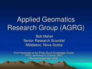
Applied Geomatics curriculum: new directions at the Centre of Geographic Sciences (COGS) Nova Scotia Community College (NSCC). Dr. Bob Maher, Senior Research Scientist Applied Geomatics Research Group (AGRG) College of Geographic Sciences (COGS)

E N D
Applied Geomatics curriculum: new directions at the Centre of Geographic Sciences (COGS)Nova Scotia Community College (NSCC) Dr. Bob Maher, Senior Research Scientist Applied Geomatics Research Group (AGRG) College of Geographic Sciences (COGS) Nova Scotia Community College (NSCC), Middleton Presented at GeoTec Conference, May 2007, Calgary, Alberta
Outline • Definition of Applied Geomatics • History of Geomatics program at COGS • Old Model: Advanced Diploma in AGR • New model: Joint MSc degree NSERC industry internship • Other learning opportunities: government, industry • Future Reflections • Conclusion
Applied Geomatics • “Customization and integration of geomatic technologies (GIS, Remote Sensing and GPS) to address research questions in the Environmental and Health Sciences” The research sits within the context of information and communication technologies
AGRG examples • Flood risk mapping • Microclimate in the Annapolis valley • Forestry applications of LiDAR • Habitat prediction for Atlantic Coastal Plain Flora species • Sampling NS civic address file for Health applications • Linking coastal process models to GIS www.cogs.agrg.nscc.ca
Relationship to GIScience GIScience is a multidisciplinary research enterprise that addresses the nature of geographic information and the application of geospatial technologies to basic scientific questions. MF Goodchild Based primarily in the discipline of geography, but drawing upon insights and methods from philosophy, psychology, mathematics, statistics, computer science, landscape architecture, and other fields, GIScientists produced much of the knowledge represented in the ten knowledge areas that comprise the BoK 2006 From Body of Knowledge 2006. Section 1, pg 6
Body of knowledge 2006 • What is Geographic Information Science and Technology • Why is a GI S&T body of Knowledge Needed? • How does the Body of Knowledge Relate to GI S&T Curriculum Planning Efforts? • How was the Body of Knowledge Developed? • GI S&T Body of Knowledge • Where is the UCGIS Model Curricula project headed?
2yr Diploma in Surveying 2yr Diploma in Cartography 2yr Diploma in Planning Direct entry from High School History of Geomatics program at COGS
Advanced Diploma in Marine Geomatics Advanced Diploma in GIS for Business Advanced Diploma in Geomatics Programming Advanced Diploma in Remote Sensing Advanced Diploma in GIS Advanced Diploma in Applied Geomatics Research - University degree and Advanced Diploma from COGS Direct entry from University History of Geomatics program at COGS
Advanced Diploma in AGR Semester 1 (course work) - Research Methods (Maher) - Advanced Data Collection Methods (Webster) - GIS Research Applications (Colville) Semester 2 (project work) - Research Project Old Model 2000-2005
Advanced Diploma in AGR Benefits: funded ($15k for two semesters) project learning Costs: “just another Advanced diploma”
Agents of change • NSERC – CCIP program matching funds from NSERC for SME in support of CED • Interest by Acadia University and COGS graduates in more stream-lined path to MSc.
New Model • Joint MSc in Applied Geomatics with Acadia University, Department of Earth and Environmental Sciences • Industry internships: Project learning after graduation from COGS
MSc in Applied Geomatics • Review by external examiner from MPHEC April 2007 • Anticipated formal start date for new Acadia graduate students – September 2007
Basic Structure • Year 1 – Attend COGS for Advanced Diploma program (GIS, RS, MG, GP, GB) • Year 2 – Resident of Acadia University • Graduate degree granted by Acadia University Advanced Diploma granted by NSCC
The ideal model April: Completed undergraduate degree in relevant science discipline. Accepted into joint MSc and Advanced Diploma May-August: field research (funded) with AGRG and Acadia scientists September: Enroll in Advanced Diploma (two semesters) May-August (yr 2): field research (funded) with AGRG and Acadia scientists
September: - enroll at Acadia for course work - conduct analysis - write thesis Graduation with both MSc and Advanced Diploma in 2 years
Changes to existing curricula • At COGS in second semester: - select Research Methods course • At Acadia in first semester: - select Applied Geomatics Research Seminar course
Other considerations • Adjunct status of faculty across institutions • Graduate student stipends responsibility of Research Scientists at both Acadia and NSCC • Thesis committee from both institutions • Tuition is paid to respective institutions
Future additions • Expand to other “application” domains. e.g. social sciences, health, business • Expand to other institutions in Atlantic Canada
Industry internships • Funded through NSERC - six months - $15k - industry defined problem - AGRG supervision - contract between industry and AGRG - contract between AGRG and intern
Not funded by NSERC e.g. ESRI internship - three months in California (funded) - $15k for six months on return - AGRG defined research problem - AGRG supervisors - contract between AGRG and intern
Other learning opportunities • Practicum with government employees, university faculty and industry partners • Timing – flexible • Duration – no fixed length – usually a few weeks • fees - per diem rate
Primary applications – LiDAR, data planning and analysis • link to C-CLEAR • International potential • Opportunity for collaborative research
Future Reflections • Major changes in the last 25 years 1980 2005 + technology Science Science technology application application
Future Reflections • COGS curriculum requires redesign to reflect: a) new technology suite b) new GI Science c) expanded application domains
Future Reflections • Market place (and students) demand - focus on capacity to learn new technologies, problem solving and research methods - more cost effective delivery (2 years down from 5)
Future Reflections -more flexibility • flexible start date • cross-institutional learning • customized pathway - financial support during project learning
Conclusion • The Applied Geomatics Research Group (AGRG) since 2000 has developed a new direction for project-based learning • This has resulted in two streams • joint MSc. AG (for research professional) • industry internship (for market inclined)
Conclusion • These streams allow us to support a variety of other activities in support of government, industry and universities • The NSCC is looking at our success in Applied Geomatics and is interested in the creation of applied research nodes at other campuses in Nova Scotia