Download
1 / 52
520 likes | 739 Views
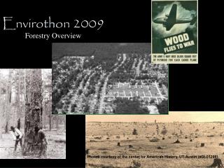
Envirothon Soils. Dennis Brezina USDA-Natural Resources Conservation Service Resource Soil Scientist – Bryan Area. Conservation…Our Purpose; Our Passion. What is Soil?.

E N D
Envirothon Soils Dennis Brezina USDA-Natural Resources Conservation Service Resource Soil Scientist – Bryan Area Conservation…Our Purpose; Our Passion.
What is Soil? Soil is the combination of air, water, organic and mineral matter on the earth’s surface that is distinguishable from its parent material and can support rooted vegetation. It is a product of the effects of CLIMATE, BIOTIC ACTIVITY, acting on PARENT MATERIAL as conditioned by TOPOGRAPHY over TIME.
Four Components of a Typical Soil Organic Soil is half solid and half pore space Air 1% 25% Mineral 49% Water 25% Pore space: Remains about the same at all times. However, if the soil is wet, the pore space will contain more water. As the soil dries, the pore space will contain more air.
TOPOGRAPHY – Soil-forming FactorSlope or configuration of the land Nearly level vs. sloping - Water shedding vs. water receiving - Flat areas are generally wetter than steeper, sloping areas Different soils will occur on different landscape positions - Soils on back and shoulder slopes are generally thinner than those on summits, footslopes and toeslopes • Summit • Shoulder • Backslope • Footslope • Toeslope
Slope Percentage Rise over Run
Slope Percentage Rise over Run
Simplified Soil Profile • A= Surface Horizon • (Most biologically active) • B = Subsoil Horizon • (Typically has higher clay content and blocky structure) • C = Parent Material • (Residual, Colluvium, Alluvium, Marine or Eolian) A B C
SOIL TEXTURE The relative proportion of SAND, SILT and CLAY • The MOST IMPORTANT PHYSICAL PROPERTY of the soil because it determines the capacity of a soil to retain moisture and air. • Essentially impossible to change unless you remove it, or add large amounts to it.
The Three SOIL Particle Sizes • Sand size particles are: • Largest of the soil particles • Feels gritty • Compare it to a baseball • Silt size particles are: • Intermediate in size • Smooth, talcum powder feel • Compare it to a marble • Clay size particles are: • The smallest in size • Sticky and plastic when wet • Compare it to a BB
Clayey Soils • High organic content • High water holding capacity • Slower permeability • Higher runoff • Agriculturally productive • Difficult to work with High Shrink-Swell • Clay minerals expand when wet and shrink when dry. • Cause cracks in building foundations, sidewalks, etc. More Water
Sandy Soils • Larger pore space • Low water holding capacity • Rapid infiltration and permeability • Higher leaching • Low organic matter • Low fertility • Generally better drained • Easy to work with This doesn’t mean that sandy soils are not as “good” as clayey soils. Sandy soils are just good for different things (peanuts, timber production, etc.).
SOIL COLOR Most visible soil property Soil color name is on the left page, and the color notation is written as: Hue Value/Chroma (10YR 6/3) Color Name HUE CHROMA VALUE
Soil ColorMost visible soil property Soil color is written as: Hue Value/Chroma (10YR 6/3) Dark = high organic content • Humus and organic matter are generally black or brown. Light = low organic content Red, yellow and brown are well drained • Generally due to oxidation of iron compounds in the soil. • Reds are highly oxidized. • Compare it to rust on iron. When metal gets wet, as it dries (oxidizes) it turns a reddish-yellow color. Gray could mean excessive wetness • The iron in soil is either removed or reduced when oxygen is removed. HUE CHROMA VALUE
Mottles/Redoximorphic Features • Mottles and redoximorphic features are caused by oxidized or reduced iron. • Red, orange and yellow colors are iron accumulations (oxidized iron). • Grays are iron depletions (reduced iron).
Gray could mean Wet • Gray surface • Contains mottles (oxidized or reduced iron). • Mottles indicate alternate wetting and drying. • Concave or Flat landscape! The water cannot drain off the area. • Wet soils could be associated with wetlands!
3 Requirements for a Wetland • Hydric Soil • More than 50 percent Hydrophytic Vegetation. • Hydrology indicating seasonal inundation, ponding or saturation by water.
Hydric Soil • Soils that formed under conditions of saturation. • Soils developed under sufficiently wet conditions to support the growth and regeneration of hydrophytic vegetation. • Essentially a “gray” soil.
Hydrology Water Marks
Soil pH • Ideal pH range is 5.5 to 7.5 • Most U.S. soils have pH range of 4 to 8.5. • In general, as rainfall increases, pH decreases • pH >8.5 could mean high salt content • pH<4 could mean Aluminum and Iron toxicity • pH meters best tool for testing • Add lime for soils less than pH of 5.5, and sulfur for soils above pH of 7.5.
Three Main Plant Nutrients N-P-K • Nitrogen (N) • Most commonly deficient nutrient • Above ground vegetative growth • Phosphorous (P) • Seed germination • Disease resistance • Root development • Plant maturation (flowering, fruiting, seed formation) • Potassium (K) • Root development • Photosynthesis (especially root crops and for starch formation) ACME FERTILIZER N-P-K
Can plants use just any form of Nitrogen? • Atmospheric Nitrogen gas (N2) is the most common gas, but it cannot be used by plants. • Nitrogen is converted into plant-usable forms through the Nitrogen Cycle • Nitrate (NO3) and Ammonia (NH3) are plant-usable forms
Organic Fertilizer - lawn clippings, manure, mulch, cottonseed meal, guano, poultry litter wood ash, peat • Inorganic Fertilizer - chemically produced. Broad range of types. Easy to use, but easy to over-fertilize. With higher fuel costs, expensive $$$ • On lawns, Rule of Thumb is to put 1 pound of Nitrogen per 1000 square feet. More is NOT always better. How can the Nutrients be put back when used up?
How much do you use? • N-P-K is expressed as a percentage of Nitrogen, Phosphorous and Potassium • Rule of thumb: 1 pound of nitrogen per 1000 square feet • So…How many pounds of this fertilizer (25-10-5) should you use on a 6000 square foot yard? ACME FERTILIZER N-P-K 25-10-5
How much Fertilizer for 6000 square feet? • 25-10-5 25% N 0.25 lb N per lb Fertilizer Rule of Thumb • 0.25 lbs N x ? lbs Fert = 1 lb N per 1000 sq ft • 0.25 lbs N x ? lbs Fert = 1 lb N per 1000 sq ft = • 0.25 lbs N 0.25 lbs N • = 4 lbs Fert per 1000 sq ft • 4 lbs Fert X 6000 sq ft = • 1000 sq ft 24 lbs Fertilizer
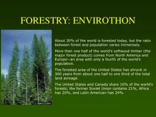
Erosion • Wearing away or removal of the earth’s soil or land surface. • Soil moved by wind, water, ice or gravity. • Especially occurs on bare soil • Areas with more than 3 percent • slope are susceptible to water erosion.
Types of Erosion • Sheet and Rill Erosion • Raindrop Splash • Wind Erosion • Gully Erosion
Stubble Mulch or Ridge-Till No-Till Conservation Practices = Things that Prevent Erosion Contour Farming Strip Cropping & Terracing Planting Wind Breaks
Preventing Raindrop Splash • Vegetative cover • Lawns, pasture or rangeland • No-Till • Stubble mulch or ridge till • Cover crops • No-Till intercepts raindrop splash almost like having grass cover. • Soil structure improves with time, and more water infiltrates and percolates through the soil.
Comparison of No-Till to Conventional Tillage Conventional tilled field No-Till field The clear water from the No-Till side of the field is transporting less topsoil, nutrients and pesticides. Milan Experiment Station-Milan, Tennessee
Preventing Sheet, Rill & Gully Erosion • Slow the speed of surface water flow • Vegetative Cover • Contour farming • Diversion Terraces • Strip Cropping • No-Till, stubble mulch or ridge-till • Grassed waterways • Contour farming and terracing intercept and slow down the speed of surface water flow. • Diversion Terraces are used on steeper land to intercept and slow down the downhill flow of water. • Grassed waterways are used to prevent all four types of erosion.
Preventing Wind Erosion • Plant Wind Breaks • Rotary hoes add surface roughness • Strip cropping • The perfect time to Break Wind http://www.ewrs.org/pwc/rotary.htm
Removal of vegetation along creeks can cause: • http://images.search.yahoo.com/ • Increased runoff • Increase floodwater energy (trees and other vegetation help dissipate floodwater energy) • Increase Streambank erosion
How can Soils affect our Bays & Estuaries? • Over fertilization can lead to Eutrophication - algal blooms, depleted oxygen • Soil erosion can lead to sedimentation • Reduce water clarity • Water temperature changes • Pesticides can attach to sediments and cause toxicity • Can impact the pH of the water Euthrophication in the Sea of Azov (Source: NASA)
What is a Watershed? • Watershed is the area of land draining into a river, river system or other body of water. • Generally it is a tributary stream or a creek. Primary Stream Tributary Streams
What is a River Basin? • A River Basin is a large watershed. • Area of land drained by a river and all of its tributaries. • Whatever you put in the water affects those downstream.
Soil Surveys • An inventory of soils that includes maps, soil descriptions, photos and tables of soil properties and features. • Used by farmers, real estate agents, land use planners, engineers and people wanting information on soil resources for land use planning.
The major parts of a soil survey publication... • How to Use this Soil Survey • Table of Contents • Introduction and General Nature of the County • General Soil Map & Block Diagrams • Detailed soil map units • Use and management and interpretive tables • Classification of soils • References • Glossary • Index to map sheets • Soil maps
Using a Soil Survey • Identify all of the soil map unit symbols at your area of interest, and find the soil map unit on the soil legend. • Locate your area of interest on the map index.
Detailed soil map unit description • Map unit symbol & name • Where it is mapped • Thumbnail soil description • Soil Properties Narrative • Inclusions • Land uses • Soil Suitabilities and Limitations
What is a soil mapping INCLUSION? Compare a SOIL MAP UNIT to a red sorrel horse
What is a soil mapping INCLUSION? Now compare a SOIL MAP UNIT to a red sorrel horse with white points or “inclusions.” It is still “Red,” but it has other colors. Inclusions are areas of a different soil that are too small to delineate at the scale of mapping. Lower wet spot as an inclusion in the landscape Soil map unit (flats) with mound inclusions Mounds
What is a soil mapping INCLUSION? These dark spots in this area are inclusions. They are slightly lower than the surrounding landscape.
What is a soil mapping COMPLEX? Compare a soil mapping COMPLEX to this red paint horse What color is it? Is it white with red spots, or red with white spots? • Example: Oz Ozias-Pophers complex, frequently flooded Soil map unit that has a combination of flats and mounds Complexes are two or more kinds of soil occurring in such an intricate pattern that they cannot be shown separately on a soil map.
What is a soil mapping COMPLEX? The white spots in these map units on this aerial photograph are mounds (often called pimple or mima mounds) associated with flats.
What is a soil mapping COMPLEX? Soil map unit that has a combination of flats and mounds.
How to use the Soil Survey Tables • Table of Contents has a Summary of Tables • The Tables contain information on soil properties, suitabilities and limitations, as well as management and production. • Find the Table that has the information that you are needing.
How to use the Soil Survey Tables • Go to the table that contains the information you seek • Find your map unit symbol • Find the land use practice or yield data • Table provides information on suitability for that soil for that particular land practice HoB Houston Black will produce about 45 bushels of wheat per acre.
Question? • Given that a bushel of wheat will yield about 42 pounds of white flour, and that 1 pounds of white flour will yield about 1.7 loaves of bread; How many loaves of bread will 40 acres of HoB Houston Black yield? • From the table, HoB Houston Black will produce about 45 bushels of wheat per acre. • 45 bu X 42lbs X 1.7 loaves x 40 acres = Ac 1 bu 1 lb flour • 128,520 loaves of bread per 40 acres!