Download
1 / 33
340 likes | 488 Views
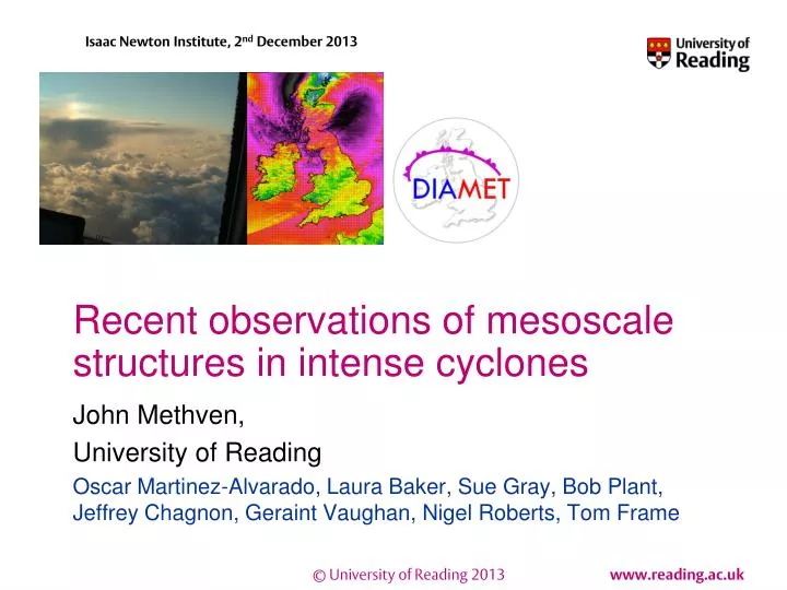
Recent observations of mesoscale structures in intense cyclones. John Methven, University of Reading Oscar Martinez-Alvarado, Laura Baker, Sue Gray, Bob Plant, Jeffrey Chagnon, Geraint Vaughan, Nigel Roberts, Tom Frame. Lecture Outline. Mid-latitude cold fronts Observations (DIAMET)

E N D
Recent observations of mesoscale structures in intense cyclones John Methven, University of Reading Oscar Martinez-Alvarado, Laura Baker, Sue Gray, Bob Plant, Jeffrey Chagnon, Geraint Vaughan, Nigel Roberts, Tom Frame
Lecture Outline • Mid-latitude cold fronts • Observations (DIAMET) • Frontal geostrophic theory • Secondary (cross-frontal) circulations • Bent-back fronts in cyclones • Observations (DIAMET) • Semi-geostrophic theory • Structure of cyclones • Mesoscale banding in winds • Conditional symmetric instability • Role of non-conservative processes (on balanced flow) • Unbalanced evolution near fronts • Conclusions
DIAbatic influences on Mesoscale structures in Extratropical sTorms Geraint Vaughan, Manchester PI John Methven, Reading PI Ian Renfrew, East Anglia PI Doug Parker, Leeds PI
13:30 radar rain rate Cold front case 29/11/11 spawning 4 tornados Met Office 29 hr forecast
Whitworth Observatory, Manchester Wind speed Pressure Temperature Wind direction Precipitation Dew pt
2. Frontal geostrophic theory Formation of fronts in potential temperature (and other conserved tracers) • Gradients grow in zones of large-scale shear or deformation • Passive advection would give only linear or exponential growth • But, can be much faster – why? • Explained by Hoskins and Bretherton (1972), J.Atmos.Sci. using semi-geostrophic theory Uses observations: 1. scaling is anisotropic (cross-frontal scale l << L) 2. Lagrangian derivative dominated by cross-front advection (U/l >> V/L) Consequence: scaling cross-front component of momentum eqn Along-front wind near geostrophic
Semi-geostrophic eqns Along-front component of momentum eqnbecomes: Note: advection by full velocity Assuming hydrostatic and anelastic gives thermal wind balance (TWB) Large-scale shear/deformation continuously increases thermal gradient ⟹ cross-frontal circulation required to maintain TWB. Cross-frontal (Sawyer-Eliassen) equation obtained from eqn:
Cross-frontal circulation TWB maintained by a cross-frontal (secondary) circulation. Define a cross-frontal streamfunction: Quasi-geostrophic theory Advecting velocity is geostrophic Semi-geostrophic theory Advection also by ageostrophic flow Using geostrophic coordinates Z=z (P=Ertel PV) (physical coord)
Frontogenesis Quasi-geostrophic vorticity Semi-geostrophic vorticity eqn At lower boundary from secondary circ. Absolute vorticity = Coriolis + relative = f + Infinite vorticity in finite time Hoskins and Bretherton (1972), J.Atmos.Sci Hoskins (1982), Ann. Rev. Fluid Mech.
Cyclone Friedhelm – 8/12/11 10m wind speed (knots) Met Office 15hr forecast (1.5km model) Radar obs
Dropsondeobs across the bent-back front Colour shading = wind speed Thin contours = moist entropy Thick = relative humidity
Tropical cyclones • Maximum azimuthal winds at the “eyewall” • Rapid slantwise ascent (10-30 ms-1) up eyewall • Due to secondary circulation required to maintain thermal wind balance (as cyclone intensifies) • Ascent vortex stretching surface front at eyewall • Semi-geostrophic frontal evolution with azimuthal symmetry
4. Back to semi-geostrophic theory • Generalised to 3-D (f-plane) by Hoskins (1975) • Makes geostrophic momentum approximation: • Advection by full flow (Lagrangian derivative) • But advected momentum approximated by geostrophic wind • Equations obtained assuming DV/Dt << fV, Dχ/Dt ≪ f • Result: evolution similar to quasi-geostrophic when viewed in geostrophic coordinates (X, Y). Transform to (x, y) shrinks cyclones. • Regions with cyclonic vorticity are contracted. Figure: Davies, Schar and Wernli, J. Atmos. Sci., 1991
Coordinate transformation Figure: Schar and Wernli, Q. J. Roy. Met. Soc., 1993
5. Mesoscale banding in the strong wind regions Most pronounced at 1800 UTC Distinctive precipitation banding observed on south side of intense cyclone (DIAMET IOP8) Vaughan, Methven et al, BAMS, submitted
Automatic stations at surface Maximum wind gust (5-minute median of reported values, ms-1 ) Example time series from station between Glasgow and Edinburgh (wind speed and radar precip rate) Averaging over all stations in Scotland, wind speed in precip bands < between bands (by 1.5 ms-1)
Banding in high resolution ensemble forecast Precipitation rate from 4 ensemble members of a high resolution forecast for the IOP8 cyclone. Trial of Met Office MOGREPS-UK ensemble (2.2km grid) Some members match radar out to T+36 for scales of 25km and greater – therefore some skill in forecasts of mesoscale banding Vaughan et al, BAMS, submitted
Banding in high resolution ensemble forecast Wind speed (850 hPa) from the same 4 ensemble members. Strongest winds occur between the precip bands. Also, seen in surface obs. Implications for predictability of wind damage in intense cyclones. Vaughan et al, BAMS, submitted
Sting jets • Conceptual picture [Browning, 2004] of banding in the cloud head • Highest winds where descending air advances ahead of cloud head tip. • Result of conditional symmetric instability ( f * PV < 0 )? • Role of evaporation of ice in cooling & enhanced descent?
Conditions for CSI CI = conditional convective instability CSI = f * PV < 0 (saturation, moist PV) II = absolute vorticity, ζ < 0 Note: large amplitude rolls from symmetric instability result in ζ < 0 Red points along trajectories arriving in sting jet Simulation (~12km grid) with Met Office NWP model
Conditions for CSI CI = conditional convective instability CSI = f * PV < 0 (saturation, moist PV) II = absolute vorticity, ζ < 0 Note: large amplitude rolls from symmetric instability result in ζ < 0 Red points along trajectories arriving in sting jet Simulation (~12km grid) with Met Office NWP model
Back trajectories from strong wind regions Two distinct air masses: S1=cold conveyor belt S2=sting jet airstream S1 does complete loop of cyclone in ~12 hours
Frontogenesis with boundary layer Semi-geotriptic equations introduced byCullen, 1989 & Beareand Cullen, 2010. Ekman boundary layer with vertical diffusion added to eqns. Introduces 3-way balance between Coriolis, frictional term and pressure gradient force. Enhances secondary circulation and wind speed within BL.
Unbalanced frontogenesis • Blumen (1990) introduced unbalanced frontogenesis model • Zero PV • Front intensification is transient (inertia-gravity wave) • Recently Skakespeare and Taylor (DAMTP) have created uniform PV model which combines Blumen with Hoskins & Bretherton • Balanced HB evolution in small Ro limit • Ro~1 gives different regimes: frontogenesis with radiation of inertia-gravity waves • Theory currently for straight fronts
Conclusions • Sharp fronts form rapidly in atmosphere • Secondary circulation required to maintain balanced evolution (slaved to PV) • Vortex stretching fastest at solid boundaries (BC on secondary circ) • Strongest wind region often at bent-back front SW/S of cyclone centre • Rate of change in trajectory direction faster than f • Not in low Ro regime of SG theory • Strongest winds in mesoscale bands • Wind speed greater in clear slots between rainbands • Indicates vertical motion associated with horizontal wind banding • Conditional symmetric instability is likely, with acceleration on descent • Stronger as a result of semi-geotriptic balance? • Bent-back fronts radiate waves – unbalanced frontogenesis? • Wave fronts at an angle to bent-back front and air masses