Download
1 / 19
190 likes | 291 Views
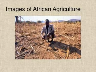
The AGRICAB project enhances African EO capacities for agriculture and forestry management through GEONETCast reception stations, training, integrated applications, and more. It focuses on improving agricultural monitoring, early warning systems, and crop yield forecasting in Senegal, Mozambique, Kenya, and other countries. The project supports the uptake of EO techniques, predictive models, and use cases, including livestock management, statistics, early warning systems, and irrigation agriculture. It also aims to stimulate the integration and development of tools, provide sustained EO data and tools, and support user communities through workshops and training sessions. With a focus on enhancing capabilities in Africa, the project contributes to food security, agricultural sustainability, and climate change resilience.

E N D
Enhancing African EO capacities for Agriculture and Forestry management:the AGRICAB project T. Jacobs, C. Tote
Outline • Background: a “family” of Africa EO projects/partnerships • Concept • AGRICAB results & upcoming work: • GEONETCast reception stations • Training & software • Integrated applications: national use cases • Contributions to GEO(SS)
Background • GMFS – Global Monitoring for Food Security • 2003 – 2013, Operational Services • Early Warning, Agricultural monitoring, CFSAM • Focus countries: Senegal, Moz., Ethiopia, Zimbabwe, Niger, Sudan, Malawi • JRC MARSOP - Agriculture monitoring via RS • VGT4Africa (FP6-SPACE), 2005-2008 • DevCoCast (FP7-ENV, mid 2008 – Q1 2012) • GEOLAND2 (FP7-SPACE, 2009-2012) • Moved to Copernicus Global Land • AGRICAB (FP7-ENV, Oct 2011-Mar 2015) • Focus countries: Kenya, Moz, S-Africa, Senegal, Tunisia • ISAC(FP7-SPACE, 2011-mid 2013, Ethiopia) • e-AGRI (FP7-ICT, Morocco, Kenya) • … and many more
Project concept Community of practise Engage Policy organizations Component 3 Stimulating the uptake of EO techniques Organize 5 regional & national stakeholder workshops Support Master students, PhD’s Component 2 Predictive models and use cases Livestock, statistics, early warning, crop yield Statistics, early warning, crop yield Livestock, statistics, early warning, crop yield Irrigation Forests & fire mapping Use cases Kenya Use cases Southern Africa Use cases Mozambique Use case North Africa Use cases Senegal, Niger Short-term trainings in Europe Integrate & further develop tools Component 1 Sustained provision of EO data and tools Conduct 2 GEONETCAST Workshops & develop training material Operate LandHub, establish & operate help desk Continue productdissemination from DEVCOCAST, expand with DEIMOS, CBERS, other products
Setting up low cost GEONETCast receivers • Setup at training workshops in 2012: • Kenya Wildlife Service, Voi, Kenya • International Institute for Water andEnvironment Engineering (2iE), Ouagadougou, Burkina Faso • National network of GNC stations in Ethiopia: • Funded by UN-WFP office • Supported by training staff • June 2013: receiver at OSS, Tunisia
Training & workshops so far • Tailored training in Europe • Broad-scaled, international workshops on GEONETCast and free processing software • June 2012, Nairobi, Kenya • Nov 2012, Ouagadougou, Burkina Faso • Working with dedicated teams in national workshops: • E.g. crop production workshops in Mozambique and Senegal, in collaboration with GMFS project • Builds on pre-existing Senegalese multi-disciplinary workgroup (GTP) • Support to • Higher education • AMESD System Administrators (training @ VITO)
Training user communities - example 50+ participants at regional GNC workshops • All countries in region, with emphasis on AGRICAB focus countries • Mix of higher education, research and operational institutes • Incl. participants from existing networks:e.g. AMESD, ACF NGO, OSFAC • Encouraged the start-up of GeoS-NetAfricanetwork: multi-disciplinary, driven by Africans
Upcoming workshops • National WS: linked to use case development • Regional WS: Bringing national results to regional level • 3 regional thematic workshops (OSS, AGRHYMET, RCMRD) in 2013 • 2 regional thematic workshops in 2014 • GEO workshop in Africa, 2014
Supporting user communities: software • Updates to existing software: • E.g. VGTExtract utility, ILWIS + toolboxes • Focus on time series processing: • E.g. • initially developed by VITO for • Inter-linking existing tools
Use cases (1/3): Crop production systems Use cases in Kenya Senegal Mozambique Use case in North Africa
Agricultural statistics • EO for more cost-effective, high quality crop area estimates • Needs to be tested, incl. comparison of different approaches • Combination of: • Ground survey (points or areas) • Airborne campaign • High resolution satellite imagery (SPOT5 / RapidEye)
Agro-meteorological modeling • Quantitative weather and crop monitoring and crop yield forecasting • Approach: • Set-up weather data infrastructure (level 1) – only Mozambique • Implementation of regional crop growth model (level 2) • Implementation of statistical crop yield forecasting (level 3)
Early warning and crop mapping • Operational (near) real-time monitoring of vegetation status • Using time series of satellite images • Improve agro-meteorological bulletins • Qualitative relations between vegetation & weather indicators • Drought (Kenya, Senegal, Mozambique) / Flooding (e.g. Limpopo Mozambique) • Assess the impact of climate change and increased climate variability
Irrigation agriculture • High water abstraction for irrigated agriculture in North Western Sahara Aquifer System • Monitor land use/land cover changes using EO • Model water abstraction based on crop masks and water requirements, integrate time series of low resolution vegetation indices
Use cases (2/3): Livestock systems • Operational forage biomass monitoring &modeling for early warning (Senegal, Niger) • Improve Index-based Livestock Insurance (Kenya) • Improved maps of livestock production systems (Continental/Global)
Use cases (3/3): Forest Systems • Generation of tree cover maps for savannah and woodland in Southern Africa • Sustainable management of ecosystem • Food security (rangeland capacity) and energy security (charcoal & fuel wood) • Production & dissemination of fire information derived from MODIS in Southern Africa • Carbon storage and fire management strategies • Based on MODIS time series • Determine the effects of different land management policies on fire regimes
Contributions/links to GEO WP Tasks • IN-04 – GEONETCast (infrastructure) – EUMETSAT (co-lead) • Task contributor • Support the setup of receiving stations • “land hub” add-on to EUMETCast GNC • Supply data (SPOT-VGT, CBERS, Landsat?) on GEONETCast • ID-02 – Capacity building • Task contributor • Training, software, GNC capacity building, ... • AG-01 – Global Agriculture • GEO CoP-Forest • GEO WS in Africa (2014) • AfricaGEOSS?
Thank you! Tim Jacobs, Carolien Toté Flemish Institute for Technological Research (VITO NV), Belgium Tim.jacobs@vito.be; carolien.tote@vito.be On behalf of the consortium of 17 Partners from 12 countries: More information: see http://rs.vito.be/africa