Download
1 / 31
310 likes | 409 Views
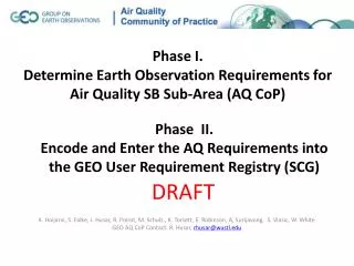
Phase I. Determine Earth Observation Requirements for Air Quality SB Sub-Area (AQ CoP). Phase II. Encode and Enter the AQ Requirements into the GEO User Requirement Registry (SCG).

E N D
Phase I. Determine Earth Observation Requirements for Air Quality SB Sub-Area (AQ CoP) Phase II. Encode and Enter the AQ Requirements into the GEO User Requirement Registry (SCG) K. Hoijarvi, S. Falke, J. Husar, R. Poirot, M. Schulz., K. Torsett, E. Robinson, A, Surijavong, S. Vlasic, W. White GEO AQ CoP Contact: R. Husar, rhusar@wustl.edu DRAFT
Background The procedures and the outcome of AQM are defined by laws and regulations in most countries including the workflow/activities, the key participants and their respective needs. AQ Management (AQM) and Science relies on a range of Earth Observations (EO) from in-situ and remote sensing platforms. Hence, AQM is a suitable application area of the Global Observing System of Systems (GEOSS) where the user needs are satisfied by services offered . This is an initial attempt to formulate User Requirements for AQM. The AQ Community of Practice is encouraged to continue its active participation in this effort. This provides a base case for the gap analysis. Next one defines the desired state The gap is the difference between the current and desired state.
Phase I. Determine Earth Observation Requirements for Air Quality SBA Methodology for Gathering User Requirements: State the SB Sub-Area: e.g. Manage Air Quality Define Major Workflow Steps of the SBA Name the Value-Adding Activities Identify Participants for Each Activity (i.e. the ‘Users’) Determine the Participant’s EO Needs Forum to Develop AQ Requirements: GEO AQ Community of Practice
1. Select SBA: AQ Management2. Define Workflow Bachmann, 2008
3. Define Value Adding Activities: Workflow Step 1: Setting AQ Standard Popul. Density Other Data PM Comp. Receptor Modeler Policy Maker Health Analyst Policy Analyst Transport Meteor. Air Qual. Analyst Gas Comp. Knowledge: Decisions Information: Processed Data Data: Observations Chem. Tr. Modeler Activity Drivers Emission Modeler Emission Analyst Spreadsheet of activities, participants, requirements
Phase I. Determining Earth Observation Requirements for Air Quality SBA GEO Task US 0901a: Priority Earth Observations for Air Quality Clearinghouse AQ Community Catalog User Requirement Registry
Phase II: Encode and Enter the AQ Requirements into the GEO User Requirement Registry (SCG) The URR is a facility for collection, sharing and describing: • User types among the nine SBAs; • Applications that use Earth observations; • Requirements for Earth observations and derived products; • Links among user types, applications, and requirements.
Encoding into URR: Activities – User Types - Requirements Workflow Activities User Types Requirements AQ Analyst Develop AQ Standard Det. Background AQ Receptor Mod. Transport Mod. AQ Analyst Assess Health Risk Characterize Current AQ Health Analyst AQ Analyst Assess Aquatic Risk Aquatic Analyst Determine Compliance AQ Analyst Assess Terrestr. Risk Terrestr. Analyst AQ Analyst Assess Visibility Risk Visibility Analyst Eval. Control Effectiveness Set AQ Standard Policy Analyst
Workflow Step 2: Evaluate Current Air Quality Workflow Activities User Types Requirements Develop AQ Standard AQ Analyst Det. Ambient AQ Attribute Sources Receptor Mod. Evaluate Current AQ Transport Mod. Emiss. Analyst Det. Emissions Emiss. Modeler Determ. Exceedance Policy Analyst Determine Compliance Eval. Control Effectiveness
Workflow Step 3: Develop and Enforce Compliance Workflow Activities User Types Requirements Develop AQ Standard AQ Analyst Attribute Sources Receptor Mod. Transport Mod. Characterize Current AQ Emiss. Analyst Det. Emissions Emiss. Modeler Develop Compliance Emiss. Reduct. Plan Policy Analyst Eval. Control Effectiveness
Workflow Step 4: Evaluate Control Effectiveness Workflow Activities User Types Requirements Develop AQ Standard Emiss. Analyst Det. Emissions Emiss. Modeler AQ Analyst Det. Ambient AQ Attribute Sources Receptor Mod. Characterize Current AQ Transport Mod. AQ Analyst Assess Health Risk Health Analyst AQ Analyst Assess Aquatic Risk Determine Compliance Aquatic Analyst AQ Analyst Assess Terrestr. Risk Terrestr. Analyst AQ Analyst Assess Visibility Risk Visibility Analyst Eval. Control Effectiveness Eval. Control Effect Policy Analyst
Activity – Participant - Requirements Browser for AQ Management http://webapps.datafed.net/catalog.aspx?table=URR_Activities
Provider - Instrument - Observation Browser for AQ Data in GEOSS Clearinghouse
It is possible to Approach:Make AQ Contribution Consistent with: GEO Task US 0901a: Priority Earth Observations for Air Quality Clearinghouse AQ Community Catalog User Requirement Registry
General Requirements by User Type EO Requirements: Where, What Type; Pollutant User Types Surface | MassConc. | PM25, PM10, O3, SO2, NO2, VOC; AQ Analyst Surface | MassConc. |PM25, PM10, PMComp, WindField Receptor Modeler Transport Modeler 4Dim | Emiss. /4DWea | PM25, PM10, SO2, NO2, VOC Emission Analyst Surface/Col| Emission Obs/ | PM25, PM10, SO2, NO2, VOC; Emission Modeler Surface | Activity Drivers | PM25, PM10, SO2, NO2, VOC; Health Analyst Surface | Expos., HealthMeas | PM25, PM10, O3, SO2, NO2 Aquatic Analyst Surface | Depos., AquaMeas | PM25, PM10, O3, SO2, NO2, VOC; Terrestrial Analyst Surface | Depos., TerrMeas. | PM25, PM10, O3, SO2, NO2 Surface | Light Ext., Vistas | PM25, PM10, PMComp Visibility Analyst Policy Analyst Surface | Analysts Outout |PM25, PM10, O3, SO2, NO2 Any AQM activity may require multiple user types Any user type can contribute to multiple AQM activities The specific user requirements depend on the activity
Value Chain for Informing the Public Observation-Data Processed Data Actionable Knowledge Gas Comp. Air Qual. Analyst Transport Meteor. Public Media Public Dec. Maker ForecastModeler Activity Drivers Emission Modeler Emission Analyst
AQ Management: Science View Processes and Earth Observations for AQ: Emissions, Transport and ambient Concentrations/Depositions User Types: Emission Analysts, Emission Modeler, AQ Data Analyst, AQ Transport Modeler, AQ Receptor Modeler, Health Analyst, Aquatic Analyst, Terrestrial Analyst, Visibility Analyst
AQ Management: Science ViewEmissions, Transport and ambient Concentrations/Depositions causing Effects on Health and Welfare Emission Analysts Emission Modeler Transport Modeler Receptor Modeler AQ Data Analyst Health Analyst Aquatic Analyst Terrestrial Analyst Visibility Analyst
GEOSS Information Flow Framework AQ Management: Information Flow View GEOSS Core AQ Analyst Modeler AQ Domain Analyst Policy Analyst Policy Maker The AQ Information system processes Earth and other observations into actionable knowledge for policy/decision makers. User Types: AQ data analysts and modelers; health, aquatic and other domain analysts, policy analysts and policy/decision makers
UIC Objectives • Enable GEO to address in a systematic, targeted, focused and comprehensive way the needs and concerns of a broad range of user communities in developing and developed countries, across issues and trans-disciplinary needs, with a particular focus on fostering new or less organized communities. • Enable GEO, in the implementation of GEOSS, to engage a continuum of users, from producers to the final beneficiaries of the data and information • Facilitate linkages and partnerships between established CPs and new user groups or organizations interested in collaborating.
Earth observations & earth system models Data-to-Information archiving & services Decision support tool development Decision making Assessment of benefits Earth system scientists and modelers Earth system service providers Environmental process modelers & researchers Policy Makers & Environmental managers Public officials, advocacy groups and the Public THE SPECTRUM OF USERShttp://www.google.com/url?sa=t&source=web&cd=6&ved=0CCkQFjAF&url=http%3A%2F%2Fwww.earthobservations.org%2Fdocuments%2Fcommittees%2Fc4%2FUIC%2520Presentation%2520C4%2520Mtg%25206-17-08.ppt&rct=j&q=Foley%20Spectrum%20of%20Users&ei=Jyu7TPXBBI3Lngejvvy-DQ&usg=AFQjCNHwFre7zIWG_68GQLe9on3A7k-2mA&sig2=SA5reCriEOLJY0a18XM7JA From observations Requirements well known To societal benefits Not aware that observational Requirements are even needed
How to Approach Users in the Lower Half of the Spectrum • What do they do in their occupation and what does their organization do? Is there a web-site? • How would they describe their more important activities? What are those of their organization? • What decision-making are they involved in, either directly or indirectly by providing research or decision support tool development? • What impact/benefits result or might potentially result from this decision-making, including the expected timeframe of the impact/benefits? Does the organization measure the impacts/benefits?
How to Approach Users in the Lower Half of the Spectrum • Does your organization operate a system or systems that collect observational data, either in-situ or remotely sensed? Describe these systems. Are they part of a larger system? • What observational data, geographical data, socio-economic data and/or models/forecasts, if any, are used in the decision-making or the indirect support to the decision-making • What are the needs for additional information that could improve the decision-making or the indirect support to the decision-making? • What regional or international working groups are you a member of or on the mailing list of?
Communities of Practice A user-led community of stakeholders, from providers to the final beneficiaries of Earth observation data and information, with a common interest in specific aspects of societal benefits to be realized by GEOSS implementation. The Communities of Practice will be self organized and will include stakeholders required to achieve benefits.
The Public An Example Community of Practice Air Quality & Health
The Air Quality Managers Air Quality Index operations Air Quality monitoring and regulatory officials Regulated industrial groups Traffic planning & highway management groups Forest & agricultural fire management officials AQ researchers AQ management decision support tool developers The Public Health Officials Public Health outcome officials Hospital & Emergency Room management groups Epidemiologists Medical Practitioners treating sensitive sub-populations Asthma, birth defect and cardiovascular disease researchers Registering User TypesAir & Health CP Examples
Global NO2 monitoring by SCIAMACHY and ROSE model Air Quality Indices PREV'AIR air quality forecasts PROMOTE applications SMOG alerts for AQ episodes, EnviroFlash and APNEE TU Fusion of AOD with ground-based data to provide better PM2.5 information to AQ and health researchers The Public Health Air Surveillance Evaluation (PHASE) Project A Health-based AQ index Long-range Smoke alerts Registering User ApplicationsAir & Health CP Examples
The GEOSS Architecture Users and Scientific Communities Served By GEOSS Common Approaches Systems within their Mandates UIC Goal Organize this side of the GEOSS Architecture
The GEOSS Architecture Users and Scientific Communities Served By GEOSS Common Approaches Systems within their Mandates User Requirements Success begins and ends on this side of the architecture
Resources http://www.delicious.com/rhusar/GEO+UIC+Airquality