Download
1 / 20
200 likes | 280 Views
This workshop summary covers the impact of the large synoptic storm on February 11, 2009, with details on severe weather watches, warnings, and wind patterns. It discusses challenges faced, such as tornado fatigue and optimizing effective delivery of weather alerts. Insights are shared on the outcome of the storm, including reported tornadoes and wind damage. The presentation includes surface data from Louisville, Kentucky, and items to consider for future weather events.

E N D
Watches, Warnings and Wind on February 11, 2009 National Weather Service Partners Workshop June 25, 2009 Ken Reeves Director, Forecasting Operations AccuWeather, Inc. 814-235-8751 Reeves@accuweather.com
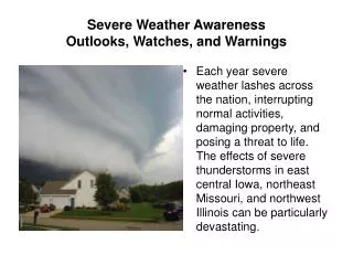
Brief Weather Setup • Large synoptic storm moving through the Midwest • Lifting warm front and aligned winds • Strong 500mb low and cold front
NWS Products Issued • High wind warnings out for most locations east of the Mississippi for February 11th • Wind warnings extended to East Coast in wake of front February 12th • 7 severe weather watches issues • Many severe weather warnings issued -- offices averaging 10 to 30 -- most tornado warnings through mid-afternoon
The Outcome • Three tornadoes reported • 335 wind report to SPC of which 18% had verified wind speeds reaching severe criteria • Damage continued February 12th but no wind reports to SPC • Strongest winds in the wake of the cold front • Wind increase upon arrival of precipitation/cold front generally 10 to 30% higher than pre-frontal synoptic winds
Items For Consideration • User confusion • Tornado fatigue (watch/warn) • Another hurricane eye wall warning problem • Optimizing for effective delivery • Large short fuse warnings areas in a storm warning environment • “Severe” weather reports http://nws.met.psu.edu/severe/2009/12Feb2009.pdf
Watches, Warnings and Wind on February 11, 2009 National Weather Service Partners Workshop June 25, 2009 Ken Reeves Director, Forecasting Operations AccuWeather, Inc. 814-235-8751 Reeves@accuweather.com