
San Antonio TransGuide Travel Time Program
San Antonio TransGuide Travel Time Program. Roger L. Strain Research Analyst Southwest Research Institute San Antonio, TX rstrain@swri.org. Model Deployment Initiative (97-99). Created area-wide database of travel speeds Real time data from instrumented segments of the freeway system

San Antonio TransGuide Travel Time Program
E N D
Presentation Transcript
San Antonio TransGuideTravel Time Program Roger L. Strain Research Analyst Southwest Research Institute San Antonio, TXrstrain@swri.org
Model Deployment Initiative (97-99) • Created area-wide database of travel speeds • Real time data from instrumented segments of the freeway system • Arterial street information (incidents, lane closures, segment speeds) • In-Vehicle Navigation (IVN) project • Transmission of real time link travel speeds and incident data from TransGuide to IVN units using FM subcarrier channel • IVN units provided point to point travel time estimate as part of route calculation • Shortest time was one of three options for route selection • Alpine and Zexel manufactured IVN units • Companies did not market units beyond MDI purchase
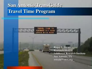
Travel Times Public Launch • TransGuide automated display of travel times on Dynamic Message Signs (DMS) launched in November of 1999 • Data provided by Data Server process from MDI • No formal outreach program • Press Release sent out the Friday before system was activated • Resulted in stories on each local television news program • Front page article in San Antonio Express News • Largely positive reaction as system went live
Travel Times in San Antonio • Travel times calculated and displayed from DMS locations to major intersections and/or interchanges • Point travel speeds used to calculate time from detector to detector based on distance between detectors • Loop Detectors • Video Detectors • Travel time messages displayed on main lane DMS • 6:00 AM to 10:00 PM • Seven days a week • Travel time messages on TransGuide website use the same algorithm
Travel Time Algorithm • Travel Time Calculation- • - Segment travel speed is chosen as lower of upstream and downstream sensor speed • Point to point travel speed is summation of segment travel times • In this example the DMS is 5.5 miles from the IH 10 interchange, with 11 travel segments defined by 12 sensor locations. For this example, all segments are exactly ½ mile in length, although in the real world the segment lengths vary.
Display of Travel Time Messages • Non Peak Usage • Travel Time messages appear alone • Peak Usage • Travel Time messages can be combined with congestion warnings • Largely negative public reaction to messages reading only “CONGESTION AHEAD” • Adding limits and travel times results in more positive reaction • Incident Interaction • Travel Times messages automatically overridden • Can be made second phase of any message with one click
Public Reaction and Use • Display of travel times on DMS very well received by public • Television and radio stations • Traffic reports use TransGuide web site travel times regularly • Station web sites link directly to or incorporate TransGuide web site for travel times and other traffic information • Travel Times messages alleviate public concerns that signs are never used • Still in line with TxDOT policy of displaying only traffic related messages on DMS
Travel Time Accuracy • Predictive Algorithms • Experimented with predictive algorithms during development • Attempted to compensate for speeds increasing or decreasing • Did not pursue because of low benefit for additional cost • Accuracy • Test runs show approximately 85% of drivers arrive within predicted travel time range • Remainder almost evenly split between early and late arrival • Public Confidence • Online surveys indicate greater than 85% confidence • Public reports quickly when travel times seem wrong
Investment in Travel Time Program • Capital investment in TransGuide • $140,000,000: CCTV, DMS, telecommunications, speed sensors, etc. • Investment in travel time program development • $60,000: initial development and integration • $10,000: upgrades and modifications (estimated) • Necessary pieces already in place: Traffic Sensor subsystem, DMS subsystem, Scenario processes • Only Travel Time specific development required • Relatively short development time • Relatively small development cost
Travel Time Significance • Initially Travel Times seemed useful, but not critical • Operator Impact • System automatically recalculates and updates messages once per minute • After starting system, operators do not have to continually monitor messages • After more than 5 years of operation • Complaints from media when travel times are unavailable • Complaints from the public when travel times are incorrect • Complaints that travel times are not available through construction zones • Public and media now EXPECT Travel Times, and they expect them to be ACCURATE
Predictive Travel Times- Government Agency Concerns • Policy of providing data to private sector at no cost has resulted in multiple private sector information sharing agreements, but no real successful examples of private sector data marketing in this area • While predicting congestion and weather related delays in travel time can be done using archived data, predicting incident related delays in travel times will be very difficult • Current investment in travel time program is relatively small, making the case for major investment on government sector side in predictive travel times will be difficult
Travel Times Through Construction Zones • San Antonio has begun installing Microwave Radar Detectors in construction zones so that travel times can be determined • Side fire radar units are pole mounted at Right of Way line, have up to 200 ft. range • Wireless radios transmit signal outside of construction zone
Future Travel Time Needs • Intercity travel times • Toll Roads/Managed Lane projects being developed in many regions statewide, using electronic toll collection is increasing market penetration of AVI tags in Texas • Installation of AVI readers on rural highways could be used to determine intercity travel times • Alternate route travel times • Encourage trucking industry to take IH 35 bypass, to avoid San Antonio/Austin traffic between Seguin, Tx and Georgetown, Tx • San Antonio is in the early stages of toll road implementation, toll lanes will have free alternates, will help to disseminate time savings for those using toll lanes
Contact: Brian G. Fariello, P.E. Roger L. Strain Traffic Management Engineer- Research Analyst TransGuide Southwest Research Institute San Antonio District- TxDOT San Antonio, TX bfariel@dot.state.tx.usrstrain@swri.org (210) 731-5247