Download
1 / 20
200 likes | 471 Views
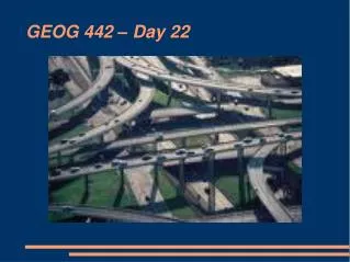
GEOG 442 – Day 22. Housekeeping Items. We have a special guest today – Daryl Amos, VIU's new energy manager. We also have two tool presentations, along with what I want to do.

E N D
Housekeeping Items We have a special guest today – Daryl Amos, VIU's new energy manager. We also have two tool presentations, along with what I want to do. Next Monday from 2:30 to 4:30 in the VIU Theatre (310), there will be a showing of “Island on the Edge,” followed by a panel of farmers, activists and a culinary arts student. It's free, but space is limited. The Regional District of Nanaimo is revisiting its Regional Growth Strategy and seeking to make it more sustainability-focused. They are looking for input. Go to their web site for more info: www.shapingourfuture.ca World Water Day tomorrow – you can buy a reusable water bottle at a table on campus from 11 to 2.
Transportation Planning A traditional weakness of transportation planning is that it has focussed on highways and other infra-structure for automobiles without coordinating with other modes of transport nor with the fit between land uses and transportation. Can you think of examples of this? There are a number of links between transportation and land use: transportation is a service to permit people, companies and institutions to carry out activities in different locations; land use helps determine demand for travel (amount and type), and transportation can affect how land is used.
Transportation Planning Transportation planning at the site level involves: determination of land uses at site estimation of of trips generated based on type and intensity of use distribution of trips to major roads assignment of vehicle volumes to roadway network analysis of capacity of roadways to handle traffic.
At a regional scale Transportation planning considers a network of nodes and links within traffic zones of varying sizes. All trips have a starting or end point (as origin or destination) in a node, and nodes are connected by links. Each link is described in terms of flow (number of trips) and friction (cost and time involved). Origin points can be quite diffuse and destinations quite precise (or not).
At a regional scale Transportation planning involves four steps: Estimation of person-trip endings in each zone, considering land use, population and economic activity. In a residential case, what is the income, rate of auto ownership, and household size? In a non-residential case, what are employment levels, floor space, and land area?
At a regional scale One would also consider trip distribution (estimation of trips starting in one zone and ending in every other zone), possibly using an attraction and repulsion model. modal split (auto, transit, other) estimation of the routes the trips will take based on an “equilibrium” model – at peak hours and 24 hours. A larger scale analysis would be iterative, using modelling (projected future spatial structure), travel demand forecasting, and testing of demand against system capacity. A crucial policy issue in the years to come will be how much continued reliance to place on the car.
Roads “A road is a strip of land specially prepared and reserved for the passage of people and goods.” Different patterns: Gridiron (doesn’t differentiate between intensities of use, disregards topography, and is monotonous, but allows for alternative routes and is kind to other modal users) Radial (single or multiple centres with direct line of travel, but resists interruptions) Linear (has same advantages and problems of radial). “Fused grid” In an urban setting, all roads are classified into local, collector, arterial, and freeway, each of which have their purposes, design criteria and limitations. In a grid pattern, local roads can be 600 feet (180 m) apart, and can be traffic calmed.
Roads • Roadway capacity is affected by width, surface, alignment, edge conditions, and vehicle type. In theory, a lane can carry 1800-2000 cars per hour. In practice, this may range from 1500 cars per hour per lane on a restricted access highway, and 200-300 on a street with side parking, and cars frequently entering and exiting. It is also affected by traffic behaviour. • 4 lanes in either direction is the practical maximum, and the greater the speed the more the need for separating cars from pedestrians. • Capacity will be reduced at crossings and intersections. Ideally, flow should be maximized by having lights that allow some lanes to keep moving. Roundabouts, little used in North America, are also very effective at “sorting” traffic. Vertical separation is only warranted at 3000 vehicles per hour and is expensive and inflexible.
Roads • Transportation engineers want to minimize distances between destinations without expanding the road network too much. They are also concerned about “penetration” of residential neighbourhoods. • Roads are expensive to build and maintain. The denser the network, the greater the number of intersections, but the simpler these will be. All of these things have to be traded off. • Where possible, continuous development along roads is good (except in the case of limited access highways), and it is good to have roads that have some degree of specialized function. • Public rights-of-way consist of the total strip of land under public control, ranging from 30 to 600 feet. It has to accommodate lanes, sidewalks and utility lines.
Roads Curbside parking requires about 8 feet, and lanes are from 9 to 12 feet wide. Vertical clearance for trucks is about 14 feet, and planting strip is often used to separate the street from the sidewalk, and can accommodate utilities and snow storage. See p. 146 for the dimensions of various kinds of roads. Intersections should be within 20 degrees of perpendicular. New urbanists have proposed narrower roadways (see p. 147), and have marshalled evidence that wide suburban streets are not necessarily safer, as assumed by traffic engineers. They are often opposed by fire departments who want roads where two fire trucks can pass each other at high speed. However, smaller fire trucks are also an option. Level roads have advantages, but there should be enough slope to allow for water drainage. 10% gradient is often the maximum gradient recommended.
Parking Desirable for business and residential, but often unsightly and impedes the flow of traffic. Can be accommodated through: Small bays in front of or behind buildings Parallel, angled, or perpendicular parking Larger or smaller lots Parking garages Underground structures Each has its advantages and disadvantages. See parking standards on p. 149. There is a trend to reduce such standards. Parking is particular important for commercial businesses, and their requirements need to balanced off against those of commuters and other people on business in a given area.
Traffic Calming A key issue in residential areas is minimizing conflicts between vehicles and pedestrians. What are some of the ways that traffic can be “calmed”? Vitality in a given area, such as a historic downtown, often depends on its pedestrian-friendliness. How can this be enhanced? How can pedestrian safety be enhanced in areas with a lot of people and vehicles? See http://www.students.bucknell.edu/ projects/trafficcalming/index.html
Transit Planning There is much debate about transit modes. These include: buses, trolleys, para-transit, express bus service, light rail transit (LTR), and heavy rail. What are some of the advantages and disadvantages of each? See transit system and planning standards chart on p. 151. Zones, nodes and links are calculated as before, with walking times to transit stops added in. “Friction” is represented by walking distance, waiting time, and cost of fare.
Advantages/ Disadvantages of Modes Advantages Disadvantages
Transit Planning One considers the four same steps: trip generation, trip distribution, modal split, and traffic network assignment and capacity. There is considerable value in having key transit nodes align with key land use nodes, either existing or being developed (see location and design criteria on p. 152). This line of thought has also taken the form of a philosophy known as transit-oriented development (TOD), pioneered by Peter Calthorpe and others. Much experimented with in Oregon and California, can you think of examples in Canada?
Pedestrians and Cyclists See Pedestrian Charter of Rights (p. 153) Conditions for “walkability”: Reduction of travel distances Increase in land use mix Elimination of pedestrian barriers and obstacles more level grades and fewer stairs Continuity of travel routes Protection from the elements Elimination of conflict with other users Increase in character and visual amenity.
Pedestrians and Cyclists role for greenways and bikeways to link key nodes and areas of green space One needs to consider road crossings (p. 154): uncontrolled controlled grade separated need to consider grades and widths (for wheelchairs and scooters), and means for pedestrians, bikes, and scooters to avoid collision. for bike routes, one should aim for directness, varied access, safety, barrier and delay removal, minimal conflict with moving vehicles and parked cars, scenic qualities, and smooth pavement or surface. [see p. 155 for standards]
New Directions and Ongoing Issues Growing trend towards telecommuting and tele-shopping could have implications for transportation systems The impacts of rising oil prices The economic, environmental and psychological costs of commuting and congestion Increasing capacity. Supply management is not always the way to go; one must also consider demand management which can take a variety of forms: strategic congestion, road and bridge tolls, financial incentives/ disincentives (taxing free parking, “green mortgages,” reducing parking requirements, free bus passes, tax break for transit or bike commuting, etc.), car co-ops & ride sharing, traffic calming, improvement in transit service, and so on.