Download

1 / 11
110 likes | 327 Views
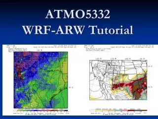
“The Goddard Multi-Scale Modeling System & Satellite Simulator for NASA PMM”. Wei-Kuo Tao & Toshi Matsui Representing Goddard Mesoscale Dynamics and Modeling Group : Wei-Kuo Tao, Jiundar Chern, Xiping Zeng, Xiaowen Li, Jainn Jong Shi , Steve Lang, Bowen Shen, and Toshihisa Matsui. Global.

E N D
“The Goddard Multi-Scale Modeling System & Satellite Simulator for NASA PMM” Wei-Kuo Tao & Toshi Matsui Representing Goddard Mesoscale Dynamics and Modeling Group: Wei-Kuo Tao, Jiundar Chern, Xiping Zeng, Xiaowen Li, Jainn Jong Shi , Steve Lang, Bowen Shen, and Toshihisa Matsui
Global Local Regional GCE WRF MMF Goddard Multi-Scale Modeling System with Unified Physics • CRMs can explicitly simulate cloud-precipitation systems. • Breaking a deadlock of cumulus parameterization. • However, CRMs still suffer from fundamental understanding in microphysics processes due to lack of routine observations. • Facing another deadlock of cloud microphysics! Unified Microphysics Radiation Land Model
Satellite Simulator:Simulate satellite observables (radiance and backscattering) from model-simulated (or assigned) geophysical parameters. Scientific Objective: • Evaluate and improve NASA modeling systems by using direct measurements from space-born, airborne, and ground-based remote sensing. • Support radiance-based data assimilation for NASA’s modeling systems. • Support the NASA’s satellite mission (e.g., TRMM, GPM, and A-Train) through providing the virtual satellite measurements as well as simulated geophysical parameters to satellite algorithm developers. ISCCP-like Simulator ISCCP DX product MODIS clouds products Braodband Simulator ERBE, CERES, TOVS, AIRS Lidar Simulator CALIPSO, ICESAT Visible-IR simulator AVHRR,TRMM VIRS, MODIS, GOES GCE, WRF, MMF output Radar Simulator TRMM PR, GPM DPR, CloudSat CPR Microwave Simulator SSM/I, TMI, AMSR-E, AMSU, and MHS Goddard Satellite Data Simulation Unit
T3EF: 1st Step Precipitating Cloud Classification • Masunaga Diagrams (Joint TbIR-HET PDF) and Cloud-Precipitation category [Masunaga et al. 2004]. • By using simulators, categorization can be donein identical, simple manner between TRMM and GCE. • Slight (~10%) overestimation of deep convective systems in GCE simulations (GM03).
GCE T3EF: 2nd Step TRMM Radar Echo CFADs • Contoured frequency with altitude diagrams (CFADs) of PR reflectivity for shallow, cumulus congestus, deep stratiform, and deep convective precipitation systems. • Largest simulated CFADs errors appear in deep convective systems. in upper troposphere. • 15dBZ bias represents that mean particle diameter in the GCE simulations could be nearly twice as large as the TRMM observations in the Rayleigh approximation (Z=D6).
T3EF: 3rd Step 2 - Congestus 3 - Deep Stratiform 4 - Deep Convective 1 - Shallow Cumulative PDF of PCTb85 • Examines microwave brightness temperature depressions caused by scattering from layers of ice particles. • Simulated PCTb85 in deep convective systems is distributed in very low Tb, indicating too much ice water content in deep convective systems. 4 - Deep Convective (after Liu and Curry 1996).
Apply A-Train and other satellites for evaluating the WRF simulation in C3VP case Evaluate spatial extent of ISCCP-based cloud types using MODIS data. Evaluate vertical profile of cloud systems using CPR reflectivity Testing simulated MW Tb against the AMSU-B Tb for future GMI sensor.
GM07 GM03 TRMM PCTb85 How to improve bulk microphysics? Modify Assumption of Drop-Size Distribution (DSD) • Constrain DSD assumptions of frozen condensate as a function of temperature (TEDD) based on the GCE spectra-bin microphysics (SBM) [Li et al. 2008]. • Improved droplet effective radius (re) in TEDD against SBM in PRESTROM simulations SBM: spectra-bin microphysics N0CTL: control bulk microphysics N0100: intercept 100 of N0CTL TEDD: temperature-dependent DSD Modify Conversion Rate • Modified Goddard microphysics (GM07: incorporating Bergeron and ice-nuclei processes, and reducing the collision efficiency in order to reduce the amount of graupel) [Lang et al. 2007] show an improvement in probability distirbution of PCTb than GM03 (default).
NASA Satellites Good enough? GCE SBM Improve SBM Radiance-based evaluation Simulator Model-Simulator-Satellite Chain Parameterize DSD For bulk microphysics GCE forced by MERRA Provide/Improve a priori database of simulated geophysical parameters and radiance Improve bulk microphysics NASA unified WRF Simulator MMF (2DGCE+fvGCM)
Goddard SDSU future development Plan Priority Order 1. Code: MPI version (DONE). 2. Surface Properties: Land surface emissivity and BRDF spectrum albedo. 3. Optical properties: Non-spherical optical properties (frozen particles and dust aerosols) 4. Radiative Transfer: 3D radiative transfer with full polarization (numerically worst case) 5. IO process: Options for GEOS5 SCM input (overlapping ensemble statistics)