Rivers: Profiles, Erosion, and Formations
E N D
Presentation Transcript
Long and cross profiles • Processes of erosion, deposition and transportation • The characteristics and formation of waterfalls and gorges • The characteristics and formation of meanders and ox-bow lakes • The characteristics of levees, deltas and flood plains • Flooding in MEDC’s and LEDC’s • The short, medium and long term attempts at managing flooding • The social, economic, environmental and political issues that have an impact upon strategies and the values and attitudes of interested groups.
Rivers begin in upland areas and flow downhill towards the sea. The start of a river is called the SOURCE and the end is called the MOUTH. Along the main river, there are many other smaller rivers which join it called TRIBUTARIES. These join with the main river at a point called the CONFLUENCE. A river and its tributaries obtain their water from the surrounding land. The area drained by the river and its tributaries is called the DRAINAGE BASIN. The boundary of the drainage basin is called the WATERSHED. The long profile of a river is a cross-section from the source to the mouth. It consists of three sections: Upper section – narrow, steep-sided valleys (v-shaped) where gorges and waterfalls may form Middle section – wider valley with floodplain but still with steep valley sides Lower section – very wide, flat-floored valley with meanders and ox-bow lakes
Processes of erosion, deposition and transportation EROSION Attrition-This is when material bashes against each other and breaks up into smaller and more rounded pieces Corrosion- This is when material in the river is broken down by chemicals Corrasion- This is when stones and pebbles rub away at the bed and banks Hydraulic action- This is the power of the water on the bed and banks TRANSPORTATION Saltation- This is when smaller pebbles are bounced along the river bed Solution- This is when lighter material is dissolved and is carried along in the water Traction- This is when larger bed load is dragged or rolled along the river bed Suspension- This is when light material is carried along within the water (in suspension) DEPOSITION A river requires lots of energy to transport its load and when this energy is reduced, the river is forced to deposit the load. An example would be on the inside of a river bend where the slow moving water has little energy and deposits the load.
The characteristics and formation of waterfalls and gorges A waterfall is a steep drop in the course of a river. They form when a band of hard, resistant rock (cap rock) lies over softer, less resistant rock. The softer rock is quickly eroded by hydraulic action and abrasion, causing the harder rock to be undercut. The hard rock overhangs until it can no longer carry its own weight. The overhang collapses and then breaks up in the water below. The great power of the water at the base of the waterfall causes a plunge pool to form. The bed of the river below the waterfall contains boulders eroded by splash back from behind the waterfall. Over time this process is repeated and eventually a steep-sided gorge forms as the waterfall retreats up stream.
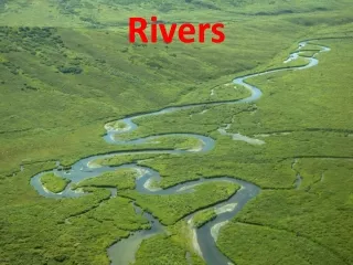
The characteristics and formation of meanders and ox-bow lakes Meanders are bends in a rivers course. Water flowing around a meander moves fastest on the outside of the bend leading to erosion and the formation of a steep river cliff. On the inside of the bend, water slows down leading to the deposition of sediment. This forms a gently-sloping slip off slope in the shallow water. Lateral erosion by meanders leads the widening of the valley floor (floodplain). Meanders often migrate downstream and become wider and larger over time. Where there are well developed meanders, a river may take a short-cut across a narrow meander neck in times of flood and this leads to the creation of sections of abandoned river called ox-bow lakes. Over time, the ox-bow lakes dry up and leave just a meander scar.
The characteristics of levees, deltas and flood plains A flood plain is the wide, flat area of land on either side of the river in its middle and lower course. A flood plain forms through both erosion and deposition. When material is deposited on the slip off slope of a meander it gradually builds up over time. When a river overflows its banks, water pours on to the floodplain and as it drains away fine material (alluvium) is deposited. Levees are natural embankments of silt along the banks of a river, which are often several metres higher than the flood plain. A delta is a flat area of sand and silt built into the sea. When a river enters the sea carrying large volumes of fine material, the velocity slows and causes the load to be deposited in layers. Over time, the deposited material forms small islands separated by river channels called distributaries.
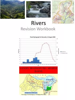
Flooding in MEDC’s and LEDC’s Flooding in MEDC’s has a different impact to flooding in LEDC’s. A large amount of housing in urban areas of MEDC’s has been built on flood plains. This has obviously led to extensive flooding in many MEDC’s (for example, Mississippi river, USA or River Severn, UK). The floods are often caused by the amount of tarmac and other impermeable surfaces which have been laid down as a result of urbanisation. This leads to rapid overland flow and rivers reaching their peak discharge rapidly in times of heavy rain and leads to extensive flooding. Emergency services and warning systems mean that loss of life in MEDCs is often small. Homes and businesses, however, are often damaged and the cost can be great (the Mississippi floods of 1993 caused $10 billion of damage). Plans to prevent flooding are often only put in after a flood has occurred. However, as MEDC’s are more economically developed, they are able to implement effective strategies to reduce the damage from flooding in the future. Flooding in LEDC’s has a massive impact on the economy, health system and people. The floods can occur due to monsoon rains, snow melt in spring or just unusually high rainfall (for example, River Ganges, Bangladesh). Loss of life may be great as emergency services struggle to cope with the vast amount of help that is needed. Communication links are often destroyed and as the quality of housing is often of a poor standard, many homes are completely destroyed leaving people homeless. Due to the lack of provision for clean up operations, water often remains stagnant which leads to the rapid spread of water-borne diseases, such as cholera and typhoid. LEDCs may need to seek aid from MEDCs to assist with the damage caused by severe flooding.
The short, medium and long term attempts at managing flooding SHORT TERM Sand bags - to prevent further damage to property MEDIUM TERM Afforestation - trees are planted to absorb water and reduce surface runoff. Managed flooding - the river is allowed to flood in some places to avoid destruction close to large settlements Planning - governments and local councils implement plans to help prevent damage to property in future LONG TERM Dam building- dams are built in order to control the amount of discharge released River engineering- the river channel may be widened, deepened or straightened to allow water to flow more quickly
The values and attitudes of interested groups Environmental groups and residents often prefer options which have as little impact on the settlement and environment as possible, such as planting trees Governments and investment groups often prefer hard engineering options, such as dam building, as this can often generate large profits and can also attract people for leisure purposes such as sailing
SUMMARY • The start of a river is called the SOURCE and ends at the MOUTH • The long profile of the river consists of three sections; • Upper- where gorges and waterfalls form • Middle- where meanders tend to form • Lower- where deltas and floodplains form • There are four processes of erosion and transportation • Deposition is the putting down of material along the river due to a loss of energy • A waterfall is a steep drop in the course of a river. They form when a band of resistant rock lies over softer, less resistant rock • Meanders are bends in a rivers course • A flood plain is the wide, flat area of land on either side of the river in its lower course • Levees are natural embankments of silt along the banks of a river, which are often several metres higher than the flood plain. • A delta is a flat area of sand and silt built into the sea. When a river enters the sea carrying large volumes of sand, the velocity slows and causes material to be deposited. • Flooding in MEDC’s has a different impact to flooding in LEDC’s • There are short, medium and long term attempts at managing flooding