Download
1 / 84
860 likes | 1.13k Views
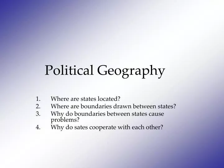
Political Geography . Where are states located? Where are boundaries drawn between states? Why do boundaries between states cause problems? Why do sates cooperate with each other?. POLITICAL GEOGRAPHY. Interaction of politics and place.

E N D
Political Geography Where are states located? Where are boundaries drawn between states? Why do boundaries between states cause problems? Why do sates cooperate with each other?
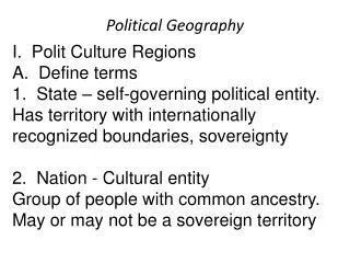
POLITICAL GEOGRAPHY Interaction of politics and place • The study of the interaction of geographical area and political process • It is the formal study of territoriality. • Covers forms of government, borders, treaties, trading blocs, conflicts and war.
STATE • A politically organized territory • Administered by a sovereign government • Recognized by a significant portion of the international community. A state must also contain: • a permanent resident population • an organized economy
I. Where are states Located? A. Problems of defining States 1. State- An area organized into a political unit by a sovereign government. Occupies a defined area on the earths surface with a permanent population 2. Sovereignty- A states independence of internal affairs from other states 3. Antarctica is the only land mass that does not belong to any state. Treaties of 1959 and 1991 define this Some countries claim portions but the UN refuses to acknowledge claim Australia, Norway, France, Chile, U.K., New Zealand
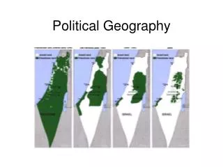
4. Korea- occupied by Japan until after WWII then divided into two sovereign countries North Korea (Communist) and South Korea (Dictatorship/ Democracy) • North Korea ( Democratic Peoples Republic of Korea) • South Korea ( Republic of Korea) In 1950 the North will invade the South and start a three year war- Korean War • The US backed the South (37,000 casualties) • The Soviets backed the North Truce was drawn in 1953 at the 38th Parallel • Armistice still stands today- actively at war • DMZ- The most militarized zone in Korea
5. China and Taiwan- after the communist take over of China the Nationalist fled • The nationalist claim to be the rulers of China but will take Taiwan for now • Since then China has claimed Taiwan but the people of Taiwan still claim sovereignty 6. Africa- Sahrawi Arab Democratic Republic claims the territory of the western Sahara • Morocco claims their own sovereignty and built a wall around its city • Cease fire was administered by the UN in 1991; Spain now controls two cities in Morocco
United Nations Member States (192) The United Nations System is based on five active principal organs UN General Assembly UN Security Council UN Economic and Social Council UN Secretariat International Court of Justice Non-member States Taiwan (China) Vatican City Western Sahara (territory of Morocco) Palestinian Territories Tibet (China)
Enlargement of Soviet bloc after World War II Berlin Wall, 1961-89
B. Varying Size of States • Largest – Russia – 6.6 million square miles 2. Other states more than 2 million a. Canada, US, China, Brazil, and Australia 3. Monaco- .6 square miles 4. Microstates – states with very small land areas C. Development of the State Concept 1. Ancient and Medieval States a. Ancient Fertile Crescent b. First states were known as City-States 2. Early European States a. Roman Empire b. Collapsed in 5th Century
NATION - STATE • A country whose population possesses a substantial degree of cultural homogeneity and unity. Classic Example of a Nation-State: Japan
3. Colonialism- effort of one country to implement settlements to impose political, economic, an a cultural agenda on another territory • 3 reasons- • Missionaries trying to impose Christianity • Raw materials and other resources • Increase the prestige of their country ( more territories) 4. Colony- territory that is legally tied to a sovereign state rather then being completely independent a. European states b. Imperialism c. Few remaining colonies d. Least populated
African colonies
Koreans Imperialism: Kim So Wol • When seeing me sickens you and you walk out I'll send you off without a word, no fuss. • Yongbyon's mount Yaksan's azaleas by the armful I'll scatter in your path. • With parting steps on those strewn flowers treading lightly, go on, leave. • When seeing me sickens you and you walk out why, I'd rather die than weep one tear.
East versus West: View of Communist “Red Bloc” during Cold War Lumping failed to recognize differences among Communists, or local causes of conflict
II. Where are boundaries drawn? Why do boundaries cause problems? A. Boundary- invisible marking the extent of a states territory 1. 2 types- a. Physical- Mountains, Deserts, water -All strategically important -Oceans are problem because the extent that country owns; 1983- established ruling 12 nautical miles out from land and fishing rights 200 miles b. Cultural Boundaries- Geometric- mathematical lines drawn on a map -Religious, Language (often found in Europe) -Implemented lines- UN nations- Green Line in Cyprus -Relic Boundaries- Hadrian's wall and the Great Wall
Forms of Government Source: Matthew White, 2003. http://users.erols.com/mwhite28/othergov.htm Adapted from FreedomHouse.org
Source: Matthew White, 2003. http://users.erols.com/mwhite28/othergov.htm Adapted from FreedomHouse.org
Source: Matthew White, 2003. http://users.erols.com/mwhite28/othergov.htm Adapted from FreedomHouse.org
U.S.- Canada boundary Alberta- Montana
U.S.- Mexico boundary Calexico, California- Mexicali, Mexico
B. This leads to five shapes of states- 1. Compact States- distance from the center to the boundary is short 2. Prorupted State- Compact state with large projecting extensions, ex Congo 3. Elongated- Long and narrow- ex. Chili 4. Fragmented- Several discontinued pieces- Ex U.S. 5. Perforated State- Completely surrounds another state- ex South Africa
C. Other types 1. Landlocked- no direct outlet to the ocean- ex most of Africa 2. Frontier- zone where state exercises complete control 3. Unitary State- most of the power is in the hands of the central government 4. Federal State- allocates large power to units in local govt within the country • The trend recently is allocates more power to the central government then to the independent territories
The Geography of Representation D. Electoral geography 1. Redistricting 2. Gerrymandering (practice of drawing boundaries of legislative districts so as to unfairly favor one political party over another).
ELECTORAL GEOGRAPHY Political Geography of Elections Variation of voting districts and voting patterns
Gerrymandering- the process of redrawing lines in order to benefit the party in power Wasted vote – spreads opposition supporters across many districts but in the minority Excess vote – concentrates opposition supporters into a few districts Stacked vote – links distant areas of like-minded voters through oddly shaped boundaries
“Gerrymandering” Redistricting for partisan purposes
U.S. congressional delegation redistricting Reapportionment : allocating seats to a geographic area (normally done after every census)
Tom Delay’s District in Texas After Texas Republicans won a majority in 2002, they enacted redistricting legislation to protect their wins.
1860 Presidential Vote Led to Southern secession, Civil War
Davis (D) 48% Simon (R) 42% Camejo (G) 5% Copeland (L) 2%