Download
1 / 47
470 likes | 575 Views
EFFECTS OF CLIMATE CHANGE ON FOREST FIRES OVER NORTH AMERICA AND IMPACT ON U.S. OZONE AIR QUALITY AND VISIBILITY.

E N D
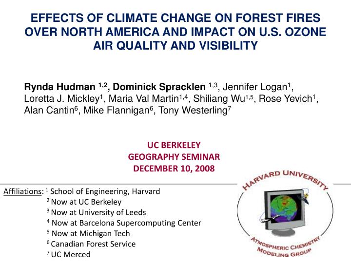
EFFECTS OF CLIMATE CHANGE ON FOREST FIRES OVER NORTH AMERICA AND IMPACT ON U.S. OZONE AIR QUALITY AND VISIBILITY Rynda Hudman 1,2, Dominick Spracklen1,3, Jennifer Logan1, Loretta J. Mickley1, Maria Val Martin1,4, Shiliang Wu1,5, Rose Yevich1, Alan Cantin6, Mike Flannigan6, Tony Westerling7 UC BERKELEY GEOGRAPHY SEMINAR DECEMBER 10, 2008 Affiliations: 1 School of Engineering, Harvard 2 Now at UC Berkeley 3 Now at University of Leeds 4 Now at Barcelona Supercomputing Center 5 Now at Michigan Tech 6 Canadian Forest Service 7 UC Merced
WHY DO ATMOSPHERIC SCIENTIST CARE ABOUT WILDFIRES? • Releases 1-4 Pg C / yr (~30-50% of the fossil fuel source) • Accounts for 2/3 of the variability in CO2 growth rate between 1997 and 2001 • 20-60% of the global organic carbon aerosol (particulate) emission, 30% of the black carbon (soot) emission • Potential for climate feedbacks • Impacts ozone/aerosol air quality, visibility, human health
TROPICS DOMINATE FIRE ACTIVITY BUT NORTH AMERICAN RECORD PUNCTUATED BY LARGE FIRE YEARS [Bowman et al., 2009] Mean area burned: ~3 million hectares 2x size of Connecticut Large fire years increase emissions by X10
NORTH AMERICAN FIRES AFFECT ATMOSPHERIC COMPOSITION ON A HEMISPHERIC SCALE In 2004, a blocking ridge set up over Canada and Alaska creating one of the largest fire seasons on record. http://asl.umbc.edu/pub/mcmillan/www/index_INTEXA.html
LOCAL EFFECTS OF WILDFIRE EMISSIONS Hayman fire caused worst air quality ever in Denver • 56000 ha, June 8-22, 2002 • 30 miles from Denver and Colorado Springs • EPA 24-hr standard = 35 µg/m3, and annual standard = 15 µg/m3. June 8, 2002 June 9, 2002 PM10 = 40 μg/m3 PM2.5 = 10 μg/m3 PM10 = 372 μg/m3 PM2.5 = 200 μg/m3 Colorado Department of Public Health and Environment Vedal et al., Env Res, 2006
WILDFIRE DRIVES INTERANNUAL VARIABILITY IN ORGANIC CARBON AEROSOL IN THE SUMMER Model gives same variability as observed OC in summer at IMPROVE sites in the West OC contribution to total fine aerosol: 40% in low fire years 55% in high fire years same fires every year [Spracklen et al., 2007] [Spracklen et al., 2007]
PRESENT DAY FIRE IMPACTS ON OZONE Ozone enhancement from NA biomass burning 0-2 km Simulated July 2004 mean Max enhancement during July 15-24 2004 8-hr max ozone air quality standard in the United States = 75 ppbv [Hudman et al., 2009]
CLIMATE DRIVES FIRE ACTIVITY OVER NORTH AMERICA Temperature Rainfall Wind speed Relative Humidity Canadian Fire Weather Index Model Other factors: Large Scale circulation Fuel availability Ignition Source Fire Suppression
OBSERVED INCREASE IN WILDFIRE ACTIVITY OVER NORTH AMERICA DUE TO CLIMATE CHANGE? Area burned in Canada has increased since the 1960s, correlated with temp. increase. 5 year means [Gillett et al., 2004] Increased fire frequency over western U.S. in recent decades – related to warmer temp., earlier snow melt. [Westerling et al., 2007]
PREDICTING THE IMPACT OF FUTURE CLIMATE CHANGE ON WILDFIRE AND AIR QUALITY 1. DEVELOP RELATIONSHIPS BTWN CLIMATE AND ANNUAL AREA BURNED OBSERVED AREA BURNED OBS WEATHER & FUEL MOISTURE/ FIRE SEVERITY Yearly Area Burned = C1X1 + C2X2 + … + C0 Climate Model Output 2. CLIMATE MODEL OUTPUT PREDICT FUTURE AB 3. PRED. FUTURE AIR QUALITY FUTURE AREA BURNED Emissions CHEMICAL TRANSPORT MODEL
I. WESTERN U.S. ECOREGIONS & MET USED IN REGRESSION Combine ecoregions of similar vegetation and topography Use observed meteorology from surface weather stations (USFS) FWI (Spracklen et al., 2009)
WHERE ARE THE FIRES IN THE WESTERN U.S.? Mean area burned (1º x 1º grid) in 1980-2004 (Westerling, UC Merced) Mean fuel consumed Large areas burned in CA and the southwest, but fuel burned is greater in forest than in shrub ecosystems The Pacific North West and Rocky Mountain Forests are most important for biomass consumption and emissions. (Spracklen et al., 2009)
PREDICTING WILDFIRE OVER THE WESTERN U.S. Area Burned (ha) R2 of Area Burned regressions 48% 57% 52% Area Burned (ha) 37% 24% 49% Year Regressions ‘capture’ 24 – 57% of the interannual variability in area burned over western US. Temperature contributes 80-90% of the regression in forested regions. (Spracklen et al., 2009)
CHANGES IN MAY-SEPT TERMPERATURE (2000 – 2050) GISS GCM3 A1B Scenario - CO2 concentrations reach 522ppm Temperature Predicted met Changes Temp. +1-3ºC across West Rainfall and RH increase slightly Wind speed decreases slightly (Spracklen et al., 2009)
PREDICTED INCREASE IN AREA BURNED Pacific Northwest US Observed area burned Predicted area burned 78% increase Rocky Mountain Forests 175% increase Predicted area burned for 1995-2004 does not match observed areas on a yearly basis, as it is based on GCM output, but 10 year mean is the same. (Spracklen et al., 2009)
PREDICTED INCREASE IN AREA BURNED + 1-3K Pacific Northwest US Rocky Mountain Forests Predicted area burned for 1995-2004 does not match observed areas on a yearly basis, as it is based on GCM output, but 10 year mean is the same. (Spracklen et al., 2009)
FUTURE WILDFIRE AND PARTICULATE AIR QUALITY Change in wildfire biomass consumption AB + FUEL Emissions Δbiomass consumption = + 90% Change in surface OC aerosol (Jun-Aug) Δsurface OC aerosol = + 40% Chemical Transport Model Climate change projected to cause a 90% increase in biomass consumed and 40% increase in OC concentrations by 2050. (Spracklen et al., 2009)
FUTURE WILDFIRE AND PARTICULATE AIR QUALITY Present day fires in black, 1996-2000 Future fires in red, 2046-2050 OC increases by 40%, EC increases by 20% (not shown). For OC, 75% of increase is from fire emissions, 25% from higher biogenic emissions in a warmer climate. (Spracklen et al., 2009)
PREDICTED JULY MEAN MAXIMUM 8-HR OZONE perturbation from fires doubles 5 Years Future (2046-2050) vs. 5 Years Present (1996-2000) Consistent with these results, recent observational estimates of regional enhancements of 2 ppbv for each 1 million acres burned [Jaffe et al., 2008] (Hudman et al., in prep)
SUMMARY WESTERN U.S. • Regressions capture much of the variability in annual area burned over the western U.S. (24-57%). Temperature is the key predictor. • 2050 climate change (A1B) is predicted to increase annual mean area burned over western U.S. (+54%) 90% increase in biomass consumed relative to the present-day driven by 1-3K increase in temperature. • Future fires drive a 40% increase in organic carbon aerosol over the western US and a 1-3 ppbv enhancement (doubling fire enhancement) in summertime afternoon ozone.
II. BOREAL ECOREGIONS & MET USED IN REGRESSION Largest Area Burned over Plain regions [French et al., 2003] [Stocks et al., 1999] [105 ha] Combine ecoregions of similar vegetation and topography (12 ecoregions) Alaska wx stations (USFS) & Canadian wx stations (CFS) (Hudman et al., in prep)
SUMMER 2004: 500hPa GEOPOTENTIAL HEIGHT Height of pressure level above mean sea level Strong ridges are accompanied by warm and dry weather conditions at the sfc +60 Jul 1 – Aug 15 2004 Anomaly Strong Alaskan Ridge record fires (Hudman et al., in prep)
CANADIAN FIRE WEATHER INDEX MODEL Drying time 2/3 day 15 day 52 day Severity Rating Severity Rating is a combination of drought and fire spread potential
REGRESSIONS CAPTURE VARIABILITY IN REGIONS WITH LARGEST AREA BURNED (15-62%) • ALASKA/CANADA SUMMARY: 2-3 predictors chosen per region • Most Common Predictors: • Monthly/Seas. 500 mb GPH Anomaly (Max contributor 7/12 ecoregions) • Max/Mon./Seasonal Severity Rating (Max contributor in 3/12 ecoregions) More influenced by fire suppression and human caused fires GPH was chosen over temperature (Hudman et al., in prep)
PREDICTING WILDFIRE OVER CANADA AND ALASKA - - - national totals for Canada (not included in regression) + Alaska Regressions capture 71% of the variability in Canada and Alaska About as good a non-linear regression which use many more variables (Hudman et al., in prep)
DOES RAIN OFFSET TEMPERATURE/GPH INCREASE? GISS simulated May – August 2046-2055 vs. 1996-2005 June 500mb anomaly over Fairbanks, Alaska (1940 – 2006) GISS Mean 1999-2008 : -14 m 2045-2054 : 5 m [Fairbanks GPH Courtesy of Sharon Alder, BLM] (Hudman et al., in prep)
DOES RAIN OFFSET TEMPERATURE INCREASE? GISS simulated May – August 2046-2055 vs. 1996-2005 Rain Seasonal Severity Rating Dry spell length important…GISS suggests decreased dry spell length, likely very model dependent (Hudman et al., in prep)
MOST GCMS PREDICT INCREASED SUMMERTIME PRECIPITATION A1B 1980-1999 vs. 2080-2099 Predicted Summer ppt Change # of models showing increased ppt Dry spell length important…GISS suggests decreased dry spell length, likely very model dependent (IPCC, 2007, Ch 11)
PREDICTED CHANGE IN AREA BURNED 2000-2050 change in area burned GPH dominates DSR dominates Combination 34% increase over Alaska, 8% (-34 to +118%)increase in Canada. Large regional variability. Seems consistent with recent study by Meg Krawchuck (UCB) (Hudman et al., in prep)
PREDICTING FUTURE AIR QUALITY • Distribute annual area burned by month ( ha/month) • Randomly place AB w/in ecosystem into 1°x1° (based on current fire size stats) • Combine with fuel consumption which varies throughout season based on fuel moisture + make assump. severity (kg DM/ha) • Combine with emission factors ( g species/kgDM) • Assume 20% of emissions in FT (Maria Val Martin MISR work) • Input into GEOS-Chem CTM (w/ GISS met) future air quaity (Hudman et al., in prep)
PRESENT DAY SURFACE OZONE ENHANCMENT JUL-AUG Fires predicted to enhance 8-hr max ozone by 3-10 ppbv, 1-4 ppbv reaching Midwest U.S. (Hudman et al., in prep)
CHANGE IN SURFACE OZONE ENHANCMENT JUL-AUG Doubling of enhancement over Alaska, 1-2ppbv increase over populated Quebec cities and Midwest (20-40% increase) A decrease of ozone toward the Arctic (Hudman et al., in prep)
PERCENT CHANGE IN SURFACE OC/EC JUL-AUG Preliminary Result [%] Transport of Black Carbon aerosol to the Arctic decreases by 40% (Hudman et al., in prep)
FUTURE WORK • Examine change in extreme events using current simulations and Regional modeling (U. Houston) • Implement plume rise model into GEOS-Chem (Maria Val Martin) • Improve regressions of desert southwest using PDSI (Harvard) • Update Canada/Alaska regressions LFDB when avail. • Do an envelope study of GCM response to Canada/Alaska regressions to look at variability in response (Harvard) • Impacts of new understanding of NOx emission factors on ozone response (Harvard, Anna Mebust UCB) Thanks for your attention!
SUMMARY CANADA/ALASKA • Regressions capture much of the variability in annual area burned over Alaska (53-57%), and Canada (15-62%). Key predictors : 500 mb GPH anomaly & severity rating. • 2050 climate change (A1B) increases annual mean area burned: Alaska (+34%) relative to the present-day, but unlike most previous studies little change over Canada as a whole (8%), but varies regionally (-34 - + 118%) due to increases in GCM precipitation vs. temperature (scenario/GCM dependent). • Present day ozone enhancements due to wildfire 3-10 ppbv over Canada and Alaska. Future fire increases range from -2 - +4 ppbv. Large decreases of BC toward the Arctic.
1. WILDFIRE PREDICTION MODEL Observed daily Temperature, Wind speed, RH, Rainfall, 500hpa GPH anom. (Canada/Alaska) Daily forest moisture/fire danger parameters Canadian Fire Weather Index System Aggregate area burned to ecosystem Linear stepwise regression Area burned database Predictors of Area Burned Stepwise linear regression between meteorological/forest moisture variables & area burned [Flannigan et al. 2005]
IMPLICATION OF RISING OZONE BACKGROUND FOR MEETING AIR QUALITY STANDARDS Europe AQS (8-h avg.) Europe AQS (seasonal) U.S. AQS (8-h avg.) U.S. AQS (1-h avg.) 0 20 40 60 80 100 120 ppb Preindustrial ozone background Present-day ozone background at northern midlatitudes EPA policy-relevant background (PRB) : U.S. surface ozone concentrations that would be present in absence of North American anthropogenic emissions PRB is not directly observable and must be estimated from global models
GEOS-Chem GLOBAL MODEL OF TROPOSPHERIC CHEMISTRY http://www.as.harvard.edu/chemistry/trop/geos • Driven by NASA/GEOS assimilated meteorological data with 6-h temporal resolution (3-h for surface quantities) • Horizontal resolution of 1ox1o, 2ox2.5o, or 4ox5o; 48-72 levels in vertical • Detailed ozone-NOx-VOC-PM chemical mechanism • Applied by over 30 research groups in U.S. and elsewhere to a wide range of problems in atmospheric chemistry • Extensively evaluated with observations • for ozone and other species (~200 papers in journal literature)
Mean Asian surface pollution enhancement (GEOS-Chem)
Global Carbon Emissions 49% Africa 13% South America 11% equatorial Asia 9% boreal forests 6% Australia
Short-lived Pollutants Affect Climate and Air Quality [IPCC, 2007] Regulations of short-lived species that improve air quality and warm the planet (BC) present a “win-win” situation, while regulations of short-lived species that reduce cooling and improve air quality (SO2) present a “win-lose” situation.
ACCOUNTING FOR DRIZZLY GCM Observations GISS Present Day GISS Future -------- Corrected (GISS – 1.5 mm) _____ Uncorrected Frequency Dryspell Length (days)
An increase from current conditions (red) is indicated by a PΔ greater than unity, little or no change (yellow) is indicated by a PΔ around unit, and a decrease (green) is indicated by a PΔ less than unity. Panels show the mean PΔ for the ensemble of ten FIRENPP (A–C) and FIREnoNPP (D–F) sub-models. Climate projections include 2010–2039 (A, D), 2040–2069 (B, E) and 2070–2099 (C, F).