Download
1 / 31
310 likes | 415 Views
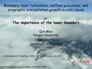
Boundary-layer turbulence, surface processes, and orographic precipitation growth in cold clouds o r: T he importance of the lower boundary. Qun Miao Ningbo University Bart Geerts University of Wyoming. acknowledgements: Yang Yang , UWKA crew, Roy Rasmussen, Dan Breed.

E N D
Boundary-layer turbulence, surface processes, and orographic precipitation growth in cold cloudsor:The importance of the lower boundary Qun MiaoNingbo University Bart Geerts University of Wyoming acknowledgements: Yang Yang, UWKA crew, Roy Rasmussen, Dan Breed NCAR orographic precip workshop, 13-15 March 2012
The advantage of a nadir view … radar+lidar • Wyoming Cloud Radar • Wyoming Cloud Lidar radar only radar+lidar vertical plane dual-Doppler below flight level
Does boundary-layer turbulence enhance snow growth in mixed-phase clouds? wind Med Bow Mtns Med Bow Mtns
(equivalent) potential temperature (K) 300 mb height, 800 mb T & wind barbs
power spectrum over this WCR section turbulent BL depth: ~ 1.0 km
Does this turbulence really matter distance (km) brief spells of snow growth by accretion or riming in rising eddies?
2009-03-10 B B time (UTC)
Composite analysis of snow growth, based on 10 flights over the Med Bow Range in SE Wyoming, using CFADs black lines: along-wind legs red lines: ladder pattern
Frequency by altitude (FAD) plots bin Z or V increment altitude above the ground (Yuter & Houze 1997) bin Dz nn reflectivity or vertical velocity
wind 2. upwind above LCL 1. upwind below LCL 3. lee crest Med Bow Range LCL east west 5.9 5.9 107 profiles 4.4
crest LCL WCR reflectivity (dBZ)
crest 2 3 1 LCL 3 2 1 1 2 3 3 2 1 rapid snow growth across the LCL … yet very little change in MEAN vertical velocity across the LCL. conclusion: snow growth must jump-start when the turbulent BL enters into cloud.
crest LCL WCR reflectivity (dBZ)
Liquid water in turbulent eddies within the BL scatterplot where LWC > 0.05 g m-3, and the aircraft is within the BL • there is some positive correlation … • snow must consume some of the droplets in the updrafts
Is BL turbulence important also for the low-level growth by collision-coalescence in non-brightband rain? frequency-by-altitude display non-bright-band rain at CZD Height, MSL (km) profiling S-band radar data, time resolution 6 min (~4 km) (Neiman et al., 2005, Mon. Wea. Rev.)
low-level snow initiation? (a) Hallet-Mossop ice multiplication on rimed surfaces like trees: we have no evidence 2006-01-18
Does blowing snow initiate glaciation in supercooled liquid orographic clouds? fall speed removed
KRWL * winds 30-40 kts during flight Blowing snow flights in ASCII (Jan-Feb 2012) leg 5 along the Sierra Madre crest sounding from BL2: deep well-mixed layer strong winds T<0°C
WCR reflectivity blowing snow plumes?? WCR vertical velocity NW SE terrain outline, seen by radar & lidar WCL backscatter power WCL depolarization ratio high depol ratio suggests this is ice, not water
WCR reflectivity WCR vertical velocity WCL backscatter power WCL depolarization ratio
Another blowing snow case, with a shallow stratus cloud deck upstream of mountain, cloud top temperature -14°C leg 3 (along-wind)
WCR reflectivity no seeding from aloft first snow (very light) wind WCR vertical velocity deep, turbulent BL SW NE WCL backscatter power cloud top (T~-12°C) cloud must be thin because terrain can often be seen WCL depolarization ratio DR is low at cloud top (droplets) and higher below (ice)
WCR reflectivity wind WCR vertical velocity deep, turbulent BL, smooth wave motion aloft WCL backscatter power cloud top WCL depolarization ratio zoom-in (next slide) terrain SW NE
WCL backscatter power cloud top terrain WCL depolarization ratio Depol Ratio is low at cloud top (droplets) and higher below (ice) 500 m terrain
conclusions • A turbulent BL drapes complex terrain. • readily distinguishable from stratiform flow aloft • FADs indicate rapid snow growth within the BL as the BL air rises through the cloud base. • Shallow orographic clouds may be glaciated by the surface below. • BL turbulence can strong (~convective updrafts) • may increase the fraction of accretionalgrowth (riming).
The FADs show the particle vertical motion. • The fallspeed of snow is NOT removed. estimating hydrometeor terminal velocity WCR (mean close-gate below & above): particle vertical motion gust probe: air vertical motion