Download
1 / 31
310 likes | 330 Views
Learn about the 2015 wildfire that trapped hundreds of vehicles between Los Angeles and Las Vegas, highlighting the risks, hazards, and lessons for disaster risk reduction.

E N D
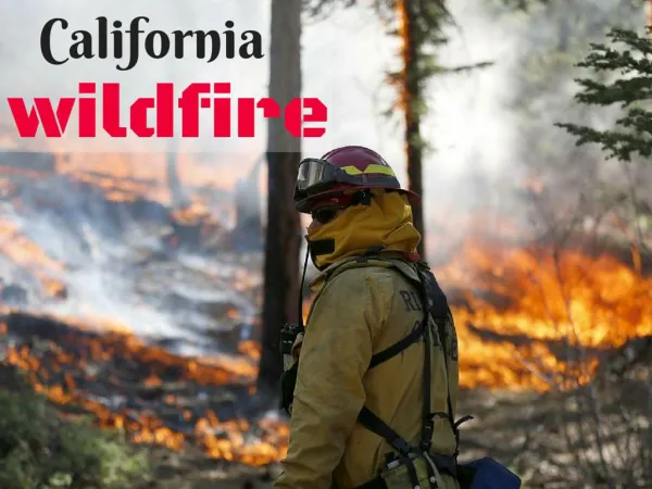
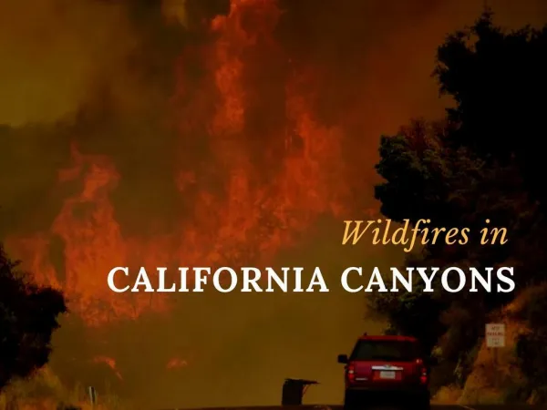
DEADLY WILDFIRE EXPERIENCE IN SOUTHERN CALIFORNIAJuly 17, 2015 Walter Hays, Global Alliance for Disaster Reduction, Vienna, Virginia, USA
Natural Phenomena that Cause Disasters Planet Earth’s atmospheric-lithospheric interactions cause: • WILDFIRES • Wildfires
WILDFIRES are conflagrations caused by lightning discharges (or acts of man) in wilderness areas close enough to one or more urban interfaces that they threaten people, property, infrastructure, and business enterprise.
THE WILDERNESS AREAS typically contain national forests, national parks, or resorts and the adjacent urban areas typically contain large, expensive homes.
LOCATIONS OF MAJOR WILDFIRES Four locations: 1) Australia, 2) California, 3) Europe, and 4) Yellowstone Park (USA), have wilderness-urban interfaces that have been repeatedly impacted over the years by wildfires.
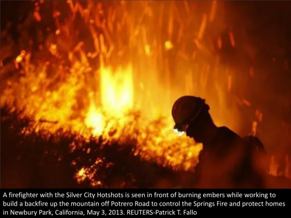
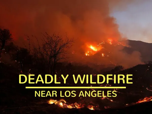
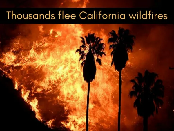
THE JULY 17TH WILDFIRE EXPERIENCE WAS NOTABLE BECAUSE IT JUMPED INTERSTATE 15 AND TRAPPED HUNDREDS OF CARS AND TRUCKS BETWEEN LOS ANGELES AND LAS VEGAS
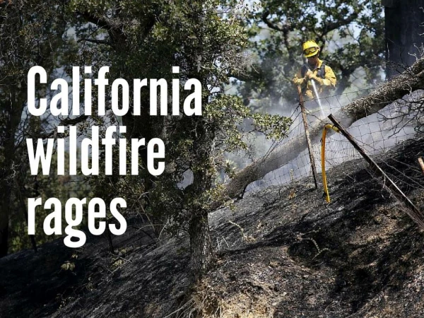
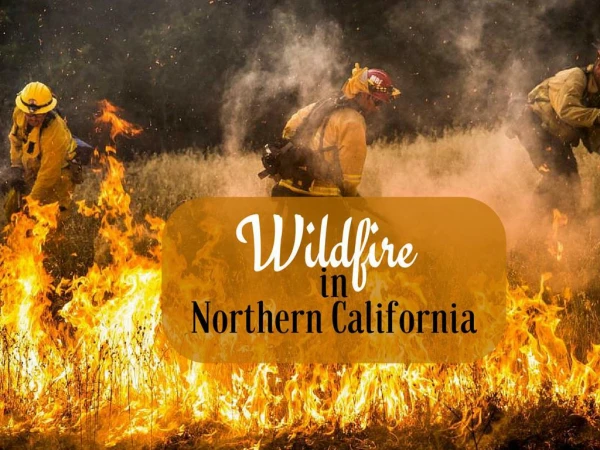
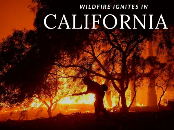
THE JULY 17th WILDFIRE IN SOUTHERN CALIFORNIA CREDIT THE ASSOCOATED PRESS FOR THE PHOTOGRAPHS, WHICH ARE USED SOLELY FOR EDUCATIONAL PURPOSES WITH NO FINANCIAL GAIN
PLANET EARTH HAS THOUSANDS OF “WILDFIRE LABORATORIES” EACH WILDFIRE PROVIDES VALUABLE LESSONS ON DISASTER RISK REDUCTION
WILDFIRES CAN CAUSE HIGH-RISK SITUATIONS Any wildfire can be devastating to people, property, infrastructure, business enterprise, and the environment.
WILDFIRE HAZARDS (AKA POTENTIAL DISASTER AGENTS) • SUNDOWNER WINDS • SANTA ANNA WINDS • LOCAL CHANGES IN AIR QUALITY • LOCAL CHANGES IN WEATHER
WILDFIRE HAZARDS (AKA POTENTIAL DISASTER AGENTS) • FIRE • HOT GASES AND SMOKE • HOT SPOTS • BURNED OUT SLOPES (with increased susceptibility to insect infestation, erosion, and landslides)
DISASTER RISK ASSESSMENT FOR WILDFIRES TWO EXAMPLES OF THE BASIC CONCEPTS: CALIFORNIA AND AUSTRALIA
HAZARDS EXPOSURE VULNERABILITY LOCATION ELEMENTS OF RISK RISK
CAUSES OF DAMAGE LIGHTNING STRIKES MANMADE FIRES PROXIMITY OF URBAN AREA TO THE WILDLAND FIRE WIND SPEED AND DIRECTION (DAY/NIGHT) WILDFIRES DRYNESS DISASTER LABORATORIES HIGH TEMPERATURES LOCAL FUEL SUPPLY
HAZARD MAPS • INVENTORY • VULNERABILITY • LOCATION • PREVENTION/MITIGATION • PREPAREDNESS • EMERGENCY RESPONSE • RECOVERY and • RECONSTRUCTION RISK ASSESSMENT POLICY OPTIONS ACCEPTABLE RISK RISK UNACCEPTABLE RISK WILDFIRE DISASTER RISK REDUCTION DATA BASES AND INFORMATION COMMUNITY HAZARDS: GROUND SHAKING GROUND FAILURE SURFACE FAULTING TECTONIC DEFORMATION TSUNAMI RUN UP AFTERSHOCKS
FORECASTS OF WEATHER CONDITIONS MONITORING TECHNOLOGIES (E.G., REMOTE SENSING, TEMPER-ATURE, HUMIDITY, WINDS) WARNING SYSTEMS DATABASES FOR EACH WILDFIRE COMPUTER MODELS OF WILDFIRES MAPS; ZONING DISASTER SCENARIOS HAZARD ASSESSMENTS RISK ASSESSMENTS EMERGING TECHNOLOGIES FOR WILDFIRES
THE PEOPLE ABANDONED THEIR CARS, CAMPERS, AND TRUCKS AND FLED FOR THEIR LIVES