Introduction to Geographic Data Sources in GIS: Understanding Key Digital Resources
This lecture covers essential geographic data sources relevant to curating and utilizing Geographic Information Systems (GIS). It emphasizes the importance of using existing data from various authoritative portals, including the National Geospatial Data Clearinghouse and the U.S. Census Bureau's TIGER maps. Detailed explanations are provided on types of digital spatial data such as Digital Raster Graphs (DRGs) and Digital Line Graphs (DLGs), while exploring their structure, accuracy, and applications. Students are encouraged to familiarize themselves with prominent GIS academic programs and commercial sources for enhanced project development.

Introduction to Geographic Data Sources in GIS: Understanding Key Digital Resources
E N D
Presentation Transcript
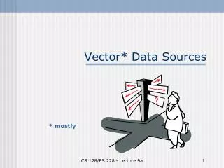
Vector* Data Sources * mostly CS 128/ES 228 - Lecture 9a
[Georgian’s] First Law of GIS Try to use somebody else’s data before you even think of generating your own CS 128/ES 228 - Lecture 9a
Geographic data portals “Be aware” of their existence, but don’t memorize details! Bear in mind while working on your course project CS 128/ES 228 - Lecture 9a
Nat. Geospatial Data Clearinghouse • Composed of many federal agency reps. • Developing the National Spatial Data Infra-structure • Working with Office of Homeland Security CS 128/ES 228 - Lecture 9a
USGS: National Mapping Info. • Primary responsibility for US mapping • Mapping standards and metadata • Topographic maps • GNIS CS 128/ES 228 - Lecture 9a
US Bureau of the Census • Address and population data, tied to the census tract • TIGER maps CS 128/ES 228 - Lecture 9a
NYS GIS Clearinghouse Familiar site? • Statewide aerial photographs • DOT maps • Gateway to many USGS & NYS products CS 128/ES 228 - Lecture 9a
Academic sites Prominent GIS programs: • Cornell U. • U. Buffalo • U. Calif., SantaBarbara • U. Minnesota CS 128/ES 228 - Lecture 9a
Commercial sites (i.e. $$) CS 128/ES 228 - Lecture 9a
ESRI’s site • nice move, licensing GIS.com!) • The GIS portal!~ 100 GIS links • GIS World CS 128/ES 228 - Lecture 9a
1. Digital Raster graphs (DRGs) • Scanned topographic maps at various scales • Resolution: 400 dpi typical • Projection and coordinate system: varies (read the metadata!) • Accuracy: roughly that of paper source maps • Layers: either 1 or 2. No full GIS capability CS 128/ES 228 - Lecture 9a
Commercial sources of DRGs Various companies(e.g., Delorme, Silva) • 1:24,000 or 1:100,000 • ~ $100/state • various tools, but one layer CS 128/ES 228 - Lecture 9a
3-D renderings CS 128/ES 228 - Lecture 9a
USGS DRGs • 1:24,000 or 1:100,000 • two layers - features - topography • feature classes can’t be separated CS 128/ES 228 - Lecture 9a
2. Digital line graphs (DLGs) • Scales 1:24,000 1:100,000 1:2 million • Full topological data structure (nodes, lines, areas + adjacency information) • Layers: 9 feature classes, street & address information, elevations • Projection: UTM (large & medium scale), Albers Conical Equal Area (small scale) CS 128/ES 228 - Lecture 9a
Olean DLG: roads (4 layers) CS 128/ES 228 - Lecture 9a
Olean DLG: add water features CS 128/ES 228 - Lecture 9a
Olean DLG: add contours CS 128/ES 228 - Lecture 9a
Olean DLG: all layers CS 128/ES 228 - Lecture 9a
How are geographical features represented? Two Mile Creek near campus CS 128/ES 228 - Lecture 9a
Larger rivers: both banks (lines) Allegheny River near campus CS 128/ES 228 - Lecture 9a
Major attribute codes CS 128/ES 228 - Lecture 9a
Minor attribute codes CS 128/ES 228 - Lecture 9a
3. TIGER maps • U. S. Census Bureau’s DLGformat • Include county,census tract, &census block • De facto standard/source for most commercial geocoding and trip planning software Topologically Integrated Geographic Encoding & Referencing system CS 128/ES 228 - Lecture 9a
The TIGER map browser CS 128/ES 228 - Lecture 9a
Center on a familiar point… CS 128/ES 228 - Lecture 9a
TIGER for Allegany NY CS 128/ES 228 - Lecture 9a
Census Bureau databases • American Factfinder • Reports in table or map form • Joins or relates? CS 128/ES 228 - Lecture 9a
Thematic maps CS 128/ES 228 - Lecture 9a
Resolution to the census tract CS 128/ES 228 - Lecture 9a
Local demographic stats CS 128/ES 228 - Lecture 9a
Summary: digital data sources • Digital raster graphs(DRGs) • Digital line graphs(DLGs) • TIGER files CS 128/ES 228 - Lecture 9a