Download
1 / 38
380 likes | 494 Views
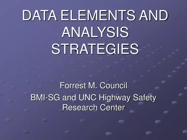
DATA ELEMENTS AND ANALYSIS STRATEGIES. Forrest M. Council BMI-SG and UNC Highway Safety Research Center. Disclaimer. The guidance and opinions presented here are mine, and do not represent guidance from NHTSA, FHWA, or any other agency (including the two organizations I work for…).

E N D
DATA ELEMENTS AND ANALYSIS STRATEGIES Forrest M. Council BMI-SG and UNC Highway Safety Research Center
Disclaimer • The guidance and opinions presented here are mine, and do not represent guidance from NHTSA, FHWA, or any other agency (including the two organizations I work for…). • All mistakes are mine too.
Can SHSP Development Be Done Without Safety Data? • NO! • But not a problem, since at least some data exists for almost all jurisdictions • And if data doesn’t exist, the problem probably isn’t large enough to worry about • Not because each life/injury isn’t important, but because there are a limited number of safety dollars to spend • The trick for state DOT analysts will be in acquiring the data, or joining with local analyst to cover local roads.
Structure of Presentation • Available data – what do we have to work with? • Basic “analysis structure” for driver, vehicle and roadway issues • How these analyses can be accomplished • Including current and upcoming tools that might help (including what can be done with limited data). • Summary: Review of selected questions given me by the planning committee.
Safety Data – What Do We Have? • Crash data • Roadway/street inventory data • Traffic volume data • Driver history • Vehicle registration • Population census • Other safety files
Police Crash Data • “Mileposted” for state system • Often un-mileposted for local system • Crash reporting thresholds may differ within a state, so know your data before combining them. • Not perfect data…but any decision using these data is better than a decision without using them
Fatal Crash Data • Fatality Analysis Reporting System (FARS) 1975-present • Higher quality data on all vehicles and occupants within all fatal crashes • “FARS Query” on-line (and can obtain files) • City and county codes for each county in US • Tempting to analyze FARS only, but • Will produce small, unrepresentative samples once you began to do “sorts” • Not as helpful for roadway treatment analyses, since two of the major factors that cause a crash to be fatal are occupant age and occupant restraint use – not roadway treatment related • Understand FARS before analyzing (i.e., imputed values, “person” count not all fatalities, problems in combining crash/vehicle/person variables in analyses).
CODES (Crash Outcome Data Evaluation System) • Police crash data enhanced with hospital and EMS or Emergency Dept. data, and maybe other data. • NHTSA-funded CODES systems or projects in Alaska, Arizona, Connecticut, Delaware, Georgia, Hawaii, Indiana, Iowa, Kentucky, Maine, Maryland, Massachusetts, Minnesota, Missouri, Nebraska, Nevada, New Hampshire, New Mexico, New York, North Dakota, Oklahoma, Pennsylvania, Rhode Island, South Carolina, South Dakota, Tennessee, Texas, Utah, Wisconsin • Data analysts there also
Truck Safety Data • MCMIS (Motor Carrier Management Information System) • FMCSA system fed by state MCSAP (Motor Carrier Safety Assistance Program) agency and motor carriers • Most comprehensive truck-safety database in US • Five file types (registration, crash, roadside inspection, compliance, enforcement) • Analysis outputs (including state trends) and tools on-line • Note that data are much more complete and improved since 2004 – be careful of multi-year comparisons for a while.
Roadway Inventory – State Highway System • Usually inventory of full state-controlled highway system • Cross-section data (number of lanes, shoulder width/type, etc.) • Limited states have curve and grade information • Limited states have intersection/interchange inventory • Expansion of Highway Performance Monitoring System (HPMS) data which has inventory of sample sections within inventory classes
Roadway Inventory- Local Jurisdictions • Usually less extensive than in state system • Pieces maintained by different departments (e.g., public works, traffic) • Sometimes supplemental data on sidewalk and crosswalk presence, bike paths, bus stops, etc. • Often just paper files, and linkage of pieces can be a problem
Traffic Volume Data • AADT usually recorded for each section on state system • Based on system of permanent (full time) counters and “short counts” done on 2-3 year cycle • Truck percentages/volumes included, but based on many fewer actual counts, so much less precise • Remember, AADT is an estimate, not an actual count for most roadway segments • Local jurisdictions often don’t have AADT, only intersection turning counts
Driver History Data • Record for each licensed driver (and unlicensed drivers who have crashes) in the state • Contains information on demographics and license status/restrictions, convictions, crashes (sometimes) • Could be used to scope and target programs related to driver violations (e.g., DUI, speeding, etc.) • Current “snapshot” since data on convictions and crashes (if present) are often purged after some time period.
Vehicle Registration Data • Record for each vehicle licensed in a state • Information on owner, vehicle type, VIN, etc. • Can sometimes be used as “denominator/ exposure” data • But annual mileage per vehicle is usually not present, and can include errors if present (e.g., odometer rollover)
Population Census Files • US Census Bureau files on gender, age and ethnicity within political subdivisions • Can be used as “denominator/exposure” data, particularly for road-user problem identification or treatment targeting
Other Safety Data • Citation (as opposed to “conviction”) data • Retained and published by some enforcement agencies (e.g., DUI citations) • Speed surveys by state and local agencies • But be careful since most are from “special locations” and not a random sample for that roadway type of jurisdiction • Most important -- observed occupant restraint (shoulder belt) use data collected by all states since 1998. • NHTSA publishes year-by-year comparisons for each state • Note that only daytime and front-seat usage
Closure on Safety Data • Crash data almost always available for full state (sometimes not mileposted) • Other supplemental files will usually be available – just have to find them • So, “lack of adequate data” is almost never a valid excuse for not developing a sound safety program.
Tired of “Data”? • OK, let’s moved to how to use it
Basic Analysis Structure for SHSPs • Five-step process • I will concentrate on first three, with limited coverage of two additional steps • Defining the critical issues in your state • Determining the best treatment strategies for each issue • Targeting the treatments to road-user subpopulations or roadway sections/locations • Note that sometimes, the order is changed • You may define the “targets” first (e.g., high-crash roadway locations, younger drivers), • Then the issues (e.g., run-off-road crashes, younger-driver inexperience) • Then the best treatments (e.g., rumble strips, Graduated Driver Licensing)
How Do We Do This? • Will be referring to four sources of information often • AASHTO Strategic Highway Safety Plan (http://safety.transportation.org/) – a plan aimed at saving an additional 9,000 lives per year • NCHRP Report 501: Integrated Management Process to Reduce Highway Injuries and Fatalities Statewide • An excellent guide to all the coordination steps necessary to advance from crash data to integrated action plans • NCHRP Report 500: Guidance for Implementation of the AASHTO Strategic Highway Safety Plan • A series of Guides presenting low-cost, effective treatments for each of a series of “Emphasis Areas” (e.g., head-on collisions, large-truck collisions, pedestrian collisions). • Can be downloaded from http://safety.transportation.org/guides.aspx. • NCHRP Report 500: A Guide for Addressing Safety Data and Analysis in Developing Emphasis Area Plans – “Data Guide” (BEING PREPARED)
Defining The Critical Issues (“Emphasis Areas”) • Usually based on crash analyses • Possible analysis processes presented in both Report 501 and Data Guide • High-frequency (Report 501, Appendix D1.3) • High crash-burden (Data Guide) combines frequency and severity using economic cost of crashes by crash types/situation) • See FHWA report Crash Cost Estimates by Maximum Police-Reported Injury Severity within Selected Crash Geometries (July 2005) • Overrepresentation • CARE (Critical Analysis Reporting Environment – see Report 501, Appendix D1.3)
Defining The Targets And Best Treatments (Or Vice-versa…) • So now we have a series of critical Emphasis Areas, and need to develop individual action plans for each • For road-user (e.g., driver, pedestrian) and vehicle-oriented programs, we often define the targets and then pick the treatments. • Can use further “drill-down” or “overrepresentation” or “crash burden” analysis to define the subpopulations of users (e.g., younger pedestrians, older male drivers, younger motorcycle operators), who are the largest share of the problem
Defining The Targets And Best Treatments (cont) • Can use further “drill-down” to identify specifics (e.g. crash types, location, day/night, etc.) • Procedures in Report 501 and Data Guide • We then can use the NCHRP Series 500 Guides or other information to pick treatments that are suitable for these subgroups.
Defining The Targets And Best Treatments (Cont) • For roadway-based Emphasis Areas, we have two procedures we can follow • Identify High-crash locations and analyze each location to define the best treatment(s) • Identify a potential high-payoff treatment (e.g. rumble strips to prevent run-off-road crashes) and then identify the set of roadway locations where this treatment will produce the greatest benefit per dollar spent (a crash-cost based procedure). • Repeat this procedure for different high-priority treatments until the fatality/injury reduction goal is reached • Note that this procedure is only possible if treatment effectiveness is known (i.e., an acceptable Accident Modification Factor or Crash Reduction Factor exists).
Tools That Can Help In These Roadway-Oriented Processes • High-Crash Location Analysis • States (and some localities) have a procedure in place to identify and analyze high-crash locations • FHWA is developing SafetyAnalyst –improved procedures for choosing sites, treatments, and evaluating the results http://www.safetyanalyst.org/
SafetyAnalyst • To assist agencies in making better decisions about: • Where to make highway safety improvements • Determining what improvements to make • Evaluating the effectiveness of implemented safety improvements
Features • Comprehensive – Integrates all parts of the safety management process and automates portions of the process that are performed manually. • Applies state-of-the-art procedures in the safety management process. • Has strong cost-effectiveness component.
SafetyAnalyst Tools • Network screening to identify sites with potential for safety improvement • Diagnosis of the nature of safety problems • Selection of countermeasures • Economic appraisal of countermeasures • Priority ranking of improvement projects • Evaluation of implemented projects • Final version and training – Late 2006
Supplementing the High-Crash Location Process • AASHTO – set a “stretch goal” for fatality and injury reductions • In most cases, this will probably not be met with the high-crash location program only • Will need to treat longer corridors or route-types • Given an Emphasis Area has been chosen (e.g., lane-departure crashes), the Data Guide presents procedures for choosing among potential treatment strategies and targeting the strategies
Supplementing the High-Crash Location Process (Cont) • Data Guide Procedures will cover three levels of safety data and treatment effectiveness • Known treatment effectiveness combined with linkable crash, roadway inventory and traffic data; • Known treatment effectiveness and crash data only (e.g., no inventory data) for both mileposted and un-mileposted crash data • Unknown treatment effectiveness and crash data only • The first two are based on a “reverse economic analysis” procedure developed by Tom Bryer as part of the AASHTO SHSP efforts. • Note that these first two could also be used for driver and vehicle-based programs, but only if treatment effectiveness is known – not often the case.
Two Addition SHSP Analysis Steps • Optimizing your safety budget – choosing the best mix of efforts (e.g., emphasis areas, locations) within your budget • Evaluating the effects of your program • (Don’t worry – only limited coverage for both!)
Budget Optimization • Can be done at different budget levels • Can be used in decisions of basic choice between emphasis areas down to choice of locations/subpopulations • Report 501 provides a detailed description in Appendix D.1.6, and a set of computerized tools on a diskette. • Note that this requires known Accident Modification Factors
Program/Project Evaluation • Report 501 describes both process and impact evaluations and procedures that can be used, along with case studies (Appendix D3) • Also provides overview of impact (crash-based) evaluation methodologies in Appendix D2 (cross-sectional studies, before/after, EB before after, time series, etc.) • NHTSA evaluation assistance
Other Resources for SHSP Developers • NHTSA will assist in FARS analysis • NHTSA course – “Data Analysis in Highway Safety Problem Identification and Program Evaluation”. • See NHTSA Region staff • NHTSA is developing on-line training modules concerning all components of a traffic records system and basic analysis of these data • On line this month www.trafficrecords101.net • FHWA course on “New Approaches to Safety Analyses” • National Highway Institute • FMCSA Division Offices will provide analysis assistance • Highway Safety Manual (see http://www.highwaysafetymanual.org/) • Will present best “safety knowledge” and “analysis tools” for roadway-safety programs (First edition – 2007)
Other Resources (cont) • Traffic Safety Information Systems International Scan: Strategy Implementation White Paper • Suggestions for improving both crash and non-crash (e.g., inventory) safety data • Recommendations for FHWA, NHTSA, AASHTO and states • Increase use of high-end automated crash-data collection systems (e.g., TraCs) and in-car computers with GPS capabilities • Conduct a Traffic Records Assessment using external reviewers (and improve the assessment of roadway-related data) • If a state’s tort system does not allow “failure to improve” litigation, the state safety data managers should recruit DOT attorneys as supporters for improved safety data • Establish a “data user/owner” committee that would include a well-staffed secretariat and representatives of all potentially linkable non-crash databases. • Establish “data-for-data partnerships” with local agencies as a possible avenue to increase collection of improved safety data. • Final Draft to FHWA by January, 2006
Selected Questions from Conference Program Team • Are data issues, e.g. needs, deficiencies, requirements, etc., addressed as an emphasis area in the plans? Should they be? • They clearly should be since (1) data is the key now and forever will be the key to safety program planning, and (2) there is money available to improve data.
Selected Questions (cont) • What is the “state-of-the-art” in technology and computerized systems? • Crash data collection: • TraCs or other on-board computer equipment equipped with GPS. • Roadway inventory: • Roadway cross-section inventory for full-jurisdiction system updated “immediately” from as-built plans. • Roadway curvature and grade from as-built plans or from FHWA’s new “Dynamic Highway Measurement” vehicle. • Intersection and interchange inventory including crossroad traffic volumes. • All roadway inventory files with both LRS and geo-coding. • Traffic counts: • Standard counting system with 2-3 year system-wide updates; • Truck counts (vehicle classification counts) with increased numbers of count points enhanced with WIM and other available data. • Data storage and linkage: • Data warehousing, where all different types of safety files and data are stored in one warehouse and linked easily to each other.