Download
1 / 28
280 likes | 401 Views
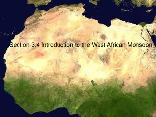
Nocturnal Stratocumulus Clouds in the West African Monsoon. Based on “Nocturnal Stratiform Cloudiness during the West African Monsoon” by Schrage, Augustyn and Fink. On nonprecipitating nights…. About ¼ of the nights were completely clear

E N D
Nocturnal Stratocumulus Clouds in the West African Monsoon Based on “Nocturnal Stratiform Cloudiness during the West African Monsoon” by Schrage, Augustyn and Fink
On nonprecipitating nights… • About ¼ of the nights were completely clear • About ¼ of the nights were completely overcast at low levels
Composite Soundings • Cloudy nights are: • More moist • Less stable (see the inversion on the clear nights) Cloudy Nights Clear Nights
925mb Flow • Stronger monsoon flow on the cloudy nights; speed convergence over the Soudanian zone. Cloudy Nights Clear Nights
700mb Flow • Cloudy nights have a weaker AEJ • Cloudy nights are in the trough of an AEW Cloudy Nights Clear Nights
200mb Flow • Strong TEJ on cloudy nights Cloudy Nights Clear Nights
Specific Humidity at 925mb • Cloudy nights are more humid than clear nights… (notice that the greatest values are over the Soudanian Zone) Cloudy Nights Clear Nights
Moisture Advection at 925mb DRY AIR ADVECTION from 12°N to the equator!!! (Know why!) Solid=cloudy, Dotted=clear
Moisture Divergence at 925mb Soudanian Zone is a region of moisture CONVERGENCE on cloudy nights, but DIVERGENCE on clear nights! Solid=cloudy, Dotted=clear
Moisture Divergence… • …is, mathematically, just q*DIV • q is positive. • Therefore, an area of moisture CONVERGENCE must be an area of CONVERGENCE
So why is there low-level convergence on cloudy nights in West Africa????
A clue! • On clear nights, there was a strong inversion at the surface. • The boundary layer doesn’t experience friction from the surface! Clear Nights
A Clue! • On cloudy nights, the boundary remains unable or statically neutral. • Boundary layer air experiences friction from the surface. Cloudy Nights
A painful, mathematical examination of the processes contributing to friction at 925mb showed that the main difference between the clear and the cloudy nights was the contribution of FRICTION!
So why is there more FRICTION on cloudy nights and less friction on clear nights?
On Clear Nights… • The surface cools by longwave radiation. • An inversion forms. Warmer! Cold!
On Clear Nights… • Winds in the boundary layer “decouple” from the surface and don’t experience friction. Warmer! Cold!
On Cloudy Nights… • Cloud cover prevents longwave radiation from escaping. • The surface stays warm and turbulence occurs throughout the night. Warmer!
On Cloudy Nights… • Monsoon flow experiences this turbulence as friction and slows down (remember the speed convergence on cloudy nights?) • Results in MOISTURE CONVERGENCE! Warmer!
On Cloudy Nights… • Moisture convergence and turbulence produce clouds, and the clouds keep the surface warm! Warmer!
New in 2009! • From the AMMA (2006) experiment: • Ceilometer • Microwave retrievals of temperature and moisture profiles • Many more radiosonde stations
New in 2009! • The ceilometer teaches us that: • These clouds are much more common than we thought—they just tend to form somewhat after 0000 UTC. • These clouds are extremely low—typically about 100m AGL!