Download
1 / 10
100 likes | 208 Views
Discover how Manatee County addressed imagery distribution challenges, reduced costs, and enhanced workflow efficiency through innovative solutions. Learn about the hardware and workflow dilemmas they faced, the transformative benefits of the implemented solution, and the positive impact on budget allocations. Explore the improved accessibility to vast amounts of imagery data and seamless integration with third-party applications. Visit the County's web image service and other related platforms for a firsthand experience.

E N D
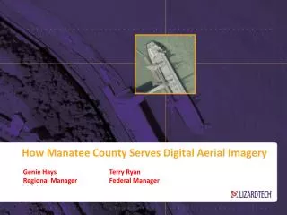
How Manatee County Serves Digital Aerial Imagery Genie Hays Terry Ryan Regional Manager Federal Manager
Overview • Manatee County Overview • Problem: Imagery Distribution & Management • Amount of Imagery • Cost of storage/distribution • Time spent on installation/management • Lower Budgets • Solution: • Q&A
Hardware & Workflow Dilemmas • Amount of Imagery • 1.3 to 5TB’s of Raw Data. • No server space for the imagery (pyramids, caching, etc.). More than 80% unavailable. • wanted to deliver full investment of data for 2003, 2007-2012, with 5 more years projected in the pipeline.
Hardware & Workflow Dilemmas • Cost of Storage/Distribution • Server space for imagery alone an estimated $30,000+and were still unable to deliver their full repository of data. • $250,000 -$300,00 increase in Server investment and licenses to deliver full repository. • Not able todeliver data to 3rd party applications: AutoCAD, Microstation, ERDAS, Flash, etc.
Hardware & Workflow Dilemmas • Time Spent on Installation/Management • Took 3 weeks for each County year to load (2003,2007-12). • Took months to load all data, with no guarantee when loaded it would work. • With current setup, they could only deliver ONE year data online. • Lower Budgets • 10% decrease in the Property Appraisers budget for 2012. 147 Days to load imagery into other storage solutions.
Solution • Store compressed imagery as MrSID/Jpeg2000 files. • Visually lossless with a 20:1 compression ratio. • Kept imagery in a FLAT FILE system. • Delivery service to ESRI products and other 3rd party applications via open source OGC WMS (Web Mapping Service). • Used LizardTech’s Express Server to accomplish cost savings and delivery needs.
Solution Benefits • Gained 1:20 reduction of cost to Server space. • Estimated savings to licenses & storage cost, $30,000-$50,000. • Can delivery 5X’s the amount of imagery. • Allows growth at a much smaller cost • All 3rd Party applications can read streaming of Imagery, Plug & Play • Installation and setup was cut down to ONE DAY, saving weeks of staff time. • Saved $$$$
Manatee County Web Image Service WMS: http://www.mymanatee.org/lizardtech/iserv/ows? Property Appraiser Site: http://www.mymanatee.org/gisapps/mapviewer/index.jsp?type=propertyappraiser Aerial Download Tool: http://www.mymanatee.org/gisapps/mapviewer/index.jsp?type=aerialdownload