Download
1 / 35
350 likes | 550 Views
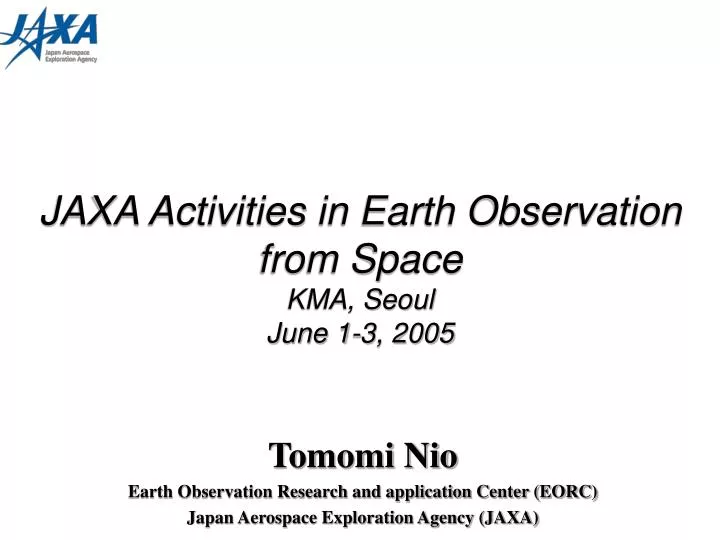
JAXA Activities in Earth Observation from Space KMA, Seoul June 1-3, 2005. Tomomi Nio Earth Observation Research and application Center (EORC) Japan Aerospace Exploration Agency (JAXA). Topics. 1. JAXA Earth Observation Program - JAXA Long-term Vision - GEOSS Implementation Plan

E N D
JAXA Activities in Earth Observation from Space KMA, SeoulJune 1-3, 2005 Tomomi Nio Earth Observation Research and application Center (EORC) Japan Aerospace Exploration Agency (JAXA)
Topics 1. JAXA Earth Observation Program - JAXA Long-term Vision - GEOSS Implementation Plan 2. Operation Status - TRMM - Aqua/AMSR-E - Terra&Aqua/MODIS - Network Interface 3. Future Program - ALOS - GOSAT - GPM - GCOM-W/C
JAXA Earth Observation Program • JAXA long-term vision was released in Apr. 2005 • 20 years plan • Main vision in Earth Observation; • To contribute the safe and rich society utilizing space technology. • To make the helpful system for the natural disaster and to develop the system for Asia-Pacific region <Risk management system> • To realize the helpful system for earth environmental problem and to use it as the policy planning tool internationally <Environment monitoring system> • Reflected the GEOSS 10-year implementation plan
Image of the vision 災害警報 災害状況 避難経路指示 家族の位置情報 被災者間通信 将来の災害・危機管理情報収集通報システム 測位衛星群 超大型移動体通信衛星 超高速通信衛星 静止衛星 小型衛星群 高分解能 陸域観測衛星 全球降水 観測衛星 災害観測 個人携帯配信 地球観測衛星群 データ収集 台風 僻地、海上等の無人観測局 火山噴火 総合情報センター 洪水 被災地上網と接続 津波 地上観測網 全ての被災地住民 災害の予測から避難指示、家族の位置確認まで直接個人携帯にサービス 地震 観測ブイ 森林火災 海難事故 不審船
1. JAXA EO program Earth Observation 10-Year Implementation Plan • Identification of key observation areas and objective (9 benefits such as reducing loss of life and property from natural and human induced disasters, understanding, assessing, predicting, mitigating, and adapting to climate variability and change and so on). • Overcome shortcomings of current observation systems (strengthen involvement of the developing countries, improve Earth observation technology, strengthen observation systems). • Give guidance for establishing new Global Earth Observation System of Systems (GEOSS) by strengthen existing observation systems, establishing successor international mechanism. The Earth Observation Summit adopted the 10- year implementation plan on February 16,2005
1. JAXA EO program Social Benefits and Requirement (GEOSS 10y-IP) The 9 social benefit area • Reducing loss of life and property from natural and human induced disasters • Understanding environmental factors affecting human health and well being • Improving management of energy resources • Understanding, assessing, predicting, mitigating and adapting to climate variability and change • Improving water resource management through better understanding of the water cycle • Improving weather information, forecasting and warning • Improving the management and protection of terrestrial, coastal and marine ecosystems • Supporting sustainable agriculture and combating desertification • Understanding, monitoring and conserving biodiversity
4.8 Agriculture 4.7 Ecosystems 4.9 Biodiversity 4.6 Weather 4.4 Climate CO2 【 】 Legend Symbol Planned Project Approved Project After Operation Period 1. JAXA EO program JAXA’s Contribution to GEOSS 4.2 Health 2002 03 04 05 06 07 08 09 10 11 12 13 14 ~ JFY ALOS 【Optical Sensor】 Disaster Monitoring And Resource Management 4.1 Disasters MOS-1,ADEOS (87~95) (96~97) 【Optical & SAR】 JERS-1 Geo-Stationary Earth Observation Mission (92~98) Disaster Monitoring Constellation Mission Global Warming And Global Water Cycle Observation 【Precipitation Radar】 GPM / DPR TRMM / PR TRMM/PR (97~) 4.5 Water 【Microwave Sensor】 ADEOS-II / AMSR Water Cycle Observation MOS-1 (87~95) Aqua / AMSR-E 【Sea Surface Wind Vector, SST】 GCOM-W/ AMSR 【Cloud, Aerosol, Vegetation】 4.3 Energy GCOM-C/ SGLI 【Optical Sensor】 Climate Change Observation MOS-1, ADEOS ADEOS-II / GLI (87~95) (96~97) Social Benefit Areas of Drafts GEOSS 10-Year Implementation Plan 【Cloud, Aerosol】 EarthCARE / CPR 【Cloud Radar】 Note: This chart includes NOT authorized plan 【Spectrometer】 GOSAT Greenhouse Gas Observation ADEOS/ILAS ADEOS-II / ILAS-II (96~97)
2. Operation Status • TRMM (’97.11- ) • After operation period ( 7.5 years old ) • A lot of Results • TRMM Typhoon database is very popular and interesting. • Aqua/AMSR-E (’02.5- ) • AMSR-E project is going to shift to the post utilization phase • MODIS&AMSR-E NRT Data Release (’04.7-) • EOC has been receiving the MODIS data by direct readout since July 2004.
2. Operation Status Tropical Cyclone Data Base • JAXA EORC Tropical Cyclone Data Base • TRMM Tropical Cyclone Data Base and AMSR/AMSR-E Data Base will be merged. • Tropical Cyclones data observed by TRMM/PR,TMI,VIRS, Aqua/AMSR-E and Midori-II (ADEOS-II)/AMSR will be available on June 8. http://www.eorc.jaxa.jp
2. Operation Status MODIS & AMSR-E NRT Data • Coverage:Around JAXA/EOC (Hatoyama station) • Release Data • Level 1B (Brightness Temperature / Geometrical Calibrated) • Sea Surface Temperature (SST) • Chlorophyll-a (CHLA) • 5 days Average SST (AMSR-E) • How to get data? • Image Gallery http://www.eoc.jaxa.jp/satellite/sendata/modis3_j.html • Binary Data (5,250yen/Month) • Registration users can download the MODIS data in 3 – 5 hours after the receiving and the AMSR-E data in 12 hours after the receiving.
2. Operation Status Network interfaces with other agencies • Japanese agencies; • RESTEC • HIT • NICT • JMA/MSC • JAFIC • Foreign agency; • NASA/JPL • EOC send the following data to JMA/MSC. • AQUA/AMSR-E : Rate Buffered data, IST, AMSR-E Level 1A • TRMM : PR QL/Level 0, TMI/VIRS real time product, RST • QuikSCAT : Met data • ALOS Users • GSI • ERSDAC • ALOS Data Node -AADN -AEDN -OADN -GISTDA
2. Operation Status Interface – AMSR-E/AQUA – GSFC (EDOS) JPL (PO.DAAC) JAXA/EOC Transpacific ATM 2Mbps EBnet ATM JAXA/EOC Wide area Ethernet JAXA/EORC ATM 1Mbps JMA/MSC DR 128Kbps JAFIC
2. Operation Status Interface –TRMM – GSFC (SDPF,TSDIS) JAXA/EOC Transpacific ATM 2Mbps JPL EBnet ATM JAXA/EOC Wide area Ethernet JAXA/EORC ATM 1Mbps JMA/MSC ISDN 1.5Mbps NICT
2. Operation Status Interface – QuikSCAT – GSFC (CSAFS) JAXA/EOC Transpacific ATM 2Mbps JPL EBnet ATM NOAA/NESDIS JAXA/EOC ATM 1Mbps JMA/MSC DR 128Kbps JAFIC
EORC move to Tsukuba 3.Future Program *Japanese Financial Year : April to March in next calendar year
3. Future Program Future Program ALOS Advanced Land Observing Satellite
3. Future Program ALOS Overview • JAXA’s High-Resolution Earth Observing Satellite • Mission • Cartography (1/25,000) • Regional Environmental Monitoring • Disaster Monitoring • Resources Survey Star Tracker Data Relay Communication Antenna 9m GPS Antenna Mass: 4000kg Power: 7kW Orbit : Sun Synchronous Altitude: 691.65km Repeat Cycle : 46days Launch Date : Sep. 2005 Solar Array Paddle 22m Phased Array type L-band Synthetic Aperture Radar (PALSAR) Panchromatic Remote-sensing Instrument for Stereo Mapping (PRISM) Advanced Visible and Near Infrared Radiometer type 2 (AVNIR-2)
3. Future Program ALOS Current Status • Post Qualification Review and Mission Development Confirmation Review were held this May. • Now we are preparing for the operation doing rehearsal, training, etc. • ALOS satellite was carried to the launch site in Tanegashima. • ALOS will be launched this September by H-IIA. • The “date” is under negotiation within JAXA. • ALOS is very expected to contribute widely to science and application field; • Natural resource management • Disaster monitoring and damage mitigation • Regional development and planning • JAXA became a member of the International Charter. http://www.disasterscharter.org/
3. Future Program Future Program GOSAT Greenhouse gasses Observing SATellite
FSSH FSSH FSSH - - - 2/3 2/3 2/3 TEDA TEDA TEDA - - - LPT2 LPT2 LPT2 TEDA TEDA TEDA - - - LPT1 LPT1 LPT1 PDL PDL PDL GOS GOS GOS 光学系ユニット 光学系ユニット 光学系ユニット CS CS CS 光学系ユニット 光学系ユニット 光学系ユニット CAM CAM CAM - - - H1 H1 H1 ESH ESH ESH SANT SANT SANT - - - 1 1 1 XANT XANT XANT - - - 2 2 2 XANT XANT XANT - - - 1 1 1 FSSH FSSH FSSH - - - 1 1 1 (進行方向、ロケット機軸方向) (進行方向、ロケット機軸方向) (進行方向、ロケット機軸方向) X X X Y Y Y Z Z Z (地心方向) (地心方向) (地心方向) 3. Future Program GOSAT Overview • Mission • To observe greenhouse effect gasses globally GOS (Greenhouse gasses Observing Sensor) MASS: Approx. 1650kg Power: 3.3kw – EOL Designed Life Span: 5years Orbit Plan: Altitude 666km Sun-Synchronous Sub-Recurrent Orbit Orbit Inclination: 98deg. Launch: Aug.2008 by H-IIA (TBD) CS (Cloud Sensor)
3. Future Program Future Program GPM Global Precipitation Measurement
3. Future Program From TRMM to GPM NASA, JAXA and NICT International Cooperation Mission Cooperation(Expected partners) : NOAA(US),NASA(US),ESA(EU), CNES/ISRO(France/India) and others
2 satellites 8 satellites 3. Future Program GPM Overview • Mission: Core Satellite • Observation of rainfall with more accurate and higher resolution • Adjustment of data from constellation satellites Constellation Satellites • More frequent observation GPM • Global observation every 3 hours ↓ • Earth heating Phenomena • Study of Climate Change • Improvement of forecasting system *DPR=Dual Frequency Radiometer 14GHz KuPR and 35GHz KaPR
GPM Data Flow TDRS GPM core ESA GCOM-W U.S. International Partners White Sands XXX JAXA XXX XXX DPR GMI MWR MWR MWR MWR MWR Tb(L1b) Tb(L1b) Tb(L1b) AMSR-2 Tb(L1b) 3. Future Program MWR GPM core (DPR,GMI) Data Pool CHINA ESA International Partners JAXA JAXA Data Pool PPS@NASA/GSFC Tb(L1c) Data center ・data collection(DPR+GMI+MWRs) ・3hr global rain map generation 3hr global rain-map user(operational and research organization, etc) GDaWG: GPM Data Working Group
3. Future Program Roles of GDaWG • To Investigate and coordinate • Common requirements • Technical interface Regarding data acquisition, processing, sharing (including near real-time), archiving and distribution. • Data format etc. • Next GDaWG meeting; • Fall or winter in 2005 (TBD)
3. Future Program GPM Data Exchange NASA Partner Partner Partner Partner Asian Area JAXA@Tsukuba 3hr- Global Rain Map L1c(Tb) (GMI and MWRs) Research Users International Flood Alert Network (IFNet) Operational Users JMA Standard NRT
3. Future Program Project Status • JAXA re-studied the mission requirement. • JAXA standard products are reconsidered. <See next page> • JAXA will have the phase-up review for the development after winter of this year. • JAXA, NICT and NASA have the international workshop every year. We are planning next workshop; • 5th GPM International Workshop • Date: 7(Mon) – 9 (Wed) , November 2005 • Place: Shinagawa Prince Hotel in Tokyo, Japan <Please join this workshop! After September everyone will be able to register in website which is linked EORC top page.> Target : Asian users We want to know and summarize user requirement again in order to reflect the system development. We hope to GPM data will be used in operational application such as IFNet (International Flood Alert Network).
3. Future Program JAXA GPM/DPR Products(draft) Blue:1st priority product, Yellow:2nd priority product, Red: research effort based product
3. Future Program Future Program GCOM Global Climate Observation Mission
GCOM Overview 3. Future Program GCOM-C GCOM-W Altitude:798km or 973.2km Inclination:99.36deg Local Time: 10:30 Sensor: - SGLI Altitude:699.6km Inclination:98.19deg Local Time: 13:30 Sensor: - AMSR-2 - SeaWinds(TBD) HK-TT&C (USB) Mission Data (X-band:TBD) Mission Data (X-band:TBD) Data (On-line) JAXA GN (Tracking & S/C Operation System) JAXA EORC (Mission Operation System) Recieving Station (High Latitude Station)
Summary • JAXA is challenging to realize the long-term vision and correspond to the GOESS implementation plan. • Risk management system • Environmental observation system • JAXA has been studying the future earth observation program such as GPM and GCOM-W. • scientific research and demonstration of operational applications such as numerical weather forecast and disaster prevention program • To keep exchanging opinion, requirement, and data with big operational users such as meteorological agencies.
Thank you! E-mail: nio.tomomi@jaxa.jp