Download
1 / 7
70 likes | 312 Views
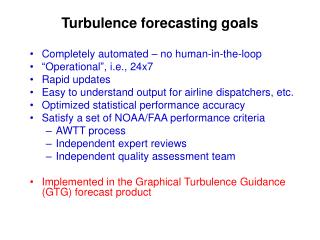
Turbulence forecasting goals. Completely automated – no human-in-the-loop “Operational”, i.e., 24x7 Rapid updates Easy to understand output for airline dispatchers, etc. Optimized statistical performance accuracy Satisfy a set of NOAA/FAA performance criteria AWTT process

E N D
Turbulence forecasting goals • Completely automated – no human-in-the-loop • “Operational”, i.e., 24x7 • Rapid updates • Easy to understand output for airline dispatchers, etc. • Optimized statistical performance accuracy • Satisfy a set of NOAA/FAA performance criteria • AWTT process • Independent expert reviews • Independent quality assessment team • Implemented in the Graphical Turbulence Guidance (GTG) forecast product
GTG Status GTG1/ADDS Example • GTG1 • On “Operational ADDS” since March 2003 • CAT above FL200 • Based on RUC 13/20 • Forecasts out to 12 hrs • GTG2 • On “Experimental ADDS” since Nov 2004 • Improved turbulence diagnostics • “CAT” above FL100 • Based on RUC 13/20 • Forecasts out to 12 hrs • Textual representation • Includes UAL in situ EDR measurements above FL200 GTG2/ EDR GTG2/PIREPS
GTG limitations - insufficient observations for tuning and verification • Currently PIREPs • <10 - ~ 300/ hr over all of CONUS (mid+upper levels) • Position uncertainty ~ 50 km • Intensity uncertainty ~ 20% • Too few in rapidly changing dynamical environments - such as thunderstorms • Require common, consistent atmospheric turbulence metric for all types of turbulence measurements • Propose eddy dissipation rate (EDR) • all in situ measurements (e.g., commercial, TAMDAR) • airborne and ground-based radar • lidar • etc.
GTG limitations – Not all turbulence sources accounted for FL460 FL100
Current turbulence forecasting research areas GTG/in situ edr tracks • Development of turbulence diagnostics for other sources of turbulence • MWT, CIT • Development of global forecast product (upper levels) • Optimal incorporation of in situ EDR measurements • Development of nowcast product (GTGN) • Rapid updates (5-10 min) • In situ EDR measurements • PIREPs • In-cloud EDR measurements for ground-based radar (NTDA) • Development of probabilistic forecasts NTDA/insitu edr tracks
EXP TURB FI UAL███████████ -- 20 Oct 2005 22:08:57Z FL 360 orient. 95 deg 'X'=aircraft, '+'=waypoint, '*'=route ' '=no_data, 'o'=smooth, 'l'=light 'M'=mod, 'S'=severe ---------(36nm to COWES)--------------- llll l*MMMMMMll 112nm lll ll*llMMMMlll llM*MMMMMMMl 108nm llM*MMlMMMMM llM*MMlllMM 104nm lMM*llll Ml*l 100nm l**l ll ol l*ll 096nm llllllllll*lll llllllllllll*ll 092nm llllllllllll*ll l llllllllll l*ll llllllll 088nm lllllMllMMlll*l lllllllll lllMMMMMMll * lllllllllll 084nm llllMMMMMMM ** llllllllllllll lllllMMMMMMl *llllllllllllllll 080nm llllllMMMMM *llllllllllllllll llllMMlMMM l*lllllllllllllll 076nm ollMMMlll l l*lllllllllllllll ollMMMllllllM*llll lllllll +STL llllllllllMMl+lll lllllll ll lll Mll*lll llllll 068nm ll llllllMMll*lllM llllll lll lllllllll*llMM llllll 064nm lll llllllll*llMM llllll l ll llllllll*lMMM lllMll 060nm lll llllllllllM*MMM lllMMMl ll lllllllMMlM*M MMllMMMM 056nm Ml llllllMMlM*M MlMMMMMM M l llllllMMlM*Ml MMMMMMMMM 052nm l lllllllllllM*MlllMMMMMMMMMMM lll lllllllllllMM*MllMMMMMMMMMMMM 048nm lll lll ollllllMM*MllMMMSSMMMMMMM llM llloollllllll*llllMMSSMMMMMMM 044nm llMMMlllollllllll*llllMMMSSMMMMMM llMMM llll lllll*llllMMMMMMMlMMM 040nm M lllllllllll*lllllMMMMMllMMM lllMMlllllll*llllllMMMlllllM 036nm MMllMMll ll*llllllllllllllM MMMlMMll lll*lllllllllll 032nm MMMllllll ool*l lll llll MMMlllllllol*l l 028nm MMMllllllMMl* lMMlll MMl* 024nm M M * M * 020nm MMll * Mlllll ** MMM +WELTS llll + llMMM lll * llMMM 012nm ll * llMM * 008nm * * 004nm * * valid ----------------X---------------- 2205Z -40nm (39.0N, 92.1W) +40nm Tactical avoidance using cockpit displays • Direct uplinks of products to cockpit are possible: • in situ data • GTG • NTDA • Successful demonstration last summer of NTDA to selected UAL aircraft with character printer • in situ uplink display demonstrations planned for next year • latest GTG nowcasts/forecasts could also be uplinked during flight • or forecasts loaded on a PC before takeoff (electronic flight bag) • Regulatory restrictions? SFO-BWI 20 Oct 05
GTG4 GTG1 GTG3 GTG2 GTG4 GTG5 Projected GTG releases – next 7 years Version Capabilities D3 D4 Op GTG1 Upper levels --- 3/03 3/03 RUC20 GTG2Improved GTG111/04 05/06 8/06 Mid levels RUC13 Text generation Uses in situ GTG3 Improved GTG2 11/07 11/08 2/09 MWT 10 km RR WRF Probabilistic forecasts GTG/TFO Global - GFS 11/07 11/08 2/09 GTG4 Improved GTG3 11/08 11/09 2/10 out-of-cloud turb forecasts GTGNRapid upates 11/08 11/09 2/10 in-cloud turb nowcasts in situ GTG4 0-2 hr analyses GTG5 Improved GTG4 11/09 11/10 2/11 Low levels GTGAK Alaska region 11/10 11/11 2/12