Download
1 / 29
300 likes | 495 Views
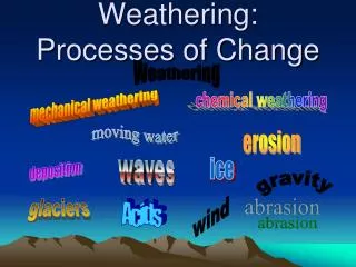
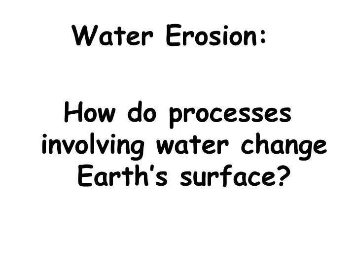
Water Erosion: How do processes involving water change Earth’s surface?. What is the MAJOR agent of erosion that has shaped Earth’s land surface? moving water. Water moving over land’s surface is called runoff . This may cause sheet erosion. The amount of

E N D
Water Erosion: How do processes involving water change Earth’s surface?
What is the MAJOR agent of erosion that has shaped Earth’s land surface? moving water
Water moving over land’s surface is called runoff. This may cause sheet erosion.
The amount of water runoff in an area depends on 5 main factors:
The amount of rain an area receives. • Vegetation - grasses, shrubs & trees reduce runoff • Type of soil - some absorb more water than others • Shape of the land – steep slopes have more run-off, which causes more erosion • How people use the land – parking lots & crop removal increase run-off
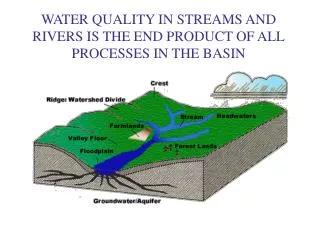
Runoff overtime: How does runoff over time affect the land and water?
Rills & Gullies Rills are tiny grooves in the soil that grow larger forming gullies. A gully is a large groove or channel in the soil that carries runoff after a storm. It moves soil & rocks. Gullies only contain water after it rains.
Streams & Rivers Gullies join together to form a larger channel called a stream. Water continuously flows here and rarely dries up. Small streams may be called creeks or brooks. Small streams flow together to form a large stream called a river.
Rill, Gully, Stream Rill erosion at a construction site.Image by M. Mamo, Labels added by UNL Gully erosion in a pasture.Image by NRCS Stream
Tributaries Streams grow together by getting water from tributaries. A tributary is a stream or river that flows into a larger river. An example: The Missouri & Ohio rivers are tributaries of the Mississippi river. Tributaries collect their water from the drainage basin or watershed.
Rivers & Tributaries http://images.google.com/imgres?imgurl=http://knol.google.com/k/-/-/3ajhc7zrwtav1/c1ssz4/figure-1%2520(2).bmp&imgrefurl=http://knol.google.com/k/new-orleans-the-geologic-difficulties-with-the-big-easy-part-1&usg=___SPqqMAUDGF2VVgD-x0Wwvs-5xk=&h=394&w=432&sz=31&hl=en&start=5&um=1&tbnid=ShJceJzlrtYlWM:&tbnh=115&tbnw=126&prev=/images%3Fq%3DMississippi%2Briver%2Band%2Bits%2Btributaries%26hl%3Den%26um%3D1
Rivers cause erosion and create valleys, waterfalls, and flood plains. Rivers form on steep mountain slopes.
How do they flow? Quickly & follow a narrow path How do they erode? Rapidly The result is that rivers form deep, V-shaped valleys.
Valleys http://www.google.com/imgres?imgurl=http://cgz.e2bn.net/e2bn/leas/c99/schools/cgz/accounts/staff/rchambers/GeoBytes%2520GCSE%2520Blog%2520Resources/Images/Rivers/V-shapedvalley.jpg&imgrefurl=http://geobytesgcse.blogspot.com/2006/11/upper-course-of-river-v-shaped-valleys.html&usg=__Hp8C8YOunbWzJy9E7kbQcOiURzA=&h=308&w=411&sz=47&hl=en&start=0&zoom=1&tbnid=giwF1FppYFy8zM:&tbnh=116&tbnw=154&ei=-kk2TfKtEMH68AbI__2tBA&prev=/images%3Fq%3Dv-shaped%2Bvalley%26um%3D1%26hl%3Den%26sa%3DN%26biw%3D1280%26bih%3D531%26tbs%3Disch:10%2C35&um=1&itbs=1&iact=hc&vpx=247&vpy=77&dur=701&hovh=194&hovw=259&tx=161&ty=116&oei=g0k2TbG1L4T58Aa8nOC7Aw&esq=12&page=1&ndsp=22&ved=1t:429,r:1,s:0&biw=1280&bih=531 http://images.travelpod.com/users/the-boy_picot/3.1149265860.580x-nice-v-shaped-valley.jpg
Features of rivers: What features are formed by erosion along a river?
Waterfalls Occur where? Where a river meets an area of hard & slowly eroding rock Then flows over softer rock downstream. How does softer rock erode? What results from this erosion? The softer rock erodes away faster & a waterfall develops.
Waterfalls Waterfalls at the Plitvicka Jezera National Park in Croatia Minnehaha Falls, Minneapolis Minnesota http://images.google.com/imgres?imgurl=http://realestate-inminnesota.com/images/Minneapolis.jpg&imgrefurl=http://realestate-inminnesota.com/&usg=__kBY-WaWcelJlC-sNAEDq6zr8eLY=&h=599&w=800&sz=162&hl=en&start=5&um=1&tbnid=WO5G4jC_rIKDMM:&tbnh=107&tbnw=143&prev=/images%3Fq%3Dminnehaha%2Bfalls,%2Bmn%26ndsp%3D18%26hl%3Den%26sa%3DG%26um%3D1
Flood Plain What is a flood plain? A wide valley in which a river flows What happens to the land during a flood? The water in the river over flows its banks into this wide river valley area.
Deposits by rivers are made as the water slows down and the fine particles settle in the river bed. Larger stones quit rolling and sliding.
Deposits by Rivers: What features result from deposition along a river?
Deltas Deltas form when sediments are deposited where a river flows into an ocean or a lake. This landform is built up as the sediments drop.
Deltas http://www.dmcii.com/disasters/new_orleans/mississippi_delta.jpg
Soil may also be added to Flood Plains during floods as sediments are deposited. This new soil added to the area makes the river valley fertile. Forests and crops may be grown here.