Download
1 / 25
260 likes | 508 Views
O ne GIS , Inc. One Platform, One Solution, One Company…. After the Storm: Using GIS for Damage Assessment and Restoration. October 2004. business focus during a hurricane.

E N D
OneGIS, Inc. One Platform, One Solution, One Company… After the Storm:Using GIS for Damage Assessment and Restoration October 2004
business focus during a hurricane • Utilities need to provide fast response times and minimize extra work for restoration crews in the field by knowing where their assets are in times of network outages. • Utilities must provide a safe work environment for their employees and the surrounding community. • Utilities need to make work processes more efficient in such areas as damage assessment and materials handling in order to best utilize the human resources available. • Utilities need to educate and inform the community regarding preparations and disaster recovery before and after the storm.
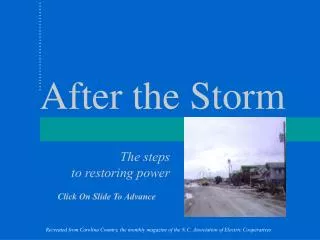
The BELCO Case Study • Friday, September 5, 2003 : Hurricane Fabian Hit • One of the Strongest to ever hit Bermuda • Category 3 Hurricane: • Sustained Winds of 120 mph • Gusts to 164 mph, the last measurement before wind damaged the equipment • Hurricane Force Winds battered the island for 8 hours! • Damage: • Approximately half of the 150 main line circuits were lost • Approximately 25,000 out of 32,000 customers without power • 4 people killed
The Response • Electric Supply restored within 3 weeks • BELCO staff, retirees, and former employees were dispatched • Caribbean Association of Electric Utilities (CARILEC) crews dispatched from Barbados, Bahamas, Jamaica, Cayman Islands, Dominica, and Belize. • Emergency Measures Organization (EMO) • Bermuda Government • The Bermuda Regiment • Bermuda Telephone Company (BTC) • Privately owned landscaping and construction companies
GIS at BELCO before and during Fabian Note: Out of the IT systems in place at BELCO, only the CIS and GIS were integrated at the time of the hurricane. GIS: ArcGIS and ArcFM CIS: CIS/OV OMS: CES Centricity SCADA: ACS WMS: Avantis
GIS at BELCO before and after Fabian • BEFORE: • GIS was used to print map books that were given to each of the crews in preparation for restoring the system outages. • GIS was used to update the CES Centricity Outage Management System. • AFTER: • GIS was used to analyze the results of the damage assessment. • GIS was used to prioritize restoration activities after the initial restoration was complete. • GIS was used to inform BELCO management and the community of the progress that BELCO was making through the development of maps and reports.
Damage Assessment: The Steps • Print map books to be used by retired BELCO employees in a system-wide survey. • An Excel spreadsheet was developed and printed for collecting Pole State and Equipment information • Survey the system beginning with the main line circuits fed from the substation and progressing out to the large branch lines, small branch lines, and individual service taps. • Pole State and equipment information was collected and loaded into Excel. • Missing Pole numbers were entered into the GIS. • Excel data was batch loaded into GIS on a daily basis for analysis. • Reports and maps were generated and distributed to management.
BELCO: Lessons Learned • This was the first time GIS was used to support hurricane restoration activities in Bermuda and management feels that the combination of GIS, CIS, and OMS were an essential reason for their ability to respond and restore customers quickly. GIS is a critical business system. • Although the process worked, a more efficient means to collect, manipulate, and analyze the damage data was needed. • The process used after Fabian required the expertise of a GIS Analyst with a high level of skills. • The average end user was required to ask for help to get information into and out of the system. • Integration with the Work Management System is necessary for Work Order generation as well as material requisition.
GIS at BELCO after Fabian and into the future Note: IT systems are now fully integrated. GIS: ArcGIS and ArcFM CIS: CIS/OV OMS: CES Centricity SCADA: ACS WMS: Avantis
The BELCO GIS environment IVR: Avaya Outage Management: CES Customer Information: CIS/OV AM/FM/GIS: ArcFM SCADA: ACS Billing and Accounting: SAP Work Order Management: Avantis
OneSolution Incident Survey Application IVR: Avaya Outage Management: CES Customer Information: CIS/OV AM/FM/GIS: ArcFM SCADA: ACS Billing and Accounting: SAP Work Order Management: Avantis
OneSolution Incident Survey Application The Toolset ArcFM Mobile Maintenance Link Incident Survey Application Custom Reports Custom Queries Customer Information: CIS/OV ArcFM Mobile AM/FM/GIS: ArcFM Billing and Accounting: SAP Maintenance Link Work Order Management: Avantis
The Solution • The Incident Survey Application provides a solution for data maintenance, editing, and reporting that fits into the high pressure business routine that occurs during and after a hurricane or other natural disaster. • Work Flow based editing and analysis environment • Map Production, Analysis, and Reporting • The Incident Survey Application provides integration that allows GIS, Work Management, and CIS data to be integrated which will support the effective operation and management of network and inventory assets during and after the storm. • GIS – ArcGIS and ArcFM • Work Management Management – Avantis, Maintenance Link • Customer Information System – CIS/OV • The Incident Survey Application provides a means for distributing data across the enterprise to: • Improve the quality of asset data by allowing the people who use the data to maintain the data, • Provide a faster turnaround for service requests and work order generation, • Provide a means for better material handling; • Eliminate redundancy; and • Support better decision making.