Download
1 / 1

E N D
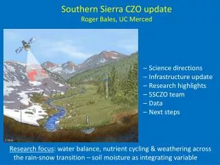
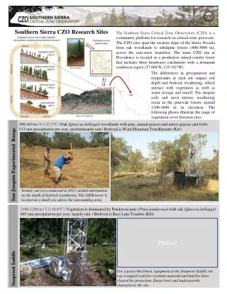
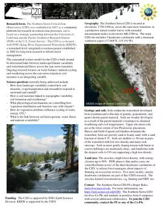
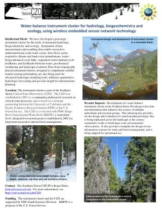
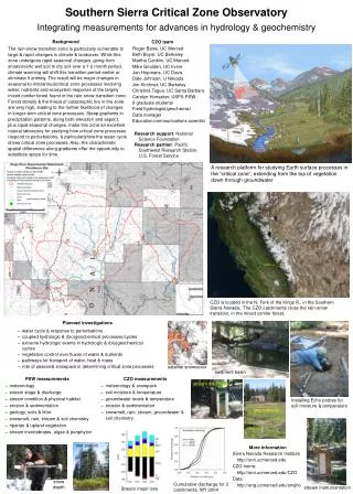
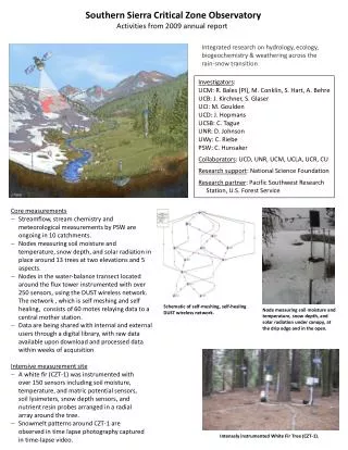
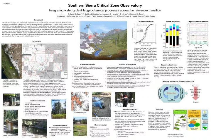
Background The rain-snow transition zone is particularly vulnerable to large & rapid changes in climate & landcover. While this zone undergoes rapid seasonal changes, going from snowcover to wet soil to dry soil over a 1-2 month period, climate warming will shift this transition period earlier or eliminate it entirely. The result will be major changes in seasonal-to-interannual critical zone processes involving water, nutrients & ecosystem response of the largely mixed conifer forest found in the rain-snow transition zone. Forest density & the threat of catastrophic fire in the zone are very high, leading to the further likelihood of changes in longer-term critical zone processes. Steep gradients in precipitation patterns, along both elevation & aspect, plus rapid seasonal changes, make this zone an excellent natural laboratory for studying how critical zone processes respond to perturbations, & particularly how the water cycle drives critical zone processes. Also, the characteristic spatial differences along gradients offer the opportunity to substitute space for time. CZO 1 5 10 15 CZO CZO August, 2004 Planned investigations CZO measurements Educational activities • water cycle & response to perturbations: rain vs. snow dominance, baseflow response, soil moisture, ET & snow patterns/responses • coupled hydrologic & (bio)geochemical processes/cycles: soil moisture controls on C/N cycles, weathering & landscape evolution • extreme hydrologic events in hydrologic & biogeochemical cycles: linking weathering & nutrient fluxes to fire/rain/snowmelt • vegetation control over fluxes of water & nutrients: linking ET, synthesis, respiration to soil moisture & water cycle • pathways for transport of water, heat & mass: subsurface pathways, role of meadows, nutrient response to rain vs. snowmelt • role of seasonal snowpack in determining critical zone processes: role of snowpack (duration) in N cycling & weathering We are currently installing water-balance instrument clusters, which include automated measurements of: • meteorology & snowpack • soil moisture & temperature • sap flow • groundwater levels & temperature • erosion & sedimentation • snowmelt, rain, stream, groundwater & soil chemistry Satellite snowcover & vegetation data provide the coverage to help scale water-cycle estimates. We are installing a 50-m eddy correlation flux tower in the mixed conifer forest. Our K-12 educational component will be to provide curriculum material to Yosemite Institute instructors & train them in order to bring more Critical Zone science into their curriculum – about 13,000 middle/high school students cycle through Yosemite Institute’s 3-5 day courses in the Sierra Nevada annually. Model Watershed Efficient selection of field sites RHESSys Parameterization, validation, refinement Hillslope scale Model to scale up in space and time (apply to climate change & fire scenarios) RHESSys is a GIS-based, terrestrial eco-hydrologic modeling framework designed to simulate carbon, water, & nutrient fluxes at the watershed scale. RHESSys models the temporal & spatial variability of ecosystem processes & interactions at a daily (and in some cases hourly) time step over multiple years by combining a set of physically based process models & a methodology for partitioning & parameterizing the landscape. Field experiments met station Regional Working at the CZO • CZO team: In addition to the Co-PI’s, who are the co-authors on this poster, the team will include 9 graduate students, a field hydrologist/geochemist, a data manager & an education/communications scientist. • CZO cooperators: As a research community platform, the CZO welcomes outside collaborators who have complimentary research objectives. • Core data: The CZO team is committed to making core data available to all investigators & cooperators. • CZO jobs: Current openings for: • data manager • education & outreach staff scientist or postdoc • soils staff scientist or postdoc • graduate students satellite snowcover sediment basin More information Acknowledgements CZO home: http://snri.ucmerced.edu/CZO Data: http://eng.ucmerced.edu/snsjho Sierra Nevada Research Institute: http://snri.ucmerced.edu Research support: National Science Foundation, Geosciences Directorate, Earth Science Division Research partner: Pacific Southwest Research Station, U.S. Forest Service stream discharge PSW measurements • meteorology • stream stage & discharge • stream condition & physical habitat • erosion & sedimentation • geology, soils & litter • snowmelt, rain, stream & soil chemistry • riparian & upland vegetation • stream invertebrates, algae & periphyton Installing Echo probes for soil moisture & temperature stream instrumentation groundwater snow depth H13A-0962 Southern Sierra Critical Zone Observatory Integrating water cycle & biogeochemical processes across the rain-snow transition R. Balesa, B. Boyerb, M. Conklina, M. Gouldenc, J. Hopmansd, C. Hunsakere, D. Johnsonf, J. Kirchnerb, C. Tagueg aUC Merced, bUC Berkeley, cUC Irvine, dUC Davis, ePacific Southwest Research Station, US Forest Service, fU. Nevada Reno, gUC Santa Barbara Catchment discharge Stream major ions High-frequency streamflow P301 P303 P304 D201 CZO location radiation Cumulative discharge for 3 catchments, WY 2004. Note the 2-week lag in spring runoff in going to higher elevation. D102, which extends 300 m lower in elevation than P301, shows earlier runoff & much more discharge in response to the early-winter storms. B203 is about 300 m higher than P301, & also shows a 2-week lag owing to later snowmelt. During rain-free periods near peak snowmelt, the streams show diel cycles in which streamflow rises during the afternoon in response to meltwater inputs. During summer dry periods, the streams show diel cycles in which streamflow falls through the mid-day hours, presumably in response to evapotranspiration losses The diel cycles in the four streams in above have different amplitudes & shapes, reflecting either differences in evapotranspiration patterns or hydrological differences in how changes in subsurface storage affect streamflow. Streams draining the catchments are sodium & calcium bicarbonate waters, with smaller amounts of chloride, potassium & magnesium, & minor amounts of sulfate. Average pH values are in the range 7.2-7.6. Jenny Parks Water balance instrument cluster The CZO is located at the rain-snow transition in the Sierra National Forest, just east of Fresno and southeast of Merced. The CZO is co-located with a long-term U.S. Forest Service (Pacific Southwest Research Station) research investigation, at the Kings River Experimental Watersheds (KREW). KREW is a watershed-level, integrated ecosystem project for long-term research on nested headwater streams, intended to inform adaptive management of forests. KREW currently includes ten instrumented, nested watersheds ranging in size from about 50 ha to 10 km2. Plans are in place by the U.S. Forest Service to evaluate the effects mechanical thinning, prescribed fire, and thinning/fire combination treatments on KREW sub-catchments, including extensive vegetation and soils characterization. Thus the CZO will focus on complimentary measurements and process-level studies. Modeling approach in Southern Sierra CZO See poster H53A-0957 for more on modeling approach