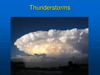
Thunderstorms
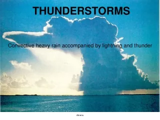
Thunderstorms. Photothèque MF/ Pluviaud. Origins and Classifications Aeronautical Consequences Forecasting Tools. Origins and Classification. Favorable aerologic and/or synoptic conditions Aeronautical Classification Names Meteorological illustrations

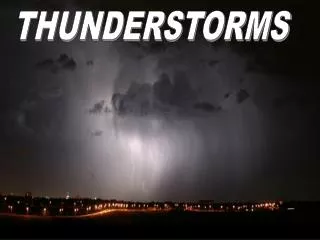
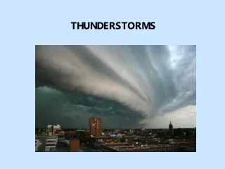
Thunderstorms
E N D
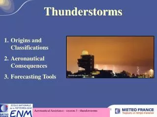
Presentation Transcript
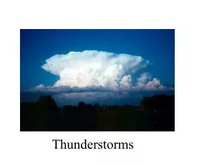
Thunderstorms Photothèque MF/ Pluviaud • Origins and Classifications • Aeronautical Consequences • Forecasting Tools Aeronautical Assistance - session 3 - thunderstorms
Origins and Classification • Favorable aerologic and/or synoptic conditions • Aeronautical ClassificationNamesMeteorological illustrations • Cell structureOrdinary cellMulti cellSuper cell Aeronautical Assistance - session 3 - thunderstorms
Favorable aerologic and/or synoptic conditions • Unstable air mass structure + lift: Synoptic lift along a frontal surface Orographic lift Dynamic forcing aloft Turbulence, friction forces • Thermal convection Ground heating by exposure to the sun Cold air advection aloft (minimal lifting) Aeronautical Assistance - session 3 - thunderstorms
Aeronautical classification • CBs embedded in the cloud mass CB EMBD (Embedded) i. Frontal thunderstorms • Isolated CBs CB ISOL, CB OCNL, CB FRQ ii. Air mass thunderstorms Aeronautical Assistance - session 3 - thunderstorms
Frontal thunderstorms • Warm front thunderstorms • Occlusion thunderstorms • Comma cloud thunderstorms • Split cold front thunderstorms Aeronautical Assistance - session 3 - thunderstorms
Warm front thunderstorms Corresponding meteorological term : split cold front CBs are "spread" over the front surface or “drowned” in the mass. Aeronautical Assistance - session 3 - thunderstorms
Occlusion thunderstorms Corresponding meteorological term :extended occlusion into comma cloud CBs are most often high base phenomena (at the base of a warm valley). There is little thunderstorm activity. Aeronautical Assistance - session 3 - thunderstorms
Comma cloud thunderstorms secondary OCNL CB OCNL CB + + --- --- ; ; • • -- -- - - For instance by north-northwesterly wind. Major instability Aligned CBs A cold air mass aloft Aeronautical Assistance - session 3 - thunderstorms
Split cold front thunderstorms http://www.meteorologie.eu.org/anasyg/cours/francais/navig/didac.htm Aeronautical Assistance - session 3 - thunderstorms
Split cold front thunderstorms http://www.meteorologie.eu.org/anasyg/cours/francais/navig/didac.htm Aeronautical Assistance - session 3 - thunderstorms
Air-mass thunderstorms(NOT EMBD) • Pre-frontal thunderstorms • Rear of depression thunderstorms • warm air thunderstorms • Orographic thunderstorms Aeronautical Assistance - session 3 - thunderstorms
Air-mass thunderstorms • These occur in unstable and homogeneous air masses, for example near a shallow low. • Near the ground: • High humidity. • Light wind. • Convection triggers the phenomena. • These situations are more frequent in spring and summer. Mountains favor this kind of thunderstorm Aeronautical Assistance - session 3 - thunderstorms
Pre-frontal thunderstorms Hot to very hot weather development in front of the front then possible organization as a squall line. These storms are often fairly violent and sometimes with hail. Aeronautical Assistance - session 3 - thunderstorms
Météo Aéro ENAC Rear of depression thunderstorms Aeronautical Assistance - session 3 - thunderstorms
Météo Aéro ENAC Rear of depression thunderstorms Aeronautical Assistance - session 3 - thunderstorms
Météo Aéro ENAC Thunderstorms in warm air V cell Aeronautical Assistance - session 3 - thunderstorms
Orographic thunderstorms Wind Raised by the wind off the terrain relief CB form on the high ground and remain attached to it. Sometimes they spread to the plains. Aeronautical Assistance - session 3 - thunderstorms
Cell structure • Ordinary cells • Multiple cells • Super cells Aeronautical Assistance - session 3 - thunderstorms
Ordinary cells Km 12 11 10 9 8 7 6 5 4 3 2 1 CD CD CD CD CD Formation Dissipation Km Km 12 12 11 11 10 10 9 9 8 8 7 7 6 6 5 5 4 4 3 3 2 2 1 1 10 to 15 km Formation Formation Dissipation Dissipation Maturity Aeronautical Assistance - session 3 - thunderstorms
Ordinary cells 180° 180° K K K 1 1 1 m m m 1 1 1 2 2 2 1 1 1 1 1 1 9 9 9 10 km 10 km 0 0 0 8 8 8 6 6 7 7 7 6 6 6 2 2 8 8 5 5 5 270° 270° 4 4 4 4 4 3 3 3 2 2 2 10 10 20 m/s 20 m/s C C C C 1 1 1 10 to 15 km D D D D Storm Formation Formation Maturity Dissipation Dissipation motion HODOGRAPH HODOGRAPHE N E LIGHT WIND SHEAR • Life cycle: 3 phases, 30 to 50 min • Propagation at the mean environmental speed. • No very violent phenomena Aeronautical Assistance - session 3 - thunderstorms
Multiple cell thunderstorm Km Km Km Propagation Propagation 12 12 12 11 11 11 10 10 10 9 9 9 8 8 8 7 7 7 6 6 6 5 5 5 4 4 4 3 3 3 2 2 2 1 1 1 CD CD 30 to 50 km Aeronautical Assistance - session 3 - thunderstorms
Multiple cell thunderstorm K K K Propagation Propagation 12 12 12 m m m N 11 11 11 10 10 10 9 9 9 10 10 8 8 8 8 8 12 km 6 6 7 7 7 4 4 E 6 6 6 2 2 5 5 5 1 1 4 4 4 3 3 3 40 m/s 40 m/s 10 10 20 20 30 30 2 2 2 1 1 1 CD DC HODOGRAPH 30 to 50 km Strong single direction wind shear • The most frequent, often strong • Group of cells at different stages of their lifecycle • Importance of Density Current (DC) • Random movement or along a preferred side Aeronautical Assistance - session 3 - thunderstorms
3D CONCEPTUAL DIAGRAM 10 km 10 km 5 km 5 km 10 Km 10 Km 10 Km 1 km 1 km 5 km 5 km 5 km CD CD CD AIR FROID COLD, DRY AIR FROID AIR CHAUD AIR CHAUD WARM, MOIST 1 km 1 km 1 km AIR ET SEC ET SEC AIR ET HUMIDE ET HUMIDE 0 0 0 100 Km 100 Km 100 Km Storm motion Super cell thunderstorm Aeronautical Assistance - session 3 - thunderstorms
A single "giant" cell with a stable structure in the mark linked to the thunderstorm Propagation = thunderstorm speed Presence of turbulent vertical movements N 3D CONCETPUAL DIAGRAM N 10 km 10 km 180° 180° 180° 5 km 5 km 4 4 4 6 6 6 10 10 10 2 2 2 8 8 8 12 12 12 14 km 14 km 10 10 10 E 1 km 1 km Km Km Km E 1 1 1 270° 270° 270° warm 5 km 5 km 5 km AIR FROID COLD, DRY 40 m/s 40 m/s 40 m/s 20 20 20 30 30 30 C C C DAMP 1 km 1 km 1 km ET SEC AIR 0 0 0 D D D 100 Km 100 Km 100 Km HODOGRAPHE HODOGRAPH AIR Storm motion Super cell thunderstorm STRONG, TURNING, WIND SHEAR Aeronautical Assistance - session 3 - thunderstorms
Km Km 15 15 15 14 14 14 13 13 13 D C 12 12 12 11 11 11 10 10 9 9 8 8 7 7 6 6 5 5 4 4 B B A A 3 3 2 2 40 30 50 20 dbz 1 1 20 km 20 km 20 km Super cell thunderstorm WHAT DOES RADAR SEE? Km Km 15 15 14 14 D D C C 12 12 50 50 11 11 10 10 60 km 60 km 9 9 40 40 8 8 7 7 30 30 6 6 5 5 4 4 B B A A 3 3 20 20 2 2 40 30 50 20 dbz 1 1 20 km 20 km 20 km 20 km VERTICAL CROSS SECTION (CD) HORIZONTAL CROSS SECTION (AB) SIGNATURES • Movement that always differs from the average wind flow (most often to the right) and often very quickly • Most violent (strong hail storms, tornados • Low level radar echoes are "hook shaped"). Aeronautical Assistance - session 3 - thunderstorms
Aeronautical Consequences • Turbulence • Icing • Hail • Lightening • Protection methods Aeronautical Assistance - session 3 - thunderstorms
Turbulence • Inside a cloud, generally moderate to strong • Vertical speeds that can hit35 m/s for ascending currents and 15 m/s for descending ones Multiple wind shear is encountered due to the sudden variations in ascension speeds. Aeronautical Assistance - session 3 - thunderstorms
Density currents observed in nature Météo Aéro Labyt Aeronautical Assistance - session 3 - thunderstorms
Density current spread Gust front (cold) Convergence CD CD zone (convection) Top view Without wind shear:The density current spreads out in all directions = ascending currents that are not forced, not localized and weak. Cross section Aeronautical Assistance - session 3 - thunderstorms
Density current spread Dry air CD CD Gust front (cold) Strong convergence zone ( strong convection) Cross section With wind shear: the dense current is dissymmetric with localized, intense convergence. Top view Aeronautical Assistance - session 3 - thunderstorms
NOAA Photo Irv Watson From ICAO P621 poster Subsiding current Motion Ascending current Warm Air on top of cool air Gust front Cool air surge Turbulence: gust front Aeronautical Assistance - session 3 - thunderstorms
Density current signature on the ground • Wind rotation and intensificationGusts that may hit or exceed 25m/s • Temperature fallBy 2 to 10°C as the case may be • Rising pressure 1 to 2 hPa • Fall θ’w and rise in humidity Aeronautical Assistance - session 3 - thunderstorms
Density current : real observations Temperature Blagnac Gust wind Rainfalls Pressure Aeronautical Assistance - session 3 - thunderstorms
Turbulence summary Without vertical wind shear, it spreads isotropically, with weak convection. In the presence of wind shear, it spreads downstream from the wind shear and generates more intense localized convection: Onset of a gust front. Aeronautical Assistance - session 3 - thunderstorms
Icing Generally moderate to strong All kinds of deposits are present. Transparent icing most often Aeronautical Assistance - session 3 - thunderstorms
Hail A phenomena that occurs on average once out of every ten times for CBs in excess of 11 km (warm air tropopause). Many forms of damage are caused to aircraft: Impact on radomes, airframe, cockpit windows… Every time hail is encountered, it costs airlines dearly. Aeronautical Assistance - session 3 - thunderstorms
Hail Aeronautical Assistance - session 3 - thunderstorms
Hail Aeronautical Assistance - session 3 - thunderstorms
Hail http://www.astrosurf.com/luxorion/Documents/meteo-grele-charter-nez.jpg http://www.astrosurf.com/luxorion/Documents/meteo-grele-charter-cockpit.jpg large aircraft too… Aeronautical Assistance - session 3 - thunderstorms
Lightening • In a CB, the average electrical field is 200 volts per meter, but it may reach far higher values of around 200,000 volts per meter. • The damage caused to aircraft is generally highly localized: • Small perforations • Navigation or electrical system failures Aeronautical Assistance - session 3 - thunderstorms
Lightening Aeronautical Assistance - session 3 - thunderstorms
Lightening Aeronautical Assistance - session 3 - thunderstorms
Lightening Aeronautical Assistance - session 3 - thunderstorms
Lightening Zen Kawasaki, Japan Aeronautical Assistance - session 3 - thunderstorms
Lightening Research is on-going to reinforce aircraft lightening protection (metal wiring harnesses protected by aircraft composite material envelopes). Aeronautical Assistance - session 3 - thunderstorms
Protection methods • Onboard weather radar: • Displaying the most active CB cores. • All commercial aircraft are equipped. The crew can avoid significant phenomena. However, transport aircraft are not equipped and must in this case fly beneath the clouds and follow routes away from strong showers. They can get assistance from air traffic control. Aeronautical Assistance - session 3 - thunderstorms
ASPOC ASPOC: Application for warning and predicting thunderstorms for ATC. Goal: Improving air traffic control by detecting thunderstorm cells and anticipating traffic disturbances. Paris airports and some other French airports are already equipped with this. Aeronautical Assistance - session 3 - thunderstorms
ASPOC (SIGNORA images) Rainfall radar and thunderstorm warning network coupling. This is integrated into the nowcasting network and allows anticipation of around 30 minutes. Aeronautical Assistance - session 3 - thunderstorms
SIGNORA • (RETIM 2000) images • (SIGNalisation des ORAges = Thunderstorm indication) • These images provide: • - Forecasts in 5 minute time increments with one radar and 10 minute increments with multi-radar data, • A localization of electrical activity, • The forecast of cell paths for the next 30 minutes. Aeronautical Assistance - session 3 - thunderstorms
Limits to the SIGNORA product • - No recognition of thunderstorms is possible before the onset of electrical activity (lightning strikes) and rainfall (for sufficient radar reflectivity). • Extrapolation is only possible from the moment the cell is identified. • Restricted anticipation capacity. • Geographic area is limited to the plains. • No information on the vertical extension of the cells. Aeronautical Assistance - session 3 - thunderstorms