

Cap De Creus
E N D
Presentation Transcript
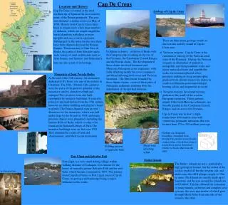
Location and History Cap De Creus is located at the most northern tip of Spain at the most easterly point of the Iberian peninsula. The area was declared a nature reserve in May of 1998. History from Cap de Creus dates back to roman times when large numbers of dolmens, which are simple magalithic burial chambers with three or more uprights and one or more capstones. Submerged I n the waters in the area there have been shipwrecks from the Roman Empire. The monastery of Sant Pere de Rodes, the castle of Sant Salvador and a wide variety of rural architecture such as farm houses, and farmers’ and fisherman’s huts are also a part of its heritage. Geology of Cap de Creus Cap De Creus There are three main geologic trends to due tectonic activity found in Cap de Creus area: a) Variscan orogeny: Cap de Creus is the easternmost outcrop of the Variscan axial zone of the Pyrenees. During the Variscan orogeny an alternation of quartzitic, metapelitic and metapsammitic rocks and minor metacalcsilicate and amphibolite rocks were metamorphosed at low pressure resulting in steep metamorphic gradient from chlorite-muscovite shales in south to sillimanite-potassium feldspar bearing schists and migmatites in north. c) Neogene tectonic developed tectonic grabens as the result of the western European extension. These grabens, mainly filled with Miocene sediments, are broadly parallel to the Catalonian Coastal Ranges and cut across the Pyrenees. Cap de Creus was in short a high-temperature deformation zone with syntectonic pegmatite intrusions that was formed from 270 to 310 million years ago. b) Alpine tectonics: collision of Iberia with the European plate resulting in the rise of the Pyrenees, the Catalonian Coastal Ranges and the Iberian chain. The development if these chains involved basement and Mesozoic-Paleogene cover sequences, with folds affecting mostly the cover sequences and thrust affecting both cover and Variscan basement. The Ebro basin, bounded by these Alpine chains, received thick piles of Paleogene sediments resulting from the denudation of the uplifted domains. Monastery of Sant Pere de Rodes At the end of the 11th century, the monastery dedicated to St. Peter, was one of the richest in Catalonia. The 10th, 11th and 12th centuries were the years of the greatest splendor of the monastery, and its church was built and enlarged. Two cloisters were also built, surrounded by monastic buildings. It entered a period of spiritual decline from the 15th century, however an Abbey building and pilgrim’s hostel was built. The Franco-Spanish wars proved disastrous for the monastery, which was laid under siege by the French in 1708, and many precious objects were plundered, including the famous Bible of Roda, which is today to be found in the National Library of Paris.The monastic buildings were set fire to in 1795. They remained in a state of ruin and abandonment, until their recent restoration. Grabens are elongated, trenchlike, structural form bounded by parallel normal faults created when a block that forms a trench floor moves downward relative to blocks that form the sides. Shear zone affecting schist Folding pattern of quartzite beds Port Lligat and Salvador Dali Medes Islands Port Lligat is a very small fishing village within walking distance of Cadaques. It is famous for the house of surrealist painter Salvador Dali and his wife Gala, which became a museum in 1997. The journey from Canyelles Petites to Port Lligat crosses Cap de Creus, its geology and landscape being a major influence in his works. The Medes islands are not a particularly high geological feature, but the action of the sea has eroded all but the western side, and underwater the cliffs plunge steeply to 50m or more. The Islands are mostly made up of limestone and the area around the islands are well faulted. This has allowed the formation of many tunnels, archways and complete cave systems, the most spectacular of which goes through Meda Petita from one side of the island to the other. by Salvador Dali