Download
1 / 75
890 likes | 2.8k Views
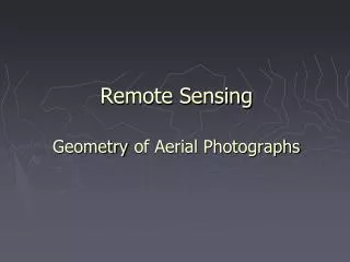
Geometry of Aerial Photographs. Aerial Cameras. Aerial cameras must be (details in lectures) : Geometrically stable Have fast and efficient shutters Have high geometric and optical quality lenses They can be classified according to type of frame : Single lens Frame Multiple frame

E N D
Aerial Cameras • Aerial cameras must be (details in lectures): • Geometrically stable • Have fast and efficient shutters • Have high geometric and optical quality lenses • They can be classified according to type of frame: • Single lens Frame • Multiple frame • Strip Frame • Panoramic • They can also be either film or digital cameras. THIS COURSE WILL DISCUSS ONLY SINGLE FRAME CAMERAS
Single lens Frame Cameras • Standard is 9” (23 cm) frame size and 6” (15.24 cm) focal length( f). • They can be classified, as mentioned before, according to the field of view to: • Normal angle ( up to 75) • Wide angle (up to 75) • Super-wide angle (greater than to 75)
Components of a single frame film camera. Three main parts: Magazine Body Lens cone assembly Components and notes to be discussed din lecture
Components of a single frame film camera. Fiducial Marks A vertical Photograph
Components of a single frame film camera. Example of a corner Fiducial Mark under Magnification
Geometry of aerial cameras Principal Point (P.P) L:
Geometry of aerial cameras • Identify the following: • L: perspective center. • Fiducial Center F.C. • Principal Point (P.P) or O: the point where the perpendicular from the perspective center intersects the photograph. Usually deviates from the F.C by a very small distance. • Principal axis: the line perpendicular from the principal center on the plane of the photograph (negative). • f the focal length, equals the Principal Distance.
Types of Photographs (by tilt) • Aerial Photos are: • 1- Vertical or tilted • Vertical photos are taken with the optical axis (Principal Line) vertical or tilted by no more than 2 • Tilted: if the optical axis is tilted by no more than 3
Types of Photographs (by tilt) • 2- Oblique Photos • If the optical axis is intentionally strongly tilted to increase coverage, they are: • Low oblique: if the tilt is not enough to show the horizon, usually 3 to 30 Low Oblique Photo
Types of Photographs (by tilt) 2- Oblique Photos • Low oblique • High oblique: if the horizon is shown on the photograph High oblique Low oblique
y High Oblique Vertical Photograph x
Types of Photographs (by tilt) 3- Convergent Photographs Low oblique photos in which camera axis converge toward one another Low Oblique Photo
Comparison between vertical and oblique photos • Coverage • Geometry • Low cloud? • View: issues with tall features and views of sides of features. • Others
Photo Coordinates (film) • We use positives for ease of geometry and familiarity of feature shapes, negatives may be used in certain applications • Lines connecting middle fiducials ON THE POSITIVE define a photo coordinate system, in which x is in the direction of flight, A RIGHT-HAND coordinate system • Measurements can be as accurate as 1 micron = 1/1000 mm y x
Photo Coordinates (digital) • Pixels in a digital image represent coordinates of rows and columns.
Geometry of a vertical photographs • The line LoO, the optical axis is assumed truly vertical Direction of flight
Geometry of a digital frame camera • Similar geometry is assumed in case of a digital camera • Uses a two dimensional array of CCD elements mounted at the focal plane of the camera. • The image is a grid of picture elements (pixels)
Similar geometry is assumed in case of a digital camera • Uses a two dimensional array of CCD elements mounted at the focal plane of the camera. • The image is a grid of picture elements (pixels) • The size of pixels in one image represent the resolution of the image, the smaller the pixel, the higher (better) the resolution. • A mega (million) pixel image includes one million pixel • Number of pixels can be as low as 500X500 = 250,000 pixels, or megas of pixels for commercial cameras, or gegapixels in classified cameras. • What is the size of image of a camera that includes a CCD frame sensor, that is 1024 X1024 elements, if the size of a pixels is 5? How many megapixels are there? • Answer: image size = 1024 X 0.005 = 5.12 mm, • No of pixels = 1024X1024= 1 mega pixel
image taken from a first-generation Landsat satellite over Milwaukee, Wisconsin.
1-m resolution image obtained from the IKONOS satellite showing San Francisco.
linear array sensors A linear CCD scans the ground at a given time. The vehicle advances a distance equals to one array and capture the next line. Will the entire image be scanned at the same time?
Flying spot scanner: The geometry is such that the after a row is finished being scanned, the vehicle advanced to the beginning of the next row. • Which digital system is suitable for what purpose?? • Why??
Image coordinate corrections Our goal is to measure photo coordinates and relate them to ground coordinates by equations to obtain ground coordinates. Once you have ground coordinates, you can draw a map, establish cross section, etc. Measured photo coordinates need to be corrected prior to substation in equations, for the following: • Film shrinkage • Principal point location • Lens distortions • Atmospheric refraction • Earth curvature • Which of the corrections inapplicable for digital images??
Scale of a Vertical Photograph • Scale of a photograph is the ratio of a distance on a photo to the same distance on the ground. • Photographs are not maps, why? • Scale of a map and scale of a photograph. • Orthphotos (orthophoto maps), what are they? • Scale (s) at any point: f S = H - h f • Average scale of a photograph: Savg = H - havg If the f, H, and h are not available, but a map is available then: photo distance X map scale Photo Scale = map distance
Ground Coordinates from a Single Vertical Photograph • With image coordinate system defined, we may define an arbitrary ground coordinate system parallel to (x,y) origin at nadir. • That ground system could be used to compute distances and azimuths. Coordinates can also be transformed to any system • In that ground system: Xa = xa * (photograph scale at a) Ya = ya * (photograph scale at a)
Relief Displacement on a Vertical Photograph • The shift of an image from its theoretical datum location caused by the object’s relief. Two points on a vertical line will appear as one line on a map, but two points, usually, on a photograph. • The displacement is from the photgraphic nadir point. In a vertical photo, the displacement is from the principal point, which is the nadir in this case. • Photographic Nadir point is where the vertical from the Exposure Station intersects the photograph.