Download
1 / 20
200 likes | 265 Views
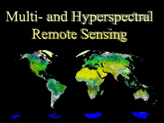
Explore the advancements in hyperspectral remote sensing, allowing for detailed measurement and analysis of environmental data through various applications such as vegetation monitoring, mineral mapping, and pollution assessment.

E N D
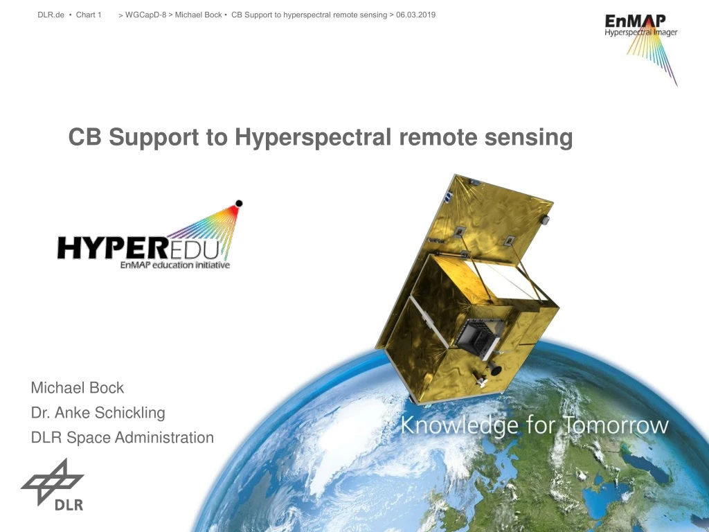
> WGCapD-8 > Michael Bock • CB Support to hyperspectral remote sensing > 06.03.2019 CB Support toHyperspectral remote sensing Michael Bock Dr. Anke Schickling DLR Space Administration
> WGCapD-8 > Michael Bock • CB Support to hyperspectral remote sensing > 06.03.2019 Hyperspectral remote sensingandimagingspectroscopy Reflectance [%] VNIR SWIR- I SWIR- II 0.4 0.6 0.8 1.0 1.2 1.4 1.6 1.8 2.0 2.2 2.4 Wavelength [µm] • Measurement of reflected solar radiation in many narrow contiguous spectral bands • Quantitative derivation of biogeophysical parameters of vegetation, soil, water bodies, artificial surfaces
> Lecture > Author • Document > Date Hyperspectral vs. multispectralsystems Many surface information can be derived more accurately with hyperspectral data, while they are essential for certain applications PAN 8 1 2 3 4 5 9 6 7 8 10 12 7 6 8a 11 3 9 5 4 2 1 70 60 50 Goethite Kaolinite Vegetation 40 Reflectance [%] 30 20 10 0 1.7 2.3 1.2 1.3 1.4 2.1 2.2 1.6 1.8 1.9 2.0 1.1 1.5 1.0 0.8 0.9 0.5 0.6 0.7 0.4 Wavelength [µm] VIS NIR SWIR Landsat 8 Sentinel-2
> WGCapD-8 > Michael Bock • CB Support to hyperspectral remote sensing > 06.03.2019 Hyperspectralapplicationfields Fed content [%] • Mine explorationtorestoration • Soilmineralogy, SOC andtexture • Vegetation monitoring: plant stress, cropresidues, plant composition > 3.0 3.0 2.5 Reflectance 2.0 1.5 Fe2+/Fe3+ 1.0 0.5 400 800 1200 1600 2000 2400 < 0.5 Wavelength [nm] chlorite calcite dolomite Fraction of non-photosynthetic vegetation illite Scaled Reflectance 100% 0% cellulose gypsum lignin soil Reflectance kaolinite dry vegetation 400 800 1200 1600 2000 2400 Wavelength [nm] 2400 400 800 1200 1600 2000 Wavelength [nm] Soilmapping Mineral mapping Dry vegetation Mapping
Pollution mapping > WGCapD-8 > Michael Bock • CB Support to hyperspectral remote sensing > 06.03.2019 Hyperspectralapplication Phycocyanin content • Hazardousmaterials: oil, dust, minewaste, pollutants, plastics • Inland andcostalwaters: phytoplanktoncomposition, (harmful) algaespecies • Urban surfacematerials low high CHL440 nm CAR 485 nm PE 570 nm PC 624 nm CHL678 nm Reflectance 400 500 600 700 800 Wavelength [nm] Urban surfacemapping Waterqualitymapping
> WGCapD-8 > Michael Bock • CB Support to hyperspectral remote sensing > 06.03.2019 EnMAP - Environmental Mapping andAnaylsisProgram EnMAP isGermany’sfirstspacebornehyperspectralmission • EnMAP aims at monitoringandcharacterizingtheEarth’senvironment on a global scale • EnMAP servestomeasureandmodelkeydynamicprocessesoftheEarth’secosystem • EnMAP is a scientificpathfinderforlater operational services
> WGCapD-8 > Michael Bock • CB Support to hyperspectral remote sensing > 06.03.2019 EnMAP – Mission Overview • Push-broom imaging spectrometer • Sun-synchronous orbit, 11h LTDN • Spectral Range: >240 bands from 380 nm (VIS) to 2400 nm (SWIR) • Ground sampling distance: 30 m , Swath: 30 km • Recording capacity: 1000 km/orbit and5000 km/day • Revisit time: 27 days at nadir and up to4 days with 30°accross-track pointing • Launch: Q4 2020, Mission lifetime: > 5 years • Open data policy Guanter et al., Remote Sensing, 2015
> WGCapD-8 > Michael Bock • CB Support to hyperspectral remote sensing > 06.03.2019 Project Management DLR Space Administration Scientific PrincipalInvestigator GFZ Potsdam EnMAP – Project structure International advisory: ESA/ CSIRO/ NASA/ University of Valencia EnMAP Science Team Geology/ Soils GFZ Space Segment OHB-System AG Ground Segment DLR Oberpfaffenhofen Forests Trier University Ecosystems/ Biodiversity HU Berlin & MPI Agriculture LMU • Advisory groups: • EnSAG – EnMAP Science Advisory Group: gives general advise towards the mission. Members are DLR Space Administration, GFZ PI and national and international advisors • ECST – EnMAP Core Science Team: gives mainly advise towards scientific activities and developments. Members are DLR Space Administration, GFZ PI, universities and research centers Water HZG & AWI Urban areas DLR
> WGCapD-8 > Michael Bock • CB Support to hyperspectral remote sensing > 06.03.2019 Research Mission support EnMAP – Mission Exploitation Program • Program goals: • Raising scientific knowledge • Supporting the science community to develop new data products, algorithms and services • Supporting the discovery of new application fields • Raising awareness of the EnMAP mission • Ensuring easy and fast access towards EnMAP data • Enable easy data processing capabilities • Supporting national and international cooperation • Explore synergies with other missions Algorithms & Applications Data handling International activities Education & Training Community building Value-Adding EnMAP Mission Exploitation Program
> WGCapD-8 > Michael Bock • CB Support to hyperspectral remote sensing > 06.03.2019 EnMAP – Science Education Program • More than 40 PhD students and Postdocs funded as part of the EnMAPscience program since 2010 • Application and algorithm development in various fields incl. agriculture, forestry, natural ecosystems, geology and soil, urban areas, coastal and inland waters
> WGCapD-8 > Michael Bock • CB Support to hyperspectral remote sensing > 06.03.2019 EnMAPSummer Schools Munich(September 2017) Trier(April 2016) Lauenburg(March 2015) Berlin(September 2012) Munich(April 2011) Trier(September 2010) wikimedia.org orangesmile.com
> WGCapD-8 > Michael Bock • CB Support to hyperspectral remote sensing > 06.03.2019 EnMAP – flight campaign datasets • Hyperspectral airborne campaign data, simulated EnMAP data and in-situ data • Datasets providedfreeofchargetosciencecommunity • Datasets published as data publications (with DOI) • Basis to simulate future EnMAP data using EnMAP simulator software EeTeS developed at GFZ (Segl et al. 2012) www.enmap.org/flights Segl, K.; Guanter, L.; etal. EeteS - The EnMAP End-to-End Simulation Tool. IEEE Journal of Selected Topics in Applied Earth Observations and Remote Sensing, 2012.
> WGCapD-8 > Michael Bock • CB Support to hyperspectral remote sensing > 06.03.2019 EnMAP information and Capacitybuilding • Development of online learning platform for imaging spectroscopy started as part of the EnMAP education initiative • Reviewed and structured Presentations and tutorials on principles, methods and applications of imaging spectroscopy • Application Tutorials for EnMAP-Box • MOOC with modules and certificate planned • To be launched in 2020 at EO-College.org EnMAP Science Plan, booklet and flyer Central point of information: www.enmap.org
> WGCapD-8 > Michael Bock • CB Support to hyperspectral remote sensing > 06.03.2019 EnMAP-Box 3 Toolbox for visualization, processing & analysis of EnMAP data • Free and open-source • Multiple targetgroups: • Imaging spectroscopynovices • Imaging spectroscopy/EO experiencesusers • Experts for EO dataprocessing, whocodetheirownworkflowsandapplications • QGIS Plugin
> WGCapD-8 > Michael Bock • CB Support to hyperspectral remote sensing > 06.03.2019 • Offernewworkflows, createsynergies, avoidredundancies • User friendly GUI anddatahandling • Availabilityofstate-of-the-art applications • Extension pointsforadvancedusers • Offerfull GIS functionality
> WGCapD-8 > Michael Bock • CB Support to hyperspectral remote sensing > 06.03.2019 EnMAP-Box 3 as a plugin PlannedtobeparttheofficialQGIS Plugins Repositoryby end of March 2019
> WGCapD-8 > Michael Bock • CB Support to hyperspectral remote sensing > 06.03.2019 EnMAP-Box 3 - toolsandapplications • Scatter Plot • Classification Workflow • Regression-basedunmixing • AgriculturalApplications • Mineral andsoilmappingapplicationcomingsoon • Extension points: • imageMathinterface • Scikit-LearnEstimatorinterface • EnMAPBoxApplicationinterface
EnMAP-Box 3 - API for algorithm development and workflow scripting HUB Datacube: http://hub-datacube.readthedocs.io HUB Workflow: http://hub-workflow.readthedocs.io
> WGCapD-8 > Michael Bock • CB Support to hyperspectral remote sensing > 06.03.2019 EnMAP-Box 3 - find us on the web Read theDocs: enmap-box.readthedocs.io Bitbucket: bitbucket.org/ENMAP EnMAP Project: www.enmap.org
> WGCapD-8 > Michael Bock • CB Support to hyperspectral remote sensing > 06.03.2019 Thankyou